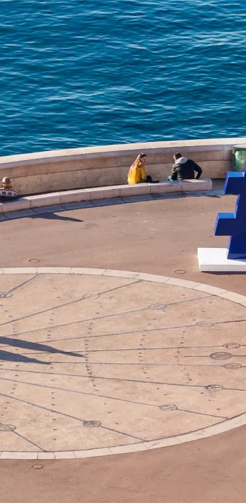
La plus haute route de France
Altitude 2715 m (col) et 2802 m (cime)
Massif du Mercantour-Argentera
Départements des Alpes-de-Haute-Provence et des Alpes-Maritimes
Sommaire
- Planifiez votre ascension à vélo du col de la Bonette et de la cime de la Bonette
- Montée du col de la Bonette et de la cime de la Bonette à vélo depuis Jausiers, par le versant nord
- Description de l’ascension du col de la Bonette et de la cime de la Bonette à vélo depuis Jausiers, par le versant nord
- Montée du col de la Bonette et de la cime de la Bonette à vélo depuis Saint-Étienne-de-Tinée, par le versant sud
- Description de l’ascension du col de la Bonette et de la cime de la Bonette à vélo depuis Saint-Étienne-de-Tinée, par le versant sud
- Conseils pour préparer l’ascension du col de la Bonette et de la cime de la Bonette
- Conditions météorologiques pour le col de la Bonette et la cime de la Bonette
- Équipement recommandé pour le col de la Bonette et la cime de la Bonette
- Les services au col de la Bonette et à la cime de la Bonette
- L'accès au col de la Bonette et à la cime de la Bonette
- Témoignages
- FAQ
Planifiez votre ascension à vélo du col de la Bonette et de la cime de la Bonette
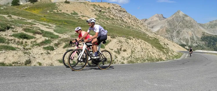
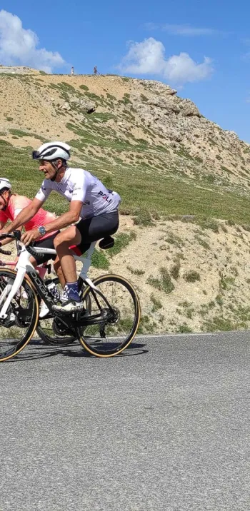
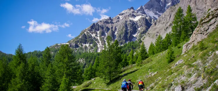
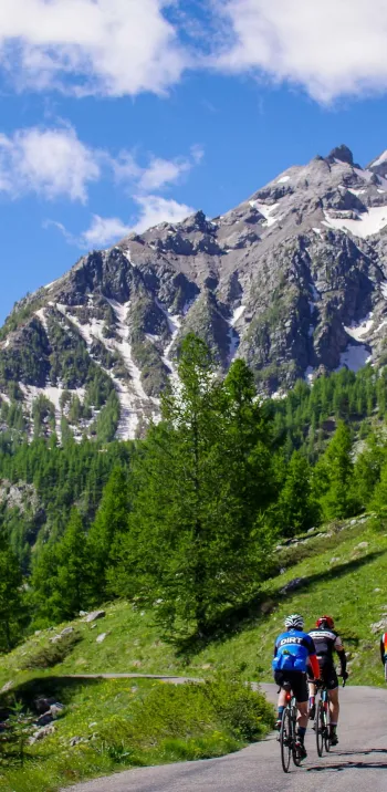
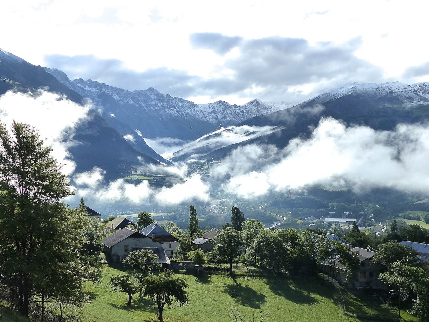
Du haut de ses 2715 m, ce col sur Route des Grandes Alpes ®, troisième col français en altitude, sépare les vallées de l’Ubaye au nord et de la Tinée au sud. Particularité de la cime, que l’on atteint depuis le col : elle est la plus haute route asphaltée de France (2802 m). Le Tour de France n’y est passé que 4 fois, 5 en comptant le rendez-vous qu’il a fixé aux passionnés de vélo, en 2024, lors de l’étape Embrun – Isola 2000. C’est sans doute pour cela que la Bonette est assez peu connue du grand public ! Pourtant l'ascension est magnifique, dans des paysages désertiques et spectaculaires où résonnent le sifflement des marmottes et le bêlement des moutons.
Les plus beaux séjours pour en profiter


France's highest road
Altitude 2715 m (col) and 2802 m (cime)
Massif du Mercantour-Argentera
Départements des Alpes-de-Haute-Provence et des Alpes-Maritimes
Summary
- Plan your bike ascent of the Col de la Bonette and the cime de la Bonette
- Bike ascent of the Col de la Bonette and the cime de la Bonette from Jausiers, by the north side
- Description of the ascent of the Col de la Bonette and the cime de la Bonette by bike from Jausiers, by the north side
- Ascent of the Col de la Bonette and the cime de la Bonette by bike from Saint-Étienne-de-Tinée, by the south side
- Description of the ascent of the Col de la Bonette and the cime de la Bonette by bike from Saint-Étienne-de-Tinée, by the south side
- Conseils pour préparer l'ascension du col de la Bonette et de la cime de la Bonette
- Weather conditions for the Col de la Bonette and cime de la Bonette
- Recommended equipment for Col de la Bonette and cime de la Bonette
- Services at Col de la Bonette col de la Bonette and cime de la Bonette
- Access to col de la Bonette and cime de la Bonette
- Témoignages
- FAQ
Plan your bike ascent of the Col de la Bonette and the cime de la Bonette
High at 2715 m, this col on Route des Grandes Alpes ®, France's third-highest pass, separates the Ubaye valley to the north and the Tinée valley to the south. A special feature of the summit, which can be reached from the pass, is that it is the highest asphalt road in France (2802 m). The Tour de France has only passed through here 4 times, 5 if you count the date it set for cycling enthusiasts in 2024, on the Embrun - Isola 2000 stage. That's probably why the Bonette is so little known to the general public! Yet the ascent is magnificent, in spectacular desert landscapes where the whistling of marmots and the bleating of sheep resound.
Cycling up the Col de la Bonette and the cime de la Bonette from Jausiers, via the north side
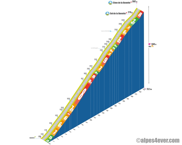
Start: Jausiers 1214 m
Distance: 23.2 km (to cime de la Bonette)
Altitude: 2715 m (col de la Bonette), 2802 m (cime de la Bonette)
Stack gain: 1501 m (to col), 1588 m (to cime)
Average gradient: 7%
Maximum gradient: 10 to 12% in the last km before the cime de la Bonette
Tour de France® rating: hors catégorie
Time to climb (rounded) the cime de la Bonette by bike from Jausiers, via the north side
- At 7 km/h: 3 h 20
- At 11 km/h: 2 h 07
- At 15 km/h: 1 h 30
- At 19 km/h : 1 h 13
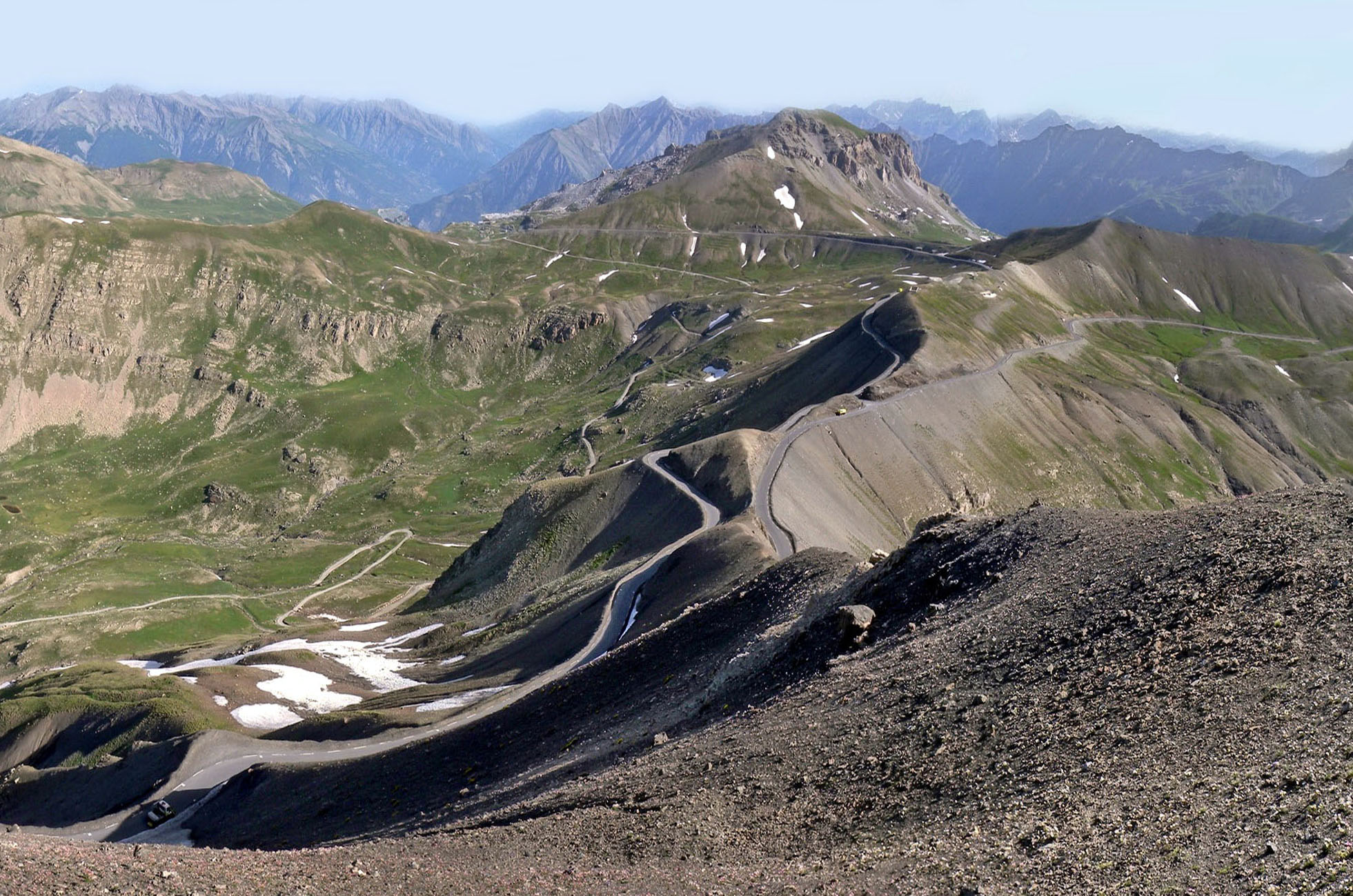
Map of the route up the Col de la Bonette and the cime de la Bonette by bike from Jausiers, via the north side
Description of the ascent of the Col de la Bonette and the cime de la Bonette by bike from Jausiers, by the north side
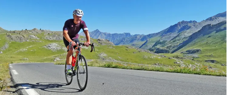
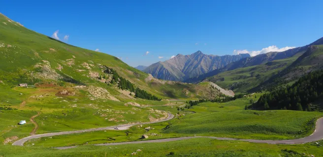
Starting from Jausiers, situated at an altitude of 1214 meters in the Ubaye Valley, the 23.2 kilometer ascent begins. On the menu: 1,588 meters of ascent, with an average gradient of 7%. With almost half the climb above 2000 meters, you'll need to be in excellent physical shape, as your cardiac and respiratory endurance will be put to the test.
Before getting into the swing of things, the Barcelonnette - Jausiers route is the ideal warm-up. However, as soon as you leave Jausiers, the gradient rapidly rises to 7%. After 3.5 kilometers, the village almost disappears into the valley floor.
As you pass the last hamlet of Chalannette (1545 m), the going gets tougher, with a section at 8%. You then enter a valley sculpted by the Torrent de Clapouse, below the 1811 m Bec de l'Aigle. Just magnificent! Passing the bridge over the Ravin de la Combette, its raised barrier and sign, unambiguously announce that you're entering a high-mountain road.
The road then takes you through a series of four switchbacks, totaling a 155-meter vertical drop, averaging 8% over around 2 kilometers.
At Le Rochas (1785 m), the landscape seems to contract and the Ubaye valley disappears. The grass of the mountain pastures gradually gives way to the austerity of the rock.
The climb continues unabated, fluctuating between 7.5 and 8% for three kilometers. By the time you pass the La Halte 2000 restaurant (Cabane de Clapouse), you're halfway up the climb. A gentler 600-meter segment at 4.5% allows you to breathe a little before attacking the remaining 12 kilometers, above 2000 meters.
The valley narrows again for about a kilometer at 7%, before plunging briefly to another bridge over the Torrent de Clapouse, extended by formidable boulders. This is followed by six switchbacks with sections at 9/10% gradient. It's a demanding 1.5 km stretch, especially if the wind is blowing! Breathtaking scenery, even if the Sommet de Caire Brun (2812 m) still hides the summit of the Bonette.
After this particularly difficult section, 600 meters at 7% separate you from the Lac des Essaupres where a brief respite awaits you. The rest isn't too bad. First 500 m at 6.5%, then a kilometer at around 5% around Rocher Peyron. At 2400 m, oxygen is running low and the Caserne de Restefond is just around the corner: 1.5 km at 8.5% to the first military building dating from 1940. Unforgiving! What follows is less arduous, with the gradient dropping to 6.5% over the next kilometer, but don't rejoice too soon: there's still 650 metres to go at 7% before you reach the Faux Col de Restefond. Finally, the summit of the Bonette is in your sights, and it's grandiose!
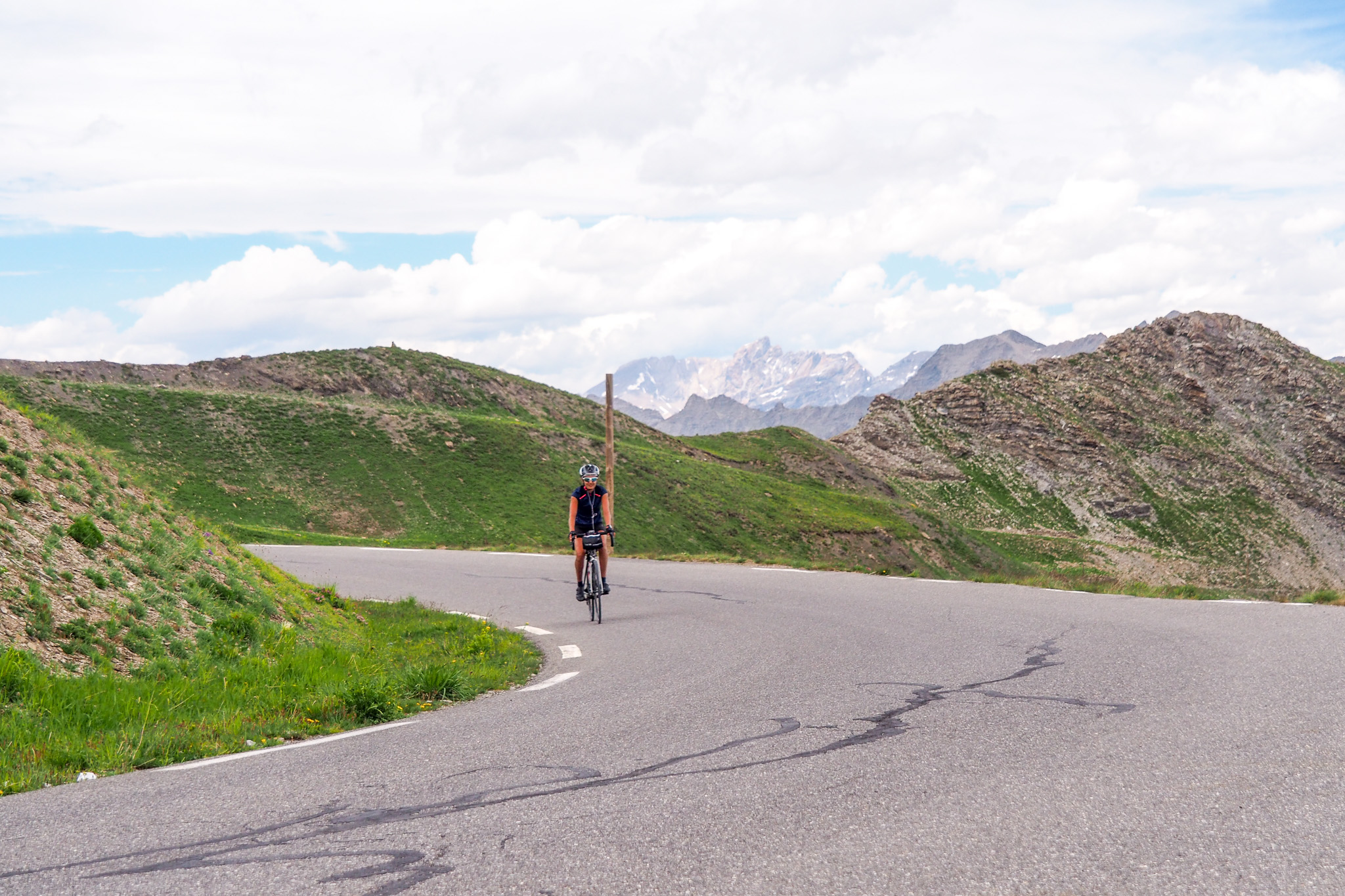
The slope eases, fluctuating between 3 and 3.5% over the last two kilometers lined with blockhouses that still separate you from the Col de la Bonette. Beware, the wind can be biting and icy at this altitude. Once you've reached the col (2715 m), the third highest in France, it's time to tackle the route around the cime de la Bonette. The choice is yours: right or left! Either way, the profile is scary. Our recommendation: take the right and summon up your last reserves of energy to tackle the last kilometer at an average gradient of 8%, which rises to 12% in the last hundred meters.
At 2802 meters and before you come full circle on the descent, congratulate yourself on having reached the highest point accessible by road in France. If you're a purist and really want to plant your flag on the true summit of the cime de la Bonette (2860 m), put down the bike and take the footpath (shoes permitting, of course).
Cycling up the Col de la Bonette and the cime de la Bonette from Saint-Étienne-de-Tinée, via the south side
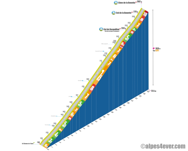
Start: Saint-Étienne-de-Tinée 1144 m
Distance: 25.4 km (to cime de la Bonette)
Altitude: 2715 m (Col de la Bonette), 2802 m (cime de la Bonette)
Elevation gain: 1571 m (to Col), 1658 m (to cime)
Average gradient: 6.5%
Maximum gradient: 10 to 12% in the last km before the cime de la Bonette
Tour de France® rating: hors catégorie
Time to climb the Col de la Bonette and cime de la Bonette by bike from Saint-Étienne-de-Tinée, via the south side
- At 7 km/h : 3 h 40
- At 11 km/h : 2 h 20
- At 15 km/h : 1 h 40
- At 19 km/h : 1 h 20
Map of the route up the Col de la Bonette and the cime de la Bonette by bike from Saint-Étienne-de-Tinée, via the south side
Description of the ascent of the Col de la Bonette and the cime de la Bonette by bike from St-Étienne-de-Tinée, by the south side
You leave Saint-Étienne-de-Tinée (1144 m), in the heart of the Tinée valley, for a beautiful 25.4 kilometer ride. The 1,658 meters of ascent and descent await you on a fairly even average gradient of 6.5%.
The route begins with a stretch of almost 700 meters, where the gradient shows 6.5% before turning into a gentler climb, oscillating between 3.5% and 4.5% over a length of 2.9 km, running parallel to the Tinée stream. The road then rises steeply for 450 metres at 6.5% until it reaches Pont Haut. At the crossroads indicating St-Dalmas-le-Selvage on the left, turn right towards Le Pra-Bousiéyas. The road narrows, but the gradient remains the same: 5.5% for 1.8 km, all the way to Pont de Vens. This is followed by a short but intense 500-meter climb at 8% to one of the wonders of the route: the Cascade de Vens. Two hairpin bends then offer varied perspectives on this site.
Continue for 1.7 km at 6.5/7% towards the vallon du Pra. Up to the hamlet of Le Pra, you'll have a moment to recover, with a 1.5 km section at 5.5%. After Pra, prepare for a long 10 km climb with an average gradient of 7.5%. An initial series of three hairpin bends takes you to Bousiéyas, the last inhabited area. You leave behind you the Vallée de la Tinée, whose source lies on the slopes of the cime de la Bonette.
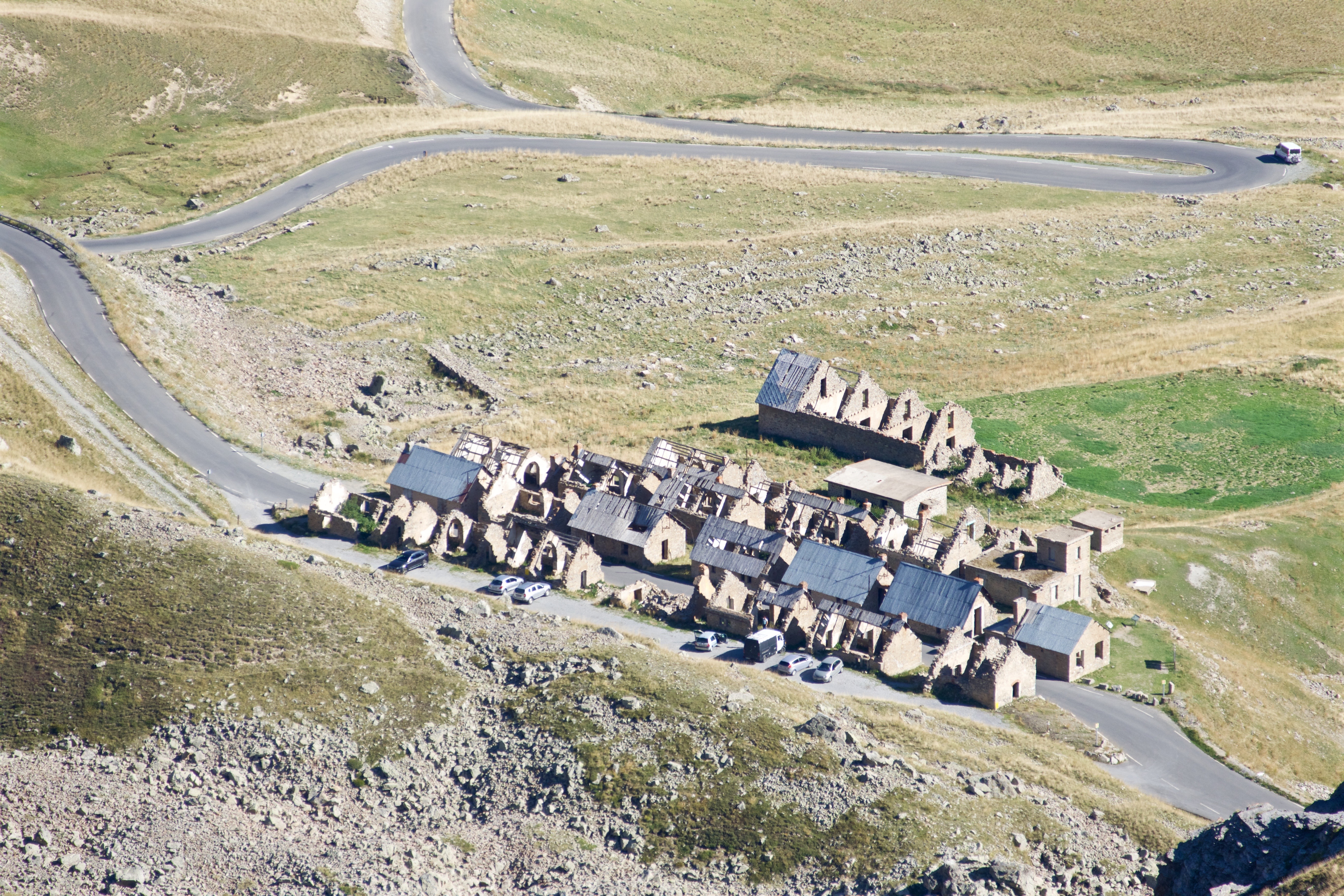
A sequence of twelve bends takes you past côte 2000, between kilometers 14 and 15. There's a stunning panoramic view, and you'll pass through the camp des Fourches, a disused military cantonment.
Take it easy on the next section (6/7% gradient), because beyond the Stèle du Général Jacquemot, who was struck by lightning on the southern slope in 1931, the road becomes particularly demanding: 225 meters at 10%, followed by 700 meters at 8.5%. Hard on the lungs!
After this difficult section, moderate effort for the next 1,700 meters which show 5.5% up to the Col de Raspaillon, also known as the Col des Granges Communes (2,513 m). At last, you can see the summit of La Bonette!
At the exit of the Col de Raspaillon, a 500-meter slope break at 8% still challenges your endurance. The next 700 meters at 3.5% represent a soothing interlude before the final assault. All that remains is to climb 1.8 km at 7.5% to reach the Col de la Bonette (2715 m). There are two options here: a climb to the left and one to the right, both equally formidable. We advise you to take the left to complete the ascent of the southern slope in style.
Warning: the final 875 meters represent an average gradient of 10%, with an ultimate effort of 12% on the last 100 meters! You will then have conquered the highest road in France (2802 m). Well done!
Conseils pour préparer l'ascension col de la Bonette et de la cime de la Bonette
Col et cime de la Bonette are in the high mountains. So please respect them! If you don't feel like going it alone, go with a specialized bike tour operator. If you're going on your own, or in a small group, don't forget to ask about weather conditions, road conditions and so on. In any case, be fit and very well prepared: it's long, it's hard, and altitude makes breathing more difficult.
Our advice:
- Why not go with a specialist travel agency, which will organize everything for you: luggage porterage, accommodation booking, possibly accompaniment and bike rental... Discover which specialist to go with on Route des Grandes Alpes ®
- Your bike and personal equipment must be carefully chosen, prepared and maintained. Discover the equipment you need to ride Route des Grandes Alpes ®.
- Don't joke about the weather! The following paragraph gives you all the contacts you need to get the information you need... and not get caught out!"
Weather conditions for Col de la Bonette and cime de la Bonette
The Col de la Bonette and cime de la Bonette route closes in October or November to reopen in May or June. If you're heading out early, check www.inforoute04.fr or www.inforoutes06.fr, or call the tourist offices in Jausiers (Alpes-de-Haute-Provence), or Saint-Étienne-de-Tinée (Alpes Maritimes).
Situated partly in the high mountains, the Col and the cime de la Bonette are subject to brutal weather variations: thunderstorms, rain, strong winds, snow more rarely. To be fully aware of conditions, consult www.meteoblue.com/fr/meteo/semaine/cime-de-la-bonette
To find out what time of year to set off on Route des Grandes Alpes ®
Recommended equipment for Col de la Bonette and cime de la Bonette
Although, in high season, it's possible to find an open café on both sides of the route, don't leave without enough water! It's the south and you can get very hot! If you don't want to cut your effort short, take two well-filled water bottles with you.
It's long, it's uphill and much of the ascent takes place at altitude. Don't forget to carry energy bars in your pockets, so you can feed yourself frequently. And don't expect to be able to enjoy a "refreshment" at the Col or at the summit of the Bonette: although, as mentioned above, you can find comfort on both sides of the mountain, there are no cafés or restaurants at the summit itself.
If you're using a VAE, remember to check the charge of your battery. If you break down on the climb, your stage will be severely compromised.
Finally, the temperature difference can be very significant between the bottom and the top. The wind, in particular, is often particularly biting. Warm clothing, which in any case will be useful on the way down, is likely to come in handy on the way up as well.
The wind, in particular, is often particularly strong.The map
The map
23 Alternative stage Barcelonnette / Saint-Etienne-de-Tinée
Services at Col de la Bonette and cime de la Bonette
Most of the necessary services exist at the foot of the two ascents: Jausiers (04) to the north and Saint-Étienne-de-Tinée (06) to the south. Charging station for VAEs in Jausiers.
In high season, you'll find one or two buvettes, cafés or restaurants on the road to the cime de la Bonette. Make sure they're open if you're planning a stopover. Nothing at the top of the pass or the summit, though!
Access to the Col de la Bonette and the cime de la Bonette
SNCF railway stations and bus stations
- Embrun (05)
- Guillestre (05)
- Nice (06)
- Barcelonnette (04)
Airport
- Nice (06)
Road access
- RN94 (05), from Gap or Briançon to Guillestre and the Col de Vars road.
- D900 (04), from Lac de Serre-Ponçon and Barcelonnette.
- M2205 or Route de la Tinée (06), from Nice.
- SS221 (Italy), from Borgo-San-Dalmazzo via Col de Larche or Col de la Lombarde.
Those who have done it speak best of it!
.jpg)
In ONE, the Bonette, because it's the highest, it's magnificent, pleasant to climb, that after the summit there's this promontory with the orientation table and this 360° view... Gérard Marion-Gallois
Dantesque day when climbing the Bonette with wind, rain, fog and thunderstorms! Romain
Beyond being proud and happy to have climbed Europe's highest pass with our panniers, this magnificent pass offers a timeless and bucolic ascent, with a multitude of small waterfalls. A real gem! Josépha Cathudal and his companion Hugo
The Col de la Bonette with its final kilometer corrects even the most spirited... to reach an altitude of 2,802 m. It's not every day you get to touch Europe's highest road! Laurent De Bruyn
A pass little known to the average person, but nevertheless the highest in Europe, a giant! Thomas Triquet;
Special mention for La Bonette, just seeing 2802m written on the sign at the summit, it gives that feeling that all the effort put in before is forgotten. It's a quiet place, with a breathtaking view of the Alpine peaks. Louis Mollard
FAQ
When can you climb the Col de la Bonette and the cime de la Bonette?
The Col de la Bonette (2715 m) and the cime de la Bonette (2802 m) are located in the high mountains. They close in October or November and reopen in May or June. For spring or autumn plans, consult www.inforoute04.fr or www.inforoutes06.fr or call the tourist offices in Jausiers (Alpes-de-Haute-Provence), or Saint-Étienne-de-Tinée (Alpes Maritimes).
In which national park are the Col de la Bonette and the cime de la Bonette located?
In the Mercantour National Park. It covers two departments (Alpes de Haute-Provence, Alpes Maritimes) and eight valleys: Roya, Bévéra, Vésubie, Tinée, Cians, Var, Verdon, Ubaye. On Route des Grandes Alpes ®, it takes you from Barcelonnette to Sospel! To find out more about the parks crossed by Route des Grandes Alpes ®
Is the ascent of the Col de la Bonette and the cime de la Bonette more difficult from the north side or the south side?
In both cases, we're talking about around 1500 m D+ for almost 25 kilometers. However, the ascent is a little easier from the south and Saint-Étienne-de-Tinée.
Can we access the Col de la Bonette and the cime de la Bonette in Gravel mode?
Route des Grandes Alpes ® Gravel offers you a magnificent stage linking the Ubaye to the Tinée, with a "side step" to the Col and the cime de la Bonette. You leave Barcelonnette and the Ubaye valley, heading south over the Col de la Cayolle to the Bachelard valley and gorges. At the Bayasse refuge-hotel, you leave the Col de la Cayolle road and head east into the mountains.
Just before the Col de la Moutière (2454 m), the itinerary offers you a round trip to the Col and the cime de la Bonette, via the "faux col" and the Col de Restefond : more about this stage Barcelonnette - Saint-Dalmas-le-Salvage
The other passes near the Col de la Bonette and the cime de la Bonette | The most beautiful passes of Route des Grandes Alpes ® |