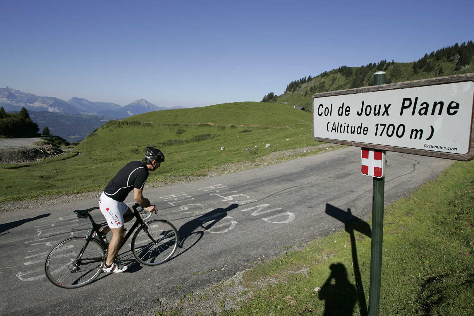
Low altitude, but steep slope!
Altitude 1691 m
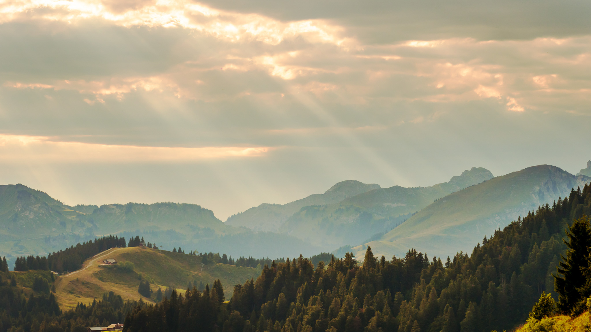
Massif du Chablais
Département Haute-Savoie
Summary
- Plan your bike ascent of the Col de Joux Plane
- Bike up the Col de Joux Plane from Morzine, by the north side
- Description of the ascent of the Col de Joux Plane by bike from Morzine, by the north side
- Ascent of the Col de Joux Plane by bike from Samoëns, by the south side
- Description of the ascent of the Col de Joux Plane by bike from Samoëns, by the south side
- Advice on how to prepare for the ascent of the Col de Joux Plane
- Weather conditions for the Col de Joux Plane
- Recommended equipment for the Col de Joux Plane
- Services at the Col de Joux Plane
- Access to Col de Joux Plane
- Témoignages
- FAQ
Plan your bike ascent of the Col de Joux Plane
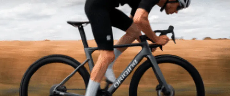
Located at an altitude of 1691 m in the Chablais massif, this col on Route des Grandes Alpes ® links the beautiful villages of Morzine (Portes du Soleil) and Samoëns (Grand Massif), as well as the Vallée d'Aulps and the Vallée du Giffre. Although not very high, the Col de Joux Plane on both sides of the mountain offers a challenging climb that should be taken very seriously. The Tour de France, which climbed it for the fourteenth time in 2023, made no mistake!
Cycling up the Col de Joux Plane from Morzine, via the north side
North side, from Morzine (74), 10.9 km at 6.5% (vertical drop: 711 m)
South side, from Samoëns (74), 11.6 km at 8.5
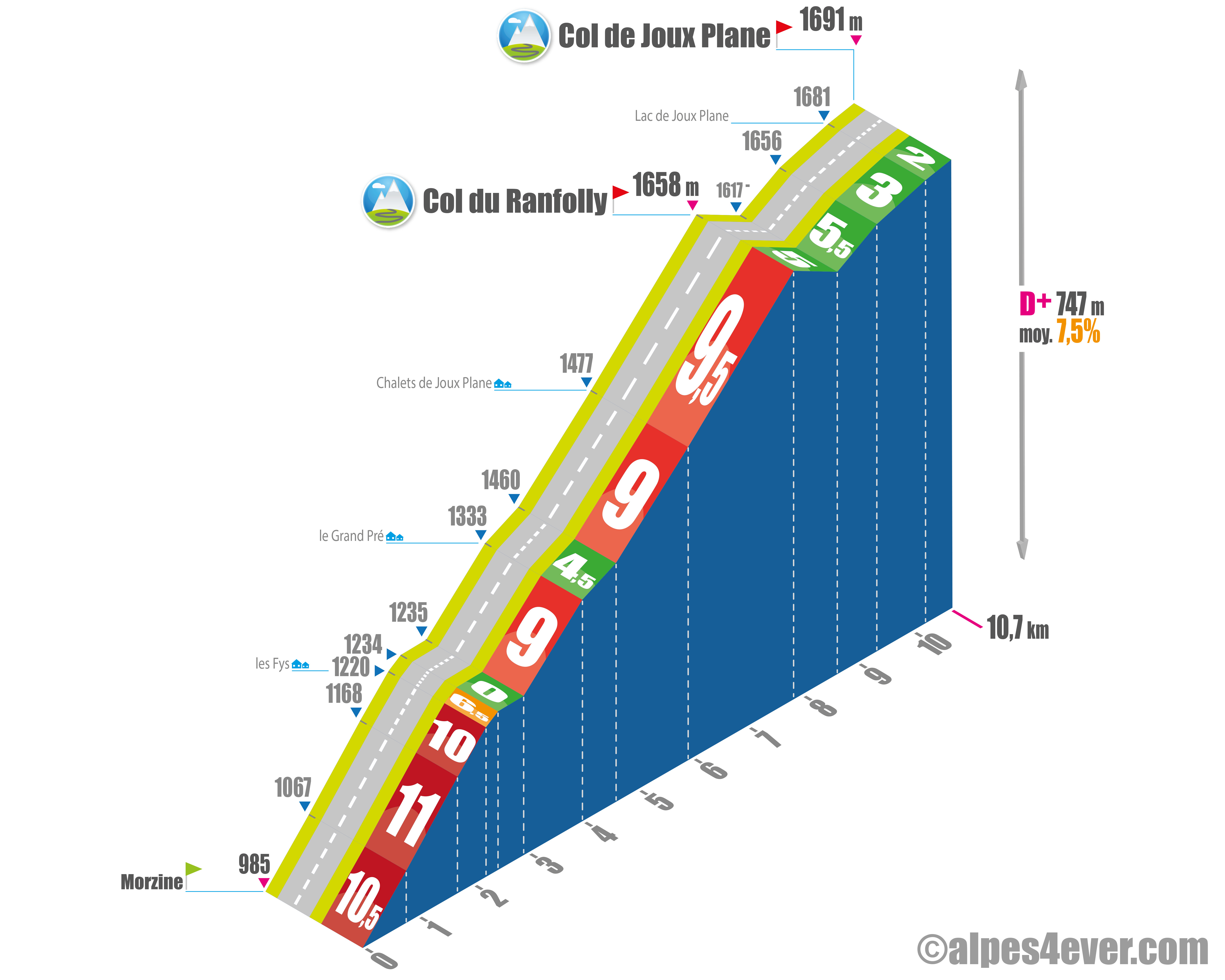
Start: Morzine, Vallée d'Aulps (980 m)
Distance: 10.7 km
Altitude: 1,691 m
Height gain: 747 m
Average gradient: 7.5%
Maximum gradient: 11% over 950 m
Tour de France® rating: hors catégorie
Time to climb (rounded) Col de Joux Plane by bike from Morzine, via the north side
- At 7 km/h: > 1 h 30
- At 11 km/h: 1 h 00
- At 15 km/h: 45'
- At 19 km/h: 40'
Map of the route up the Col de Joux Plane by bike from Morzine, via the north side
Description of the ascent of the Col de Joux Plane by bike from Morzine, by the north side
From the center of Morzine, it's almost 11 km of ascent that takes you to the summit of the Col de Joux Plane. This slope, less renowned than the south side, more often used by the Tour de France or the Dauphiné, is nonetheless particularly difficult for the first 8 km.
On this section, although a few very short passages, including one almost flat, allow you to recover from time to time, you face a succession of severe slopes: from 9 to 11%! Between mountain pastures, hamlets, small forests and ski lifts, you'll have to swallow 8 kilometers at an average of almost 8.5%.
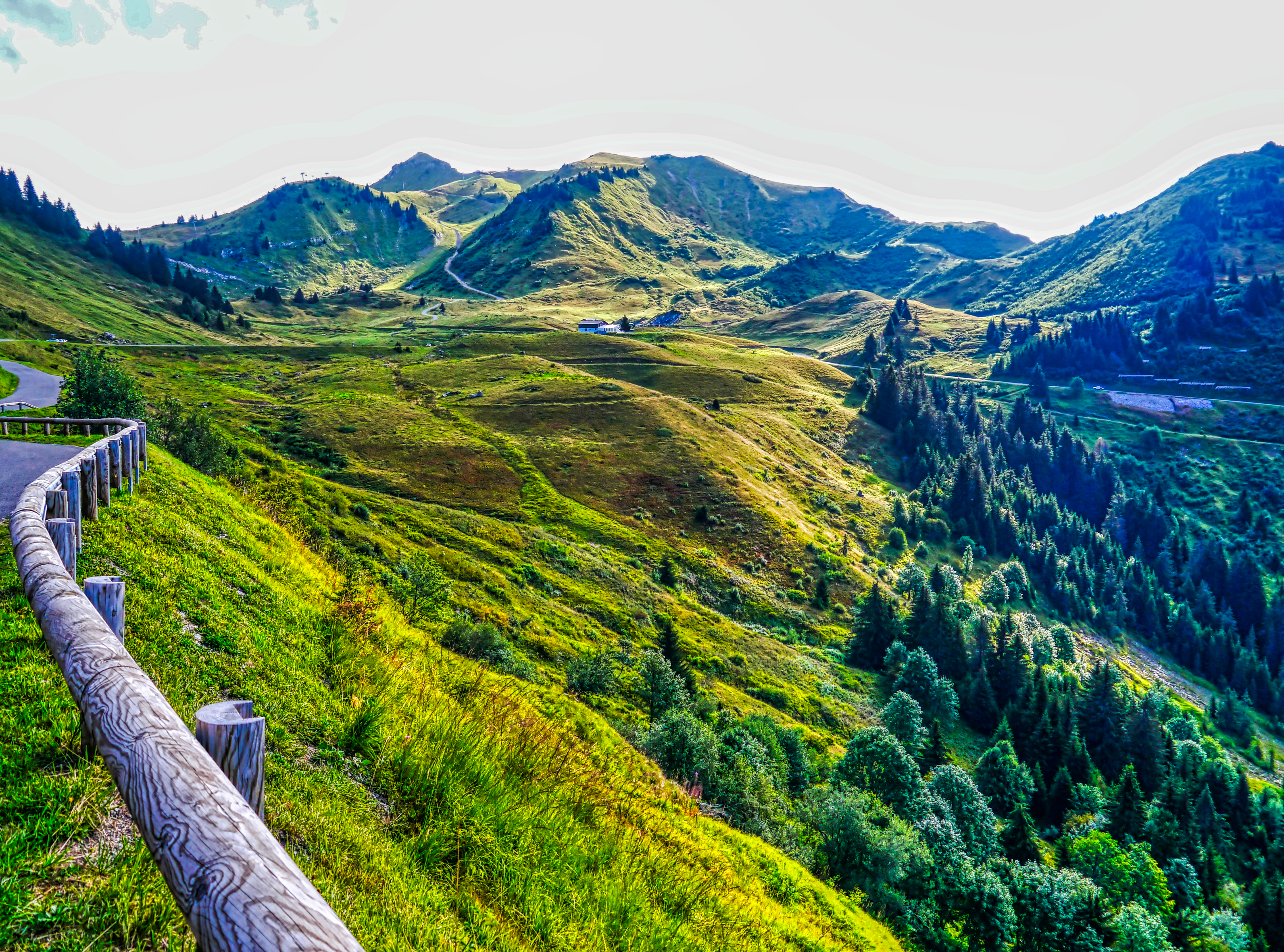
The passage of the Col de Ranfolly (1658 m) marks the end of the test, with a descent of around one kilometer, which precedes a final climb of two kilometers at 3.5% to the Col de Joux Plane, its small lake, its bucolic and verdant atmosphere.
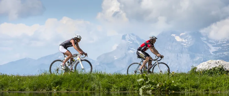
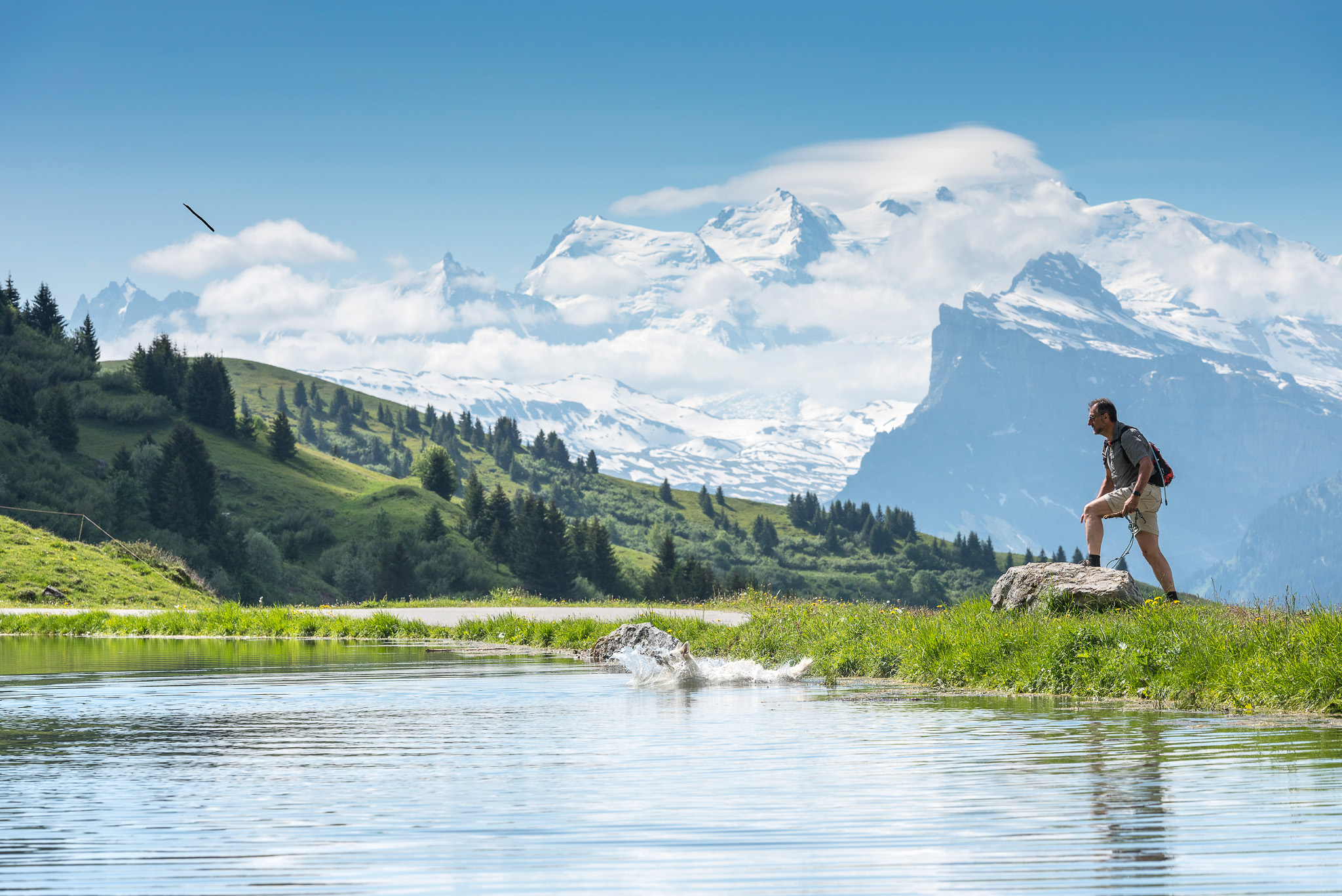
You haven't stolen the view of Mont Blanc.
Cycling up the Col de Joux Plane from Samoëns, via the south side
Start: Samoëns, Vallée du Giffre (703 m)
Distance: 11.5 km
Altitude: 1691 m
Stop: 991 m
Average gradient: 8.5%
Maximum gradient: 11% (and even 15% over a hundred meters!)
Tour de France® rating: out of category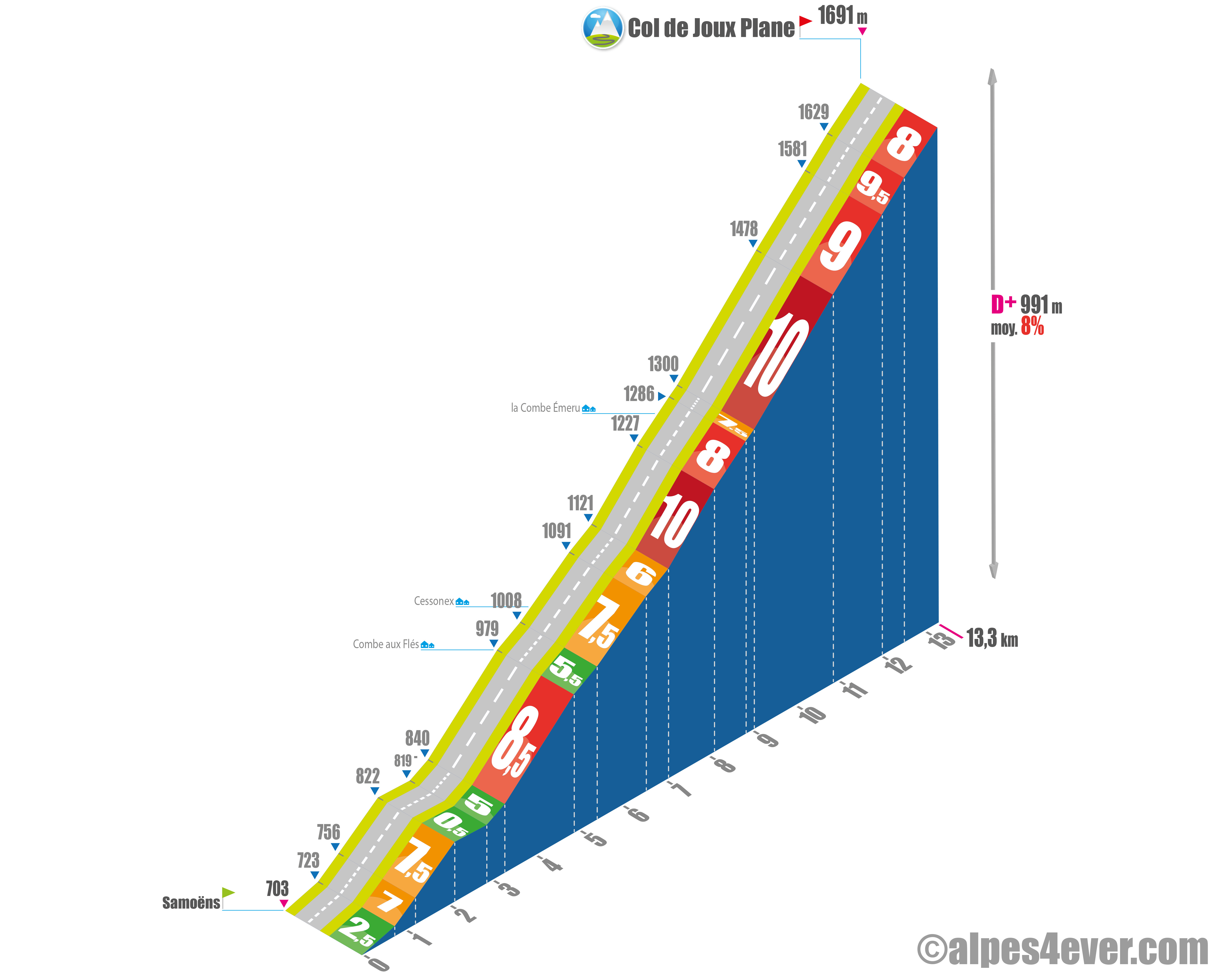
Cycling time up the Col de Joux Plane from Samoëns, via the south side
- At 7 km/h : 1 h 40
- At 11 km/h : > 1 h 00
- At 15 km/h : 45'
- At 19 km/h : 36'
Map of the route up the Col de Joux Plane by bike from Samoëns, via the south side
Description of the ascent of the Col de Joux Plane by bike from Samoëns, by the south side
On the south side, from Samoëns, the route offers virtually no respite. The first half of the ascent is the easiest, or rather the least difficult, although there are already passages at 8, 9 and even 10%. Most of the climb takes place in sunny areas. Setting off early in the summer is a must!
From the sixth kilometer onwards, it gets downright steep. Yaw after yaw, the road rises on slopes often approaching 10%. Fortunately, the forest brings a little coolness. When you come out of it and the sharp bends stop, you can see the pass two kilometers away, at the end of a long, long curve. But just because you're getting close to the goal doesn't mean it's any easier.
To the lake, the chalet and the pass parking lot, it's still a hard climb. The view, now quite clear, allows you to admire the surrounding valleys and peaks.
Note the possible variants, from Samoëns, via the hamlet of Chantemerle, or Le Villard.
Conseils pour préparer l'ascension col de Joux Plane
Attention, some parts of the road are very exposed to the sun. Ascent "à la fraiche" recommended!
Our advice:
- The first major pass on Route des Grandes Alpes® if you set off from Thonon-les-Bains, the Col de Joux Plane will put your fitness to the test. Set off well-trained, and especially for those reaching their prime, don't forget the cardio test!
- Luggage transfer and transport, hotel reservations, B&Bs, B&Bs and other types of accommodation, guidance and accompaniment, bike and VAE rental, choose your travel agency. Discover which specialist to go with on Route des Grandes Alpes ®
- Selection of equipment, outfits, preparation, maintenance: here's the equipment you need to complete Route des Grandes Alpes ®.
Weather conditions for the Col de Joux Plane
Access to the Col de Joux Plane (1691 m) depends on weather conditions. It can open in early May, or even a little earlier, and close with snow in late November or early December. It then transforms into a superb Nordic ski area, with exceptional panoramic views.
For weather conditions, here's a site to check out.
You can also see conditions in real time on the webcam on the Col de Joux Plane.
To find out what time of year to set off on Route des Grandes Alpes ®
Recommended equipment for the Col de Joux Plane
The Col de Joux Plane belongs to the "club" of medium-altitude passes, like the col de la Colombière, the col des Aravis, etc. Difficult, but neither very high nor very long. In the middle of summer, you're more likely to get a heat stroke than a snowfall. Fill up your water bottles before setting off, and put a few bars in your pockets.
A thunderstorm or heavy rain is always a possibility. So the recommendation is once again the same: pack at least one windbreaker in your "fontes", to use a Western vocabulary.
If you're on a VAE, check the charge of your battery before setting off to tackle the col
Recharge terminals: Morzine Tourist Office, Sherpa Samoëns store.
Services at the Col de Joux Plane
While challenging, the ascents, both north and south sides, are relatively short. Both start from mountain villages and resorts, Morzine and Samoëns, very well endowed with shops of all kinds. Cafés, restaurants, sports stores, food stores, accommodation - you're spoilt for choice. Above all, don't hesitate to make a stopover or stopover, you won't regret it!
If you want to enjoy a stopover at the Col de Joux Plane, check before you leave that the Relais des Vallées, a restaurant located at the summit, is open.
Access to Col de Joux Plane
SNCF and bus stations
- Thonon-les-Bains
- Cluses
Road access
- D354 from Morzine and Samoëns.
- Access to Morzine via A40, Bonneville exit, towards Taninges, Les Gets, Morzine.
- Access to Samoëns via A40, Cluses exit, towards Morillon, Samoëns.
Those who have done it speak best of it!
I have a painful memory of the Col de Joux Plane. Three of us set off on a hot summer's morning, on the south-facing slope. The heat and the first steep climb out of Samoëns broke my legs right from the start. I couldn't recover afterwards, and it was by sheer will and at a slow pace that I reached the summit. It was a magnificent descent, with the Col de Ranfolly swallowed up in the rush. But the fatigue was there and I felt it well when we continued with the Col de la Ramaz, after a break in Morzine! Jean-Loup Tétard, one of the hosts of this site.
Last summer, I decided to set out to climb the Col de Joux Plane. Setting off from Morzine, I found myself facing a fairly steep climb right from the start. The first few kilometers were really demanding, with gradients sometimes reaching 10%. Despite the difficulty, I was captivated by the beauty of the scenery, with dense forests and stunning views of the surrounding mountains. John, translated from American.
I climbed Joux Plane from Samoëns. It's a tough start, but I hung in there. The scenery is splendid, with mountains everywhere. Getting to the top was incredible, a real sense of achievement. A tough pass though! Aurélie, seasoned cyclist.
The Gravel ascent of Joux-Plane is nothing like the road version, but just as challenging, especially from the Col des Gets, where you pass through the ski slopes. But what a reward at the top! ! Lionel Terrail, co-host of Route des Grandes Alpes ®
FAQ
What is the significance of Joux Plane?
In the Jura, French-speaking Switzerland and the two Savoy regions, the term "Joux" refers to a wooded mountain. This is no longer the case at the summit of the Col de Joux Plane, located in an alpine pasture zone.
What is the origin of the name Samoëns, at the foot of the southern slope of the Col de Joux Plane?
Samoëns, classified as the most beautiful village in Haute-Savoie in 2021, is a village almost a thousand years old, with a remarkable ancient historical heritage: old covered market, church... The name Samoëns is said to date back to 1167 and to qualify "the seven mountains" surrounding the village. The inhabitants of Samoëns are the septimontaines and septimontains.
But what is the altitude of the Col de Joux Plane?
The geographical col is 1712 m: everyone agrees on that! It's easily reached from the road via a short hiking trail. As for the summit from the road, assumptions are more varied. While the sign says 1700 m, some websites put it at 1691, or even 1697 m. As it was difficult to decide, we opted for 1691 m, the height chosen by our friend Joris Lesueur, tireless pass hunter and host of the alpes4ever website. It's also the altitude that comes up most often.
To which cross-border area does Morzine belong, at the foot of the northern slope of the Col de Joux Plane?
Morzine is one of the most beautiful resorts in the Portes du Soleil, which comprises 12 resorts. Eight are in France, including Morzine and Avoriaz, and four are in Switzerland, in the canton of Valais. Since 1964, the Portes du Soleil has been one of the most beautiful ski areas in the world. More recently, and during the summer season, they have become a Mecca for cycling: mountain biking and road biking.
.The map
The map

2 Morzine-Avoriaz / Cluses
2 Morzine-Avoriaz / Cluses
Other passes near Col de Joux PlaneCol du Feu | The most beautiful passes of Route des Grandes Alpes ® |