

Between Giffre and Arve
Altitude 741 m
Massifs du Chablais et du Giffre
Département Haute-Savoie
Topo North side
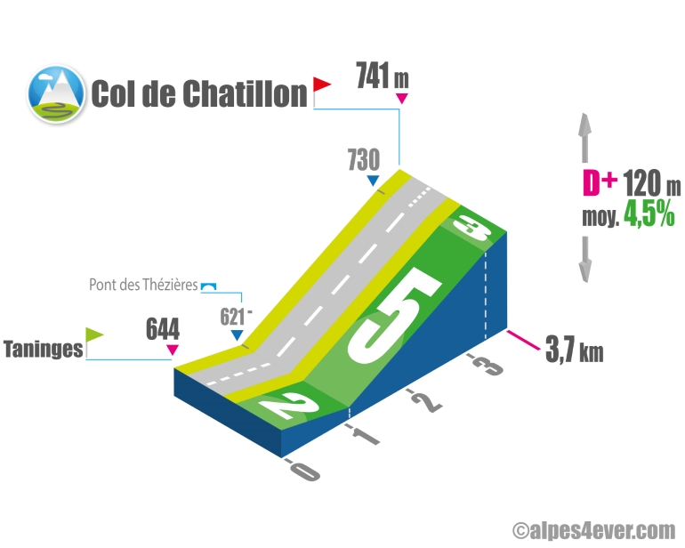
The Col de Chatillon - 741 m - links the Giffre and Arve valleys. Don't be fooled by its modest altitude and short slope - 3.7 km from Taninges: this pass can be climbed on an average gradient of 4.5%. On the other hand, you'll need to be careful with traffic, which can be heavy at certain times of the day. At the summit, there's a beautiful view of the peaks of the Massifs du Chablais and du Giffre.
.
South side top
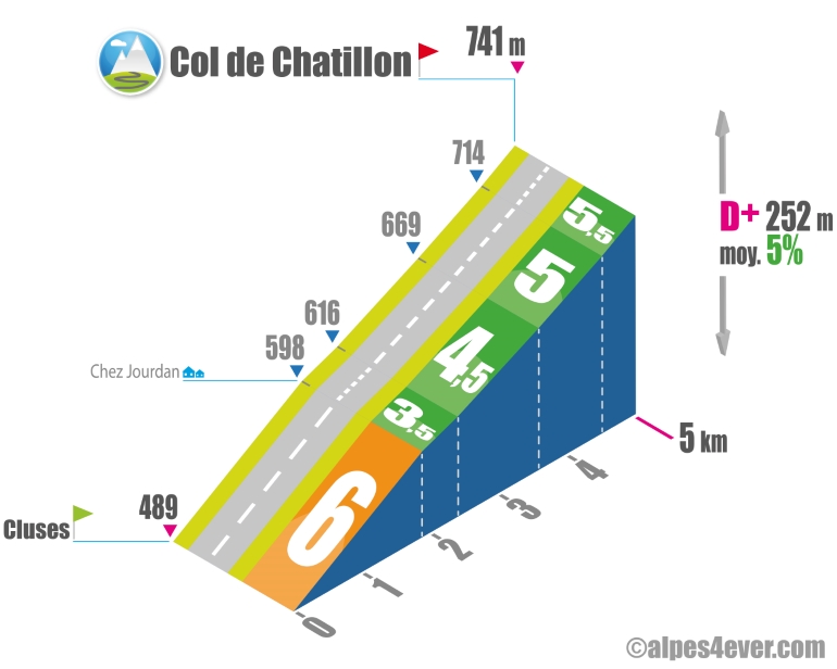
The Col de Chatillon - 741 m - links the Arve and Giffre valleys. Don't be fooled by its modest altitude and short slope (5 km from Cluses). This pass has an average gradient of between 4.5 and 6%. And you'll need to be careful with traffic, which can be heavy at certain times of the day.
.
The map
The map
1 Thonon-les-Bains / Morzine-Avoriaz
Author
Joris Lesueur
webmaster of alpes4ever.com
contact@alpes4ever.com