


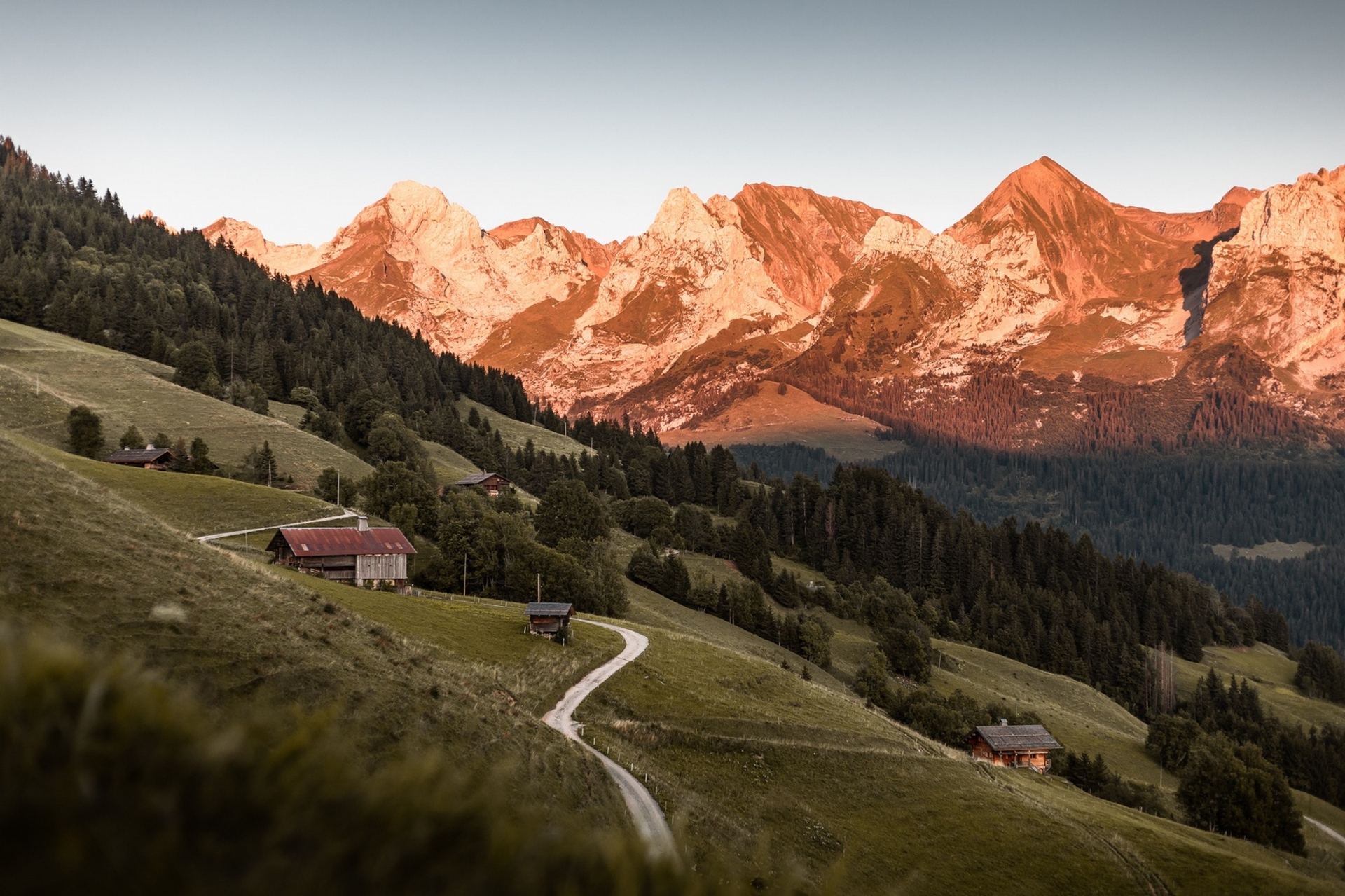
Encounter with Mont Blanc
Altitude 1486 m
Massif des Aravis
Département Savoie
Summary
- Plan your bike ascent of the Aravis Pass
- Bike up the Aravis Pass from Saint-Jean-de-Sixt, via the north side and La Clusaz
- Description of the bike ascent of the Aravis Pass from Saint-Jean-de-Sixt, via the north side and La Clusaz
- Bicycling up the Col des Aravis from Flumet, via the south side
- Describing the ascent of the Col des Aravis by bike from Flumet, by the south side
- Conseils pour préparer l'ascension du col des Aravis
- Weather conditions for the Col des Aravis
- Recommended equipment for the Col des Aravis
- Services at the Col des Aravis
- Access to Col des Aravis
- Témoignages
- FAQ
Plan your bike ascent of the Col des Aravis
Located at an altitude of 1486 m, in the Aravis massif, this col on Route des Grandes Alpes ® is a border between Savoie, where it is geographically located, and Haute-Savoie. Whether you're coming from Saint-Jean-de-Sixt, La Clusaz and even Lake Annecy on the Haute-Savoie side, or from La Giettaz, Flumet and the Val d'Arly on the Savoie side, you'll enjoy the exceptional view of Mont Blanc from the Aravis Pass with equal pleasure. It's a feast for the eyes and a treat for the taste buds, because there's no shortage of restaurants up there!
Cycling up the Col des Aravis from Saint-Jean-de-Sixt, via the north side and La Clusaz
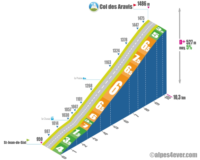
Start: Saint-Jean de Sixt (959 m)
Distance: 10.3 km
Altitude: 1486 m
Height difference: 527 m
Average gradient: 5%
Maximum gradient: 7.5%
Tour de France® rating: 2nd category
Cycling time (rounded) up the Col des Aravis from Saint-Jean-de-Sixt, via the north side and La Clusaz
- At 7 km/h: 1 h 30
- At 11 km/h: 1 h 00
- At 15 km/h: 40'
- At 19 km/h: 30'
Map of the route up the Col des Aravis by bike from Saint-Jean-de-Sixt, via the north side and La Clusaz
Description of the ascent of the Aravis pass by bike from Saint-Jean-de-Sixt, via the north side and La Clusaz
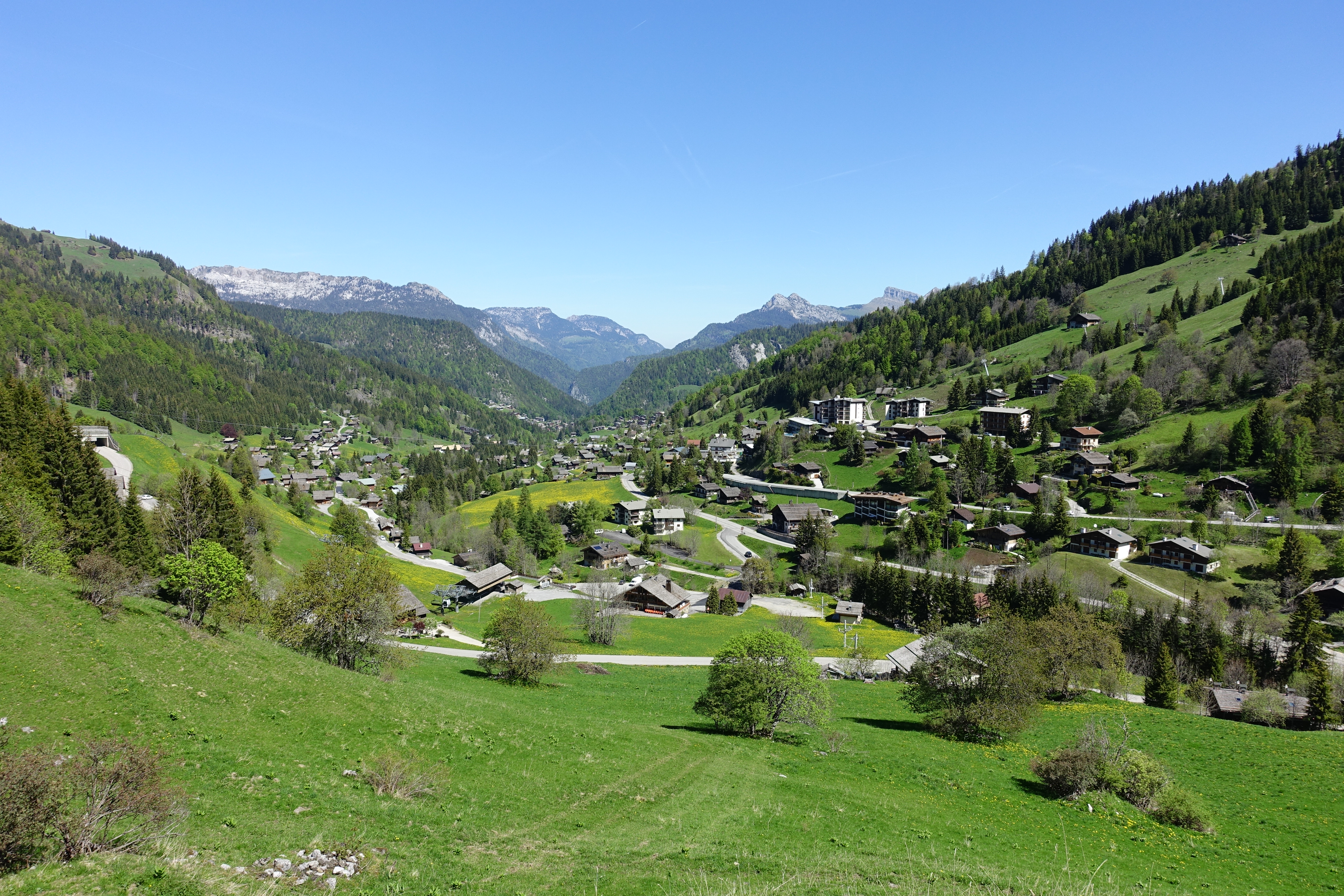
On the Haute-Savoyard side, the ascent of the Col des Aravis is generally considered to start at Saint-Jean-de-Sixt, a village located between Le Grand-Bornand and La Clusaz, where the climb becomes more serious.
In fact, the 2.6 km that separate Saint-Jean-de-Sixt and La Clusaz, constitute a rather easy first section, almost an uphill false flat. It starts to climb in the village of La Clusaz, with 400 m at 7%. The climb is very steady, with 6 magnificent switchbacks as you leave the hamlet of Les Converses, which marks the end of the inhabited area. The view over the inimitable jaggedness of the Aravis mountain range is absolutely splendid.
In the last few pitches, the road lowers for a truly tranquil finale, enough to fully appreciate the postcard of Mont-Blanc that grows bigger with every passing meter.
Cycling up the Col des Aravis from Flumet, via the south side
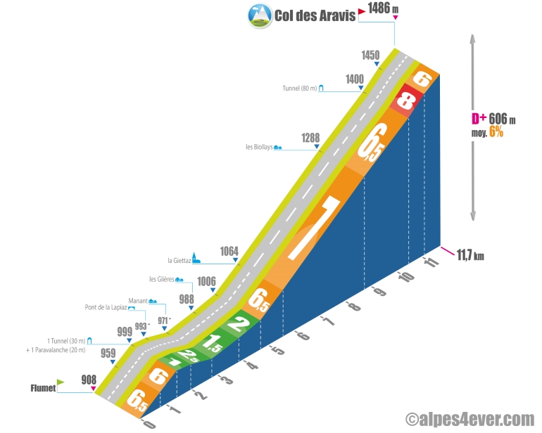
Start: Flumet (908 m)
Distance: 11.7 km
Altitude: 1486 m
Height difference: 606 m
Average gradient: 6%
Maximum gradient: 8%
Tour de France® rating: 2nd category
Time to climb the Col des Aravis by bike from Flumet, via the south side
- At 7 km/h: 1 h 45
- At 11 km/h: > 1 h 00
- At 15 km/h: 45'
- At 19 km/h: 35'
Map of the route up the Col des Aravis by bike from Flumet, via the south side
Description of the ascent of the Aravis pass by bike from Flumet, by the south side
The ascent of the Savoyard side (south side) offers, from the Val d'Arly, an 11.7 kilometer climb, with a section of rare regularity, located more or less in the middle: 7 kilometers at an average gradient of 7%.
But let's not burn out the stage! You rise above Flumet, at the bottom of the valley, the starting point of the climb, taking in almost 6 relatively easy kilometers, including a descent of almost 1.5 kilometers.
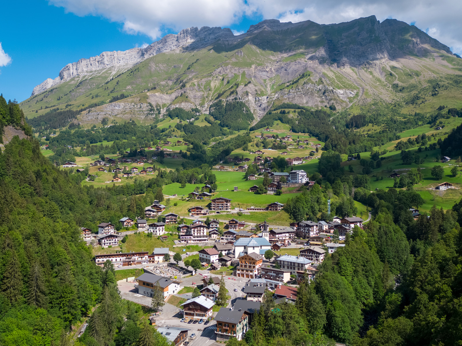
In this section you skirt the Arrondine gorges before arriving at the village of La Giettaz, popular with winter sports enthusiasts. Beware, even if they're fairly short passages, you won't be able to avoid a tunnel followed by a paravalanche.
At La Giettaz begins a remarkable sequence of switchbacks, already mentioned at the beginning of the text: 7 km x 7%. Enough to keep you busy for a while! At the end, the gradient eases slightly before offering you 600 metres at 8%, followed by a leisurely arrival at the Col des Aravis. Second warning: you'll have to cross a second tunnel of around 80 meters, with no lighting.
Conseils pour préparer l'ascension du col des Aravis
As the Col des Aravis is very busy during the high tourist season, we also remind you of safety rules on the road.
Our advice:
- Itinerant cycling can't be improvised! When to go? With whom? Which itinerary to choose... Check out our FAQ
- Want to go with a travel agency that takes care of everything, including finding you company? Go to our dedicated section: with which specialist to go with on Route des Grandes Alpes ®
- And for equipment: discover the equipment you need to ride Route des Grandes Alpes ®.
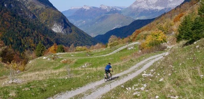
Are you a Gravel fan? It's a good thing the Aravis pass is also on the Route des Grandes Alpes® Gravel itinerary. Coming from La Clusaz, just after the pass, you take the famous "Route de la Soif", a magnificent balcony path that precedes the descent to Flumet.
Weather conditions for the Aravis pass
The Aravis pass is open all year round except for rare closures, most often due to exceptional snowfall.
For weather conditions at the pass, you can consult these two sites:
Meteoconsult
Meteoblue
And here's the webcam address: m.webcam-hd.com/les-rhodos/col-des-aravis
To know when to set off on Route des Grandes Alpes ®
Recommended equipment for the Aravis pass
Despite its medium altitude, the Col des Aravis is in the Northern Alps, not far from the Mont-Blanc glaciers. While it can get very hot there in summer, heavy precipitation, mist and fog can also cool it down considerably. Choose your clothes accordingly.
About clothes, go for bright colors. Not because it's more cheerful, but to make sure you look good to other road users!
By the way, what do you have in your repair kit?
If you don't know exactly what to take, here's a typical list: multi-tool with chain-drift, inner tube adapted to the size of your wheels, mini-pump, patch kit, tire lever, quick links adapted to your chain, derailleur hanger adapted to your bike, a spare tire, lubricant. And don't forget to renew the equipment you use as soon as you use it for the first time!
Find out more about the equipment to take with you on Route des Grandes Alpes®
Charging stations for your electric bike: Bosch charging station on the Aravis pass at Alpes Aventures.
Services near Col des Aravis
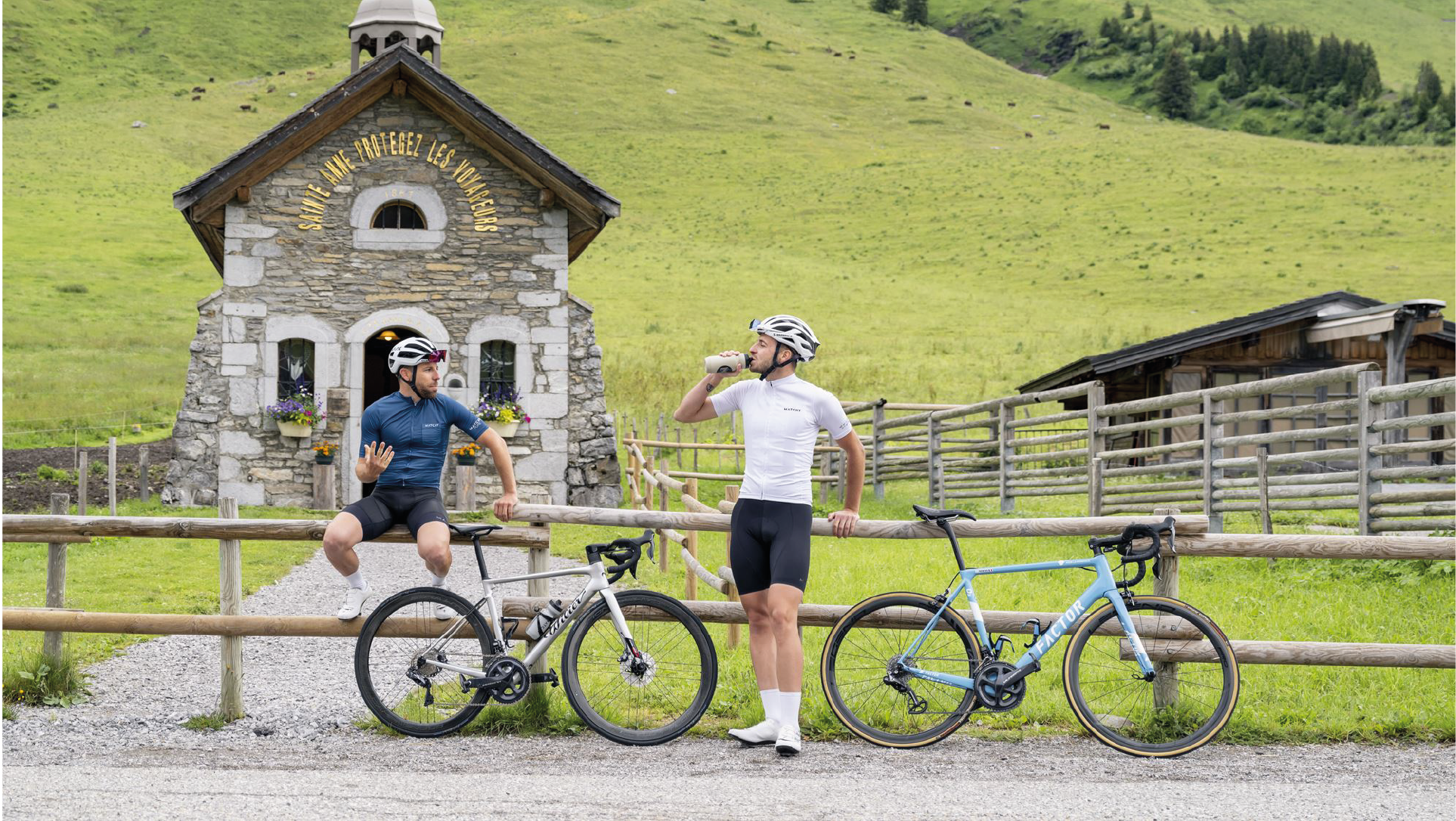
Whether you're looking for a bite to eat or a coffee to sip, you're spoilt for choice. There's no shortage of restaurants at the top of the pass, which is an extremely popular excursion spot, as Mont Blanc views go.
On the Haute-Savoie side, La CLusaz is a big, beautiful resort, where you'll find everything you need in terms of services and accommodation.
On the Savoie side, Val d'Arly and Flumet are a little more discreet, but you should have no trouble satisfying your needs. Especially if you add to that the resort of La Giettaz, in the first third of the climb.
VAE charging stations: Bosch charging station at Col des Aravis at Alpes Aventures.
Access to Col des Aravis
SNCF and bus stations
- Annecy
- Albertville
Road access
- D909 (or D16 + D909), from Annecy to the pass.
- D1212 + D909, from Ugine (73) or Sallanches (74), then the Val d'Arly.
Those who have done it speak best of it!
I set off from Le Grand-Bornand... Short climb to Saint-Jean de Sixt and then it's pretty easy all the way to La Clusaz. Crossing the resort is uneventful. After that it's never very hard, but always very beautiful, with incredible views of the Aravis skyline and the Étale massif. Samuel, Albertville.
The south side, from the Val d'Arly is definitely more difficult and much wilder than the north side. There are also fewer cars...Nadège, Grenoble.
At the top of the pass, in high season, it's better to have a bike than a car to park and eat a blueberry tart. But the view of Mont Blanc is so exceptional! Jean-François, Clichy.
Beautiful day we had, last July. Departure from La Clusaz, arrival in Bourg-Saint-Maurice, with the Col des Aravis, the Col des Saisies and the Cormet de Roselend. A fine progression through the difficulties... Vincent, Jean-Frédéric and Anthony, Strasbourg.
From La Clusaz to La Giettaz via the Aravis and back, it's a fine effort. As a bonus the two resorts, with their "onion" steeples sum up the charms of our region. Nicolas and Camille, Annecy.
On the program for "my" Route des Grandes Alpes ® South-North, the South side is a real treat! A steady slope, pleasant twists and turns, majestic views... A great climb before finishing the stage in Le Grand-Bornand! Lionel, Co-animateur de Route des Grandes Alpes®
FAQ
In Savoie or Haute-Savoie, the Col des Aravis?
Although it's true that the Col des Aravis serves as a border between the two departments, the geographical pass is in Savoie.
What are the names of the resorts on either side of the Col des Aravis?
On the northern side, in Haute-Savoie, La Clusaz is both an alpine and a cross-country ski resort. Its Confins and Beauregard plateaus are paradises for Nordic activities! On the south side, in Savoie, La Giettaz is a somewhat secret spot much appreciated by slide lovers.
What is the summit of the Aravis massif?
It's the Pointe Percée, which, from the top of its 2750 meters, dominates both the Arve valley and the Aravis valleys. Perhaps you've already read its name on tins of Reblochon, the local cheese?
How many times has the Col des Aravis been crossed by the Tour de France?
19 times between 1947 and 2023! Suffice to say, it's a regular on the Grande Boucle.
The map
The map
4 Le Grand-Bornand / Beaufort-sur-Doron
NB: Saint-Jean-de-Sixt, a village equidistant between Le Grand-Bornand and La Clusaz, is the starting point for an alternative section, involving two stages, taking you via Annecy Lake.
4 Le Grand-Bornand / Flumet
The other passes near the Aravis pass | The most beautiful passes of Route des Grandes Alpes ® |