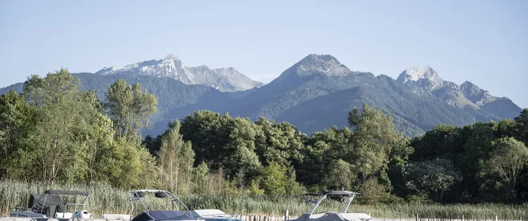
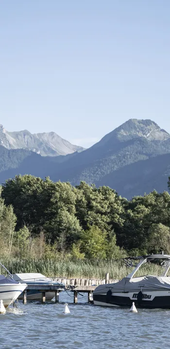
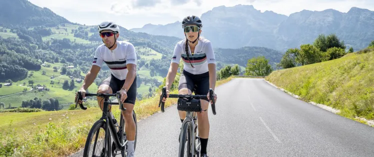
The Aravis Gateway
Altitude 1613 m
Massif des Bornes
Département Haute-Savoie
Summary
- Plan your Col de la Colombière ascent by bike
- Col de la Colombière ascent by bike from Cluses-Scionzier, by the north side
- Description of the Col de la Colombière ascent by bike from Cluses-Scionzier, by the north side
- Bicycling up the Col de la Colombière from Le Grand-Bornand, by the south side
- Description of the Col de la Colombière ascent by bicycle from Le Grand-Bornand, by the south side
- Conseils pour préparer l'ascension du col de la Colombière
- Weather conditions for the col de la Colombière
- Recommended equipment for the col de la Colombière
- Services at the col de la col de la Colombière
- Access to col de la Colombière
- Témoignages
- FAQ
Plan your bike ascent of Col de la Colombière
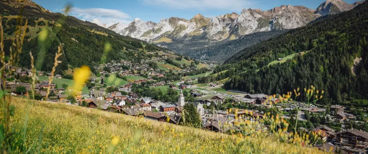
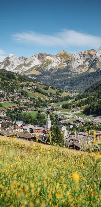
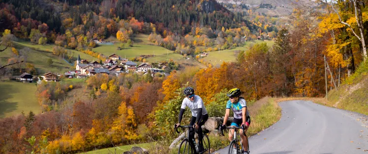
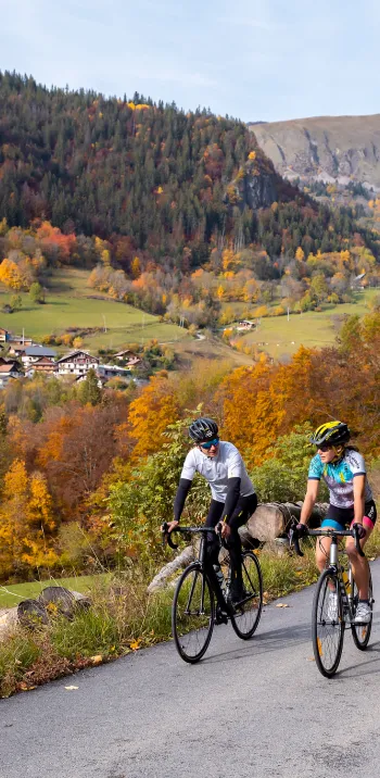
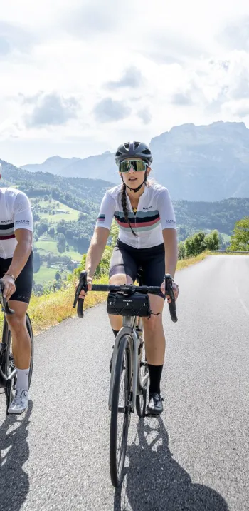
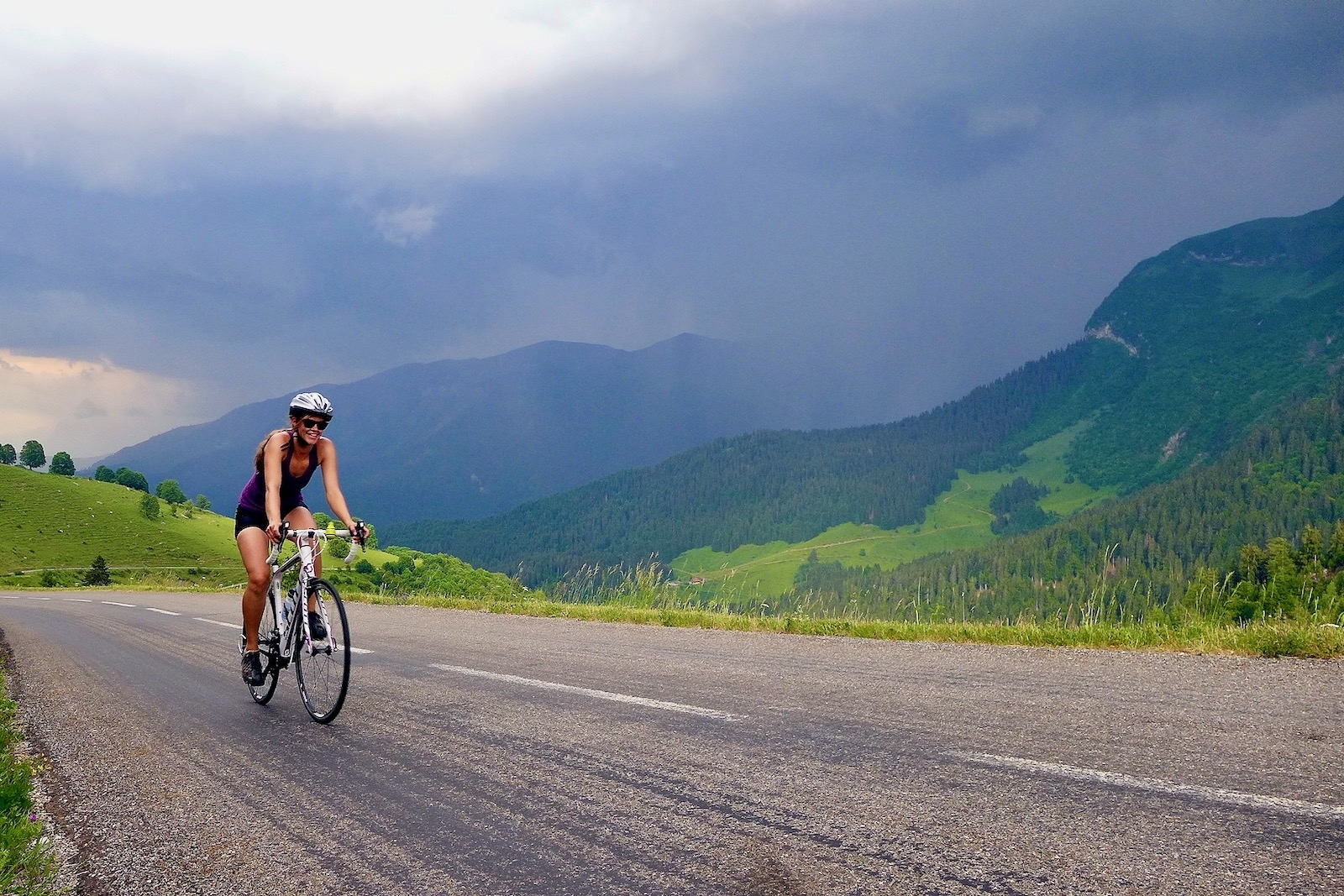
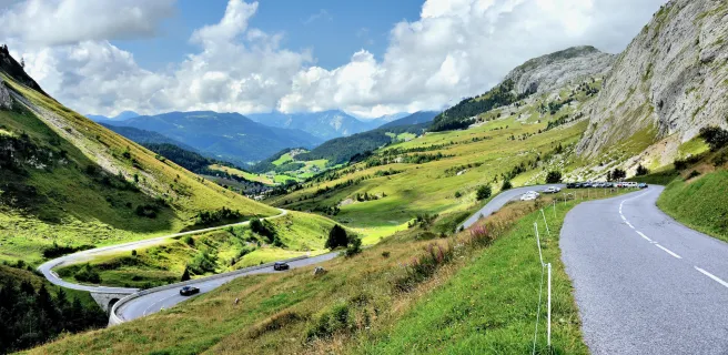
Located at an altitude of 1613 m, this col on Route des Grandes Alpes ® links the Arve valley to the Aravis massif, whose relief descends to Annecy, Haute-Savoie's major city. On the north side, you have two options, including the very tough variant via Romme sur Cluses. The routes meet at the village of Le Reposoir for the difficult final kilometers to the summit. On the south side, the ascent is gentler and takes place in a magnificent, wide-open alpine landscape. It takes you through Le Grand-Bornand, then Le Grand Bornand-Chinaillon, which are among the most authentic villages in Haute-Savoie.
Cycling up the Col de la Colombière from Cluses-Scionzier, via the north side
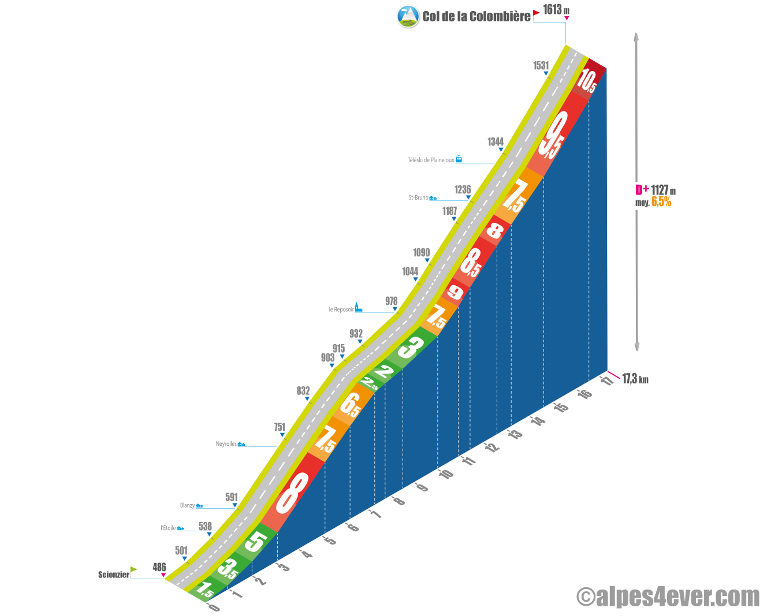
Start: Scionzier (505 m)
Distance: 16.5 km
Altitude: 1613 m
Height gain: 1108 m
Average gradient: 6.8%
Maximum gradient: 10.2%
Tour de France® rating: hors catégorie
Col de la Colombière ascent time (rounded) by bike from Cluses-Scionzier, via the north side
- At 7 km/h: 2 h 30
- At 11 km/h: 1 h 30
- At 15 km/h : 1 h 10
- At 19 km/h : 55'
Course map of the Col de la Colombière climb by bike from Cluses-Scionzier, via the north side
Description of the Col de la Colombière ascent by bike from Cluses-Scionzier, by the north side
A side with over 1100 m D+ that leaves you the choice: "difficult", or "even more difficult"?
Choice no. 1, the normal route, from Scionzier, which we'll describe first.
Choice no. 2, the variant from Cluses via Romme (Cluses and Scionzier belong to the same conurbation).
The two routes meet at the village of Le Reposoir (980 m). There is then a 7 km ascent to the Col de la Colombière.
From Scionzier to Le Reposoir
The departure from Scionzier offers a gradual entry into the 9 km ascent to Le Reposoir. The first laps are on a gentle slope, ideal for warming up. You pass through residential and rural areas, which gradually give way to meadows, then forests.
The middle section, two kilometers at 8% followed by one kilometer at 6.5%, represents the main difficulty of the climb. The dense forest cover at this point protects you from the excesses of sun and wind.
The last three kilometers to Le Reposoir are little more than an uphill false flat.
From Cluses to Le Reposoir via the Col de Romme
From Cluses to Le Reposoir via Romme, it's a completely different story!
The 9.3 kilometers to the Col de Romme (1297 m), in the center of the village of the same name, represent 815 m of ascent at almost 9% average, with maximum gradients of 12.5%. There's just one short stretch of 500 m in the middle to take a breather.
Thankfully, after Romme and up to Le Reposoir, you have 6.5 km and 300 m of negative gradient to recover.
Le Reposoir, where the two routes meet, lives up to its name. The atmosphere is calm and welcoming. It's the ideal moment to catch your breath or take a break and prepare yourself mentally for the rest of the route: just over 7 km at an average gradient of 8.5%.
The finale: from Le Reposoir to the Col de la Colombière
The ascent begins intensely with a succession of tight bends, fluctuating between 7.5% and 9% for the first three kilometers. Then, up to the Chalet Neuf ski lift where two small switchbacks offer a slight respite, you'll tackle 1.4 km at 7.5% D+.
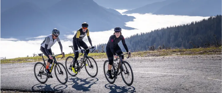
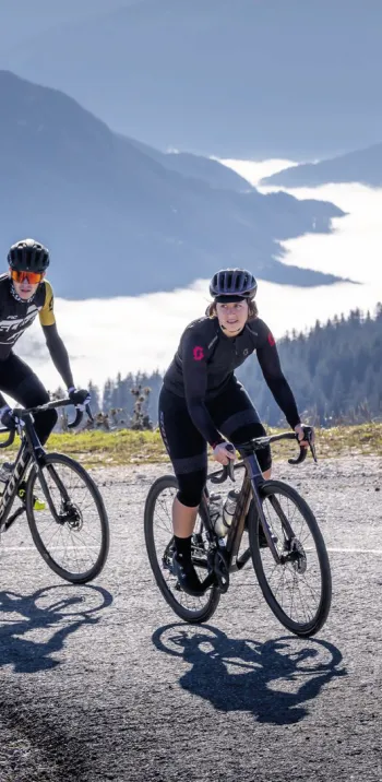
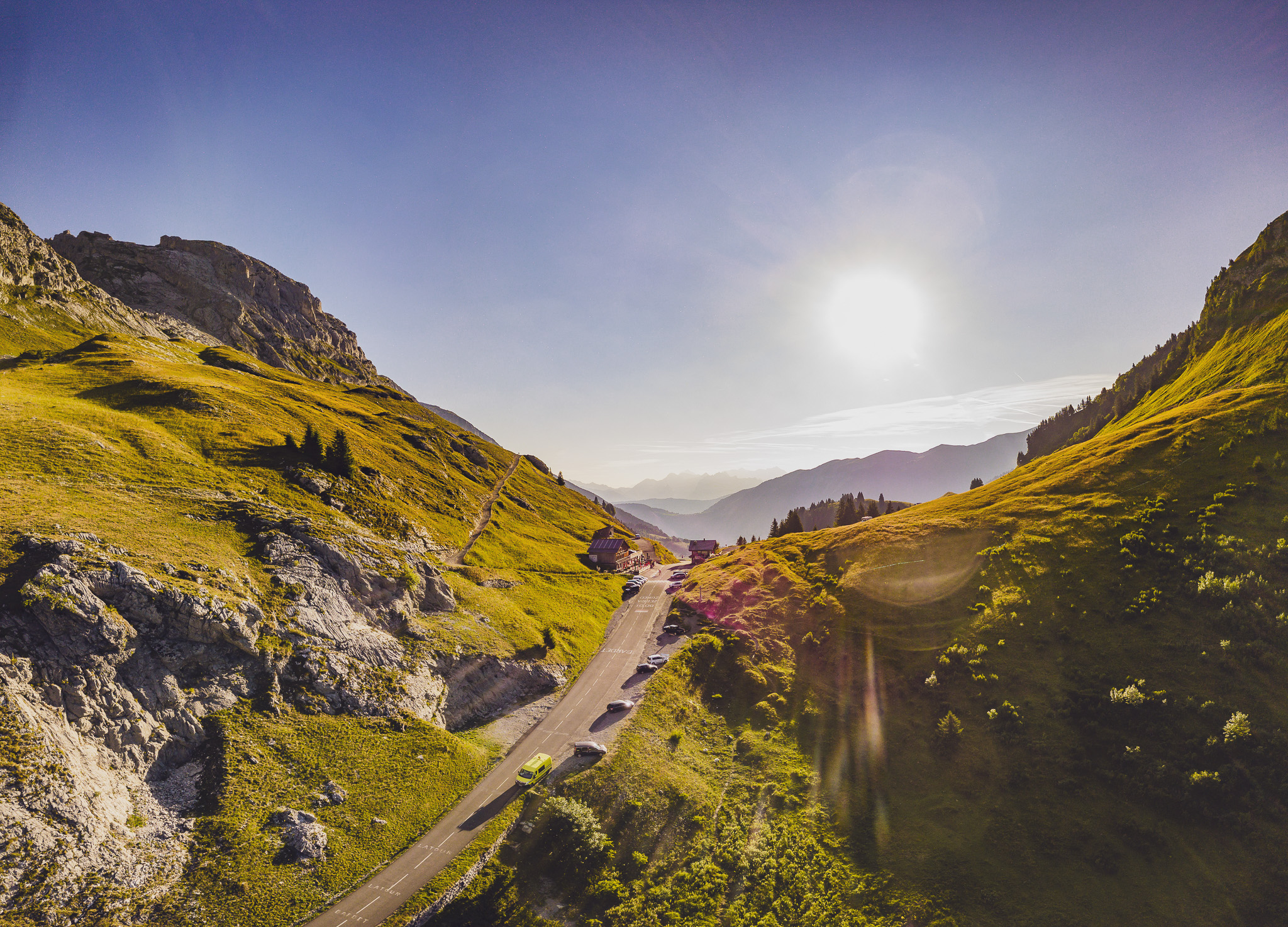
After these two switchbacks, the Col de la Colombière comes into view, with its iconic hut in sight. You may think the hardest part is over, but you're wrong!
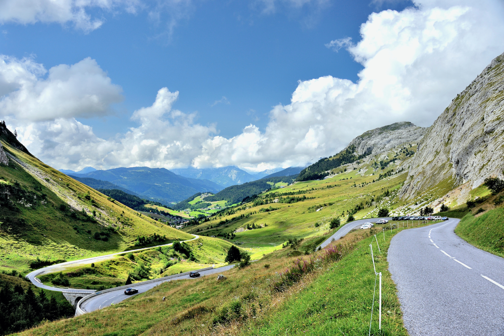
No more forest cover and welcome shade. The road continues for 2.7 km, skirting the mineral scenery of the Bargy range, an oven when the sun beats down. First 1.9 km at 9.5%, before tackling the last 800 meters, even more demanding with a 10.5% gradient, to finally reach the summit of the Col de la Colombière at 1613 m.
A finale in the breathtaking scenery of the Aravis range!
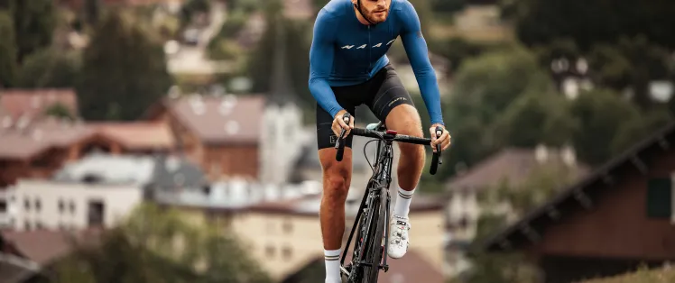
Cycling up the Col de la Colombière from Le Grand-Bornand, via the south side
Start: Le Grand-Bornand (950 m)
Distance: 11.7 km
Altitude: 1613 m
Vertical rise: 690 m
Average gradient: 6%
Maximum gradient: > 8%
Tour de France® rating: hors catégorie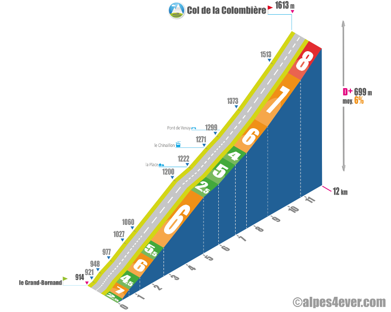
Cycling time up the Col de la Colombière from Le Grand-Bornand, via the south side
- At 7 km/h: 1 h 40
- At 11 km/h : > 1 h
- At 15 km/h : > 45'
- At 19 km/h : 35'
Map of the route up the Col de la Colombière by bike from Le Grand-Bornand, via the south side
Description of the ascent of Col de la Colombière by bike from Le Grand-Bornand, on the south side
On the south side, from Le Grand-Bornand, the Col de la Colombière is 11.7 km away. The ascent is therefore fairly short, but at an average of 6%, count on a few tricky sections all the same!
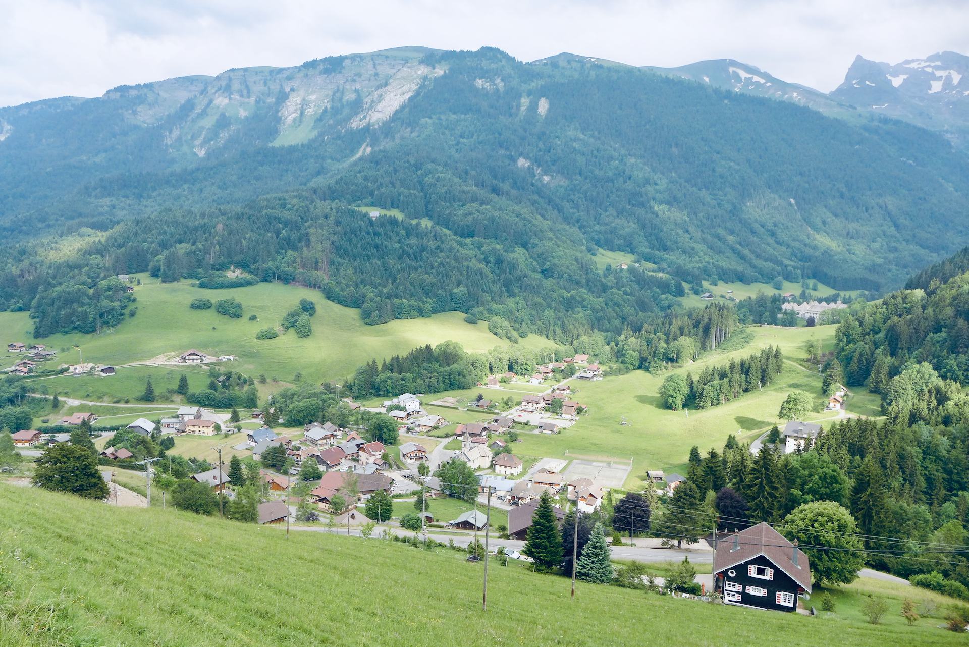
Before you set off, take time to visit Le Grand-Bornand, an authentic Haute-Savoyard village, famous for its 400 chalets, its Biathlon World Cup, its family skiing, its reblochon cheese... and regularly a stage on the Tour de France!
From Grand-Bornand Village to Grand-Bornand Chinaillon, 7 kilometers on, there are quite a few twists and turns, but nothing very nasty: 400 meters at 7% maximum...
The crossing of Chinaillon, all in length, is done quietly, on an almost false flat. As you leave the village, the most difficult part of the climb gradually begins: first 1.2 km at 6%, then 1.9 km at 7% and finally a 1.3 km ramp at 8%.
This final "ass-kicking" takes you to the col, where all that's left to do is enjoy the superb panoramas over the Aravis and Bargy ranges.
Conseils pour préparer l'ascension col de la Colombière
Don't be fooled, the col de la Colombière, especially on the north, north-east side, is tough, with portions at 9, 10%! On the same side, the variant via the Col de Romme, already used by the Tour de France and the Étape du Tour, is even tougher, with almost 9% average gradient in the nine kilometers between Cluses, the Col and the village of Romme.
Our advice:
- If you've chosen the north-south route of Route des Grandes Alpes ®, the Col de la Colombière will be one of the first major obstacles to overcome. You'll need to be well trained to pass this test without suffering too much.
- You're looking for a travel agency that handles all the organization: luggage transport, accommodation booking and even accompaniment and bike rental? Discover which specialist to go with on Route des Grandes Alpes ®
- Selection of gear, bike and its equipment, preparation, maintenance : here's the equipment you need to complete Route des Grandes Alpes ®.
Weather conditions for the Col de la Colombière
The Col de la Colombière (1613 m) generally opens in mid-May and it is not uncommon for it to close around November 20. To check road and pass conditions, visit inforoute74.
For weather conditions, visit meteoblue
To find out when to go on Route des Grandes Alpes ®
Recommended equipment for the Col de la Colombière
At 1613 m, the Col de la Colombière is not one of the highest on the Route des Grandes Alpes®, but you can still catch a good shower, end up soaking wet and catch a cold. At the very least, take a windbreaker, which you'll need on the way down anyway.
Think about taking the necessary food and enough water to drink. It can get very hot on the ascent. That said, unlike other more "desert" cols, on the Col de la Colombière you're never far from a refreshment point: Le Reposoir on the Arve valley side, Le Grand-Bornand Chinaillon and Le Grand-Bornand Village on the Aravis massif side.
You'll find a charging point for your electric-assist bike in Le Grand Bornand (Hotel La Croix Saint Maurice).
Our Route des Grandes Alpes® Gravel route also crosses the Col de la Colombière.
Click here to find out more about the Gravel bike and the special equipment it requires
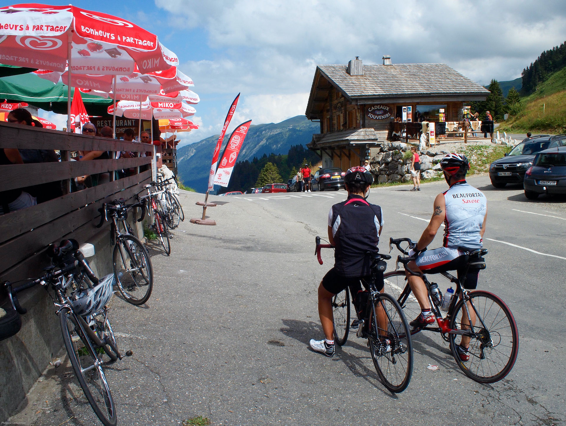
Services at Col de la Colombière
At Col de la Colombière, you're 40 km from Annecy and 18 km from Cluses, two major towns with all services and SNCF stations.
Without going that far, Col de la Colombière is just a few kilometers from Le Grand-Bornand, where you'll find cafés, restaurants, sports stores, grocery stores and all types of accommodation.
On the other side of the mountain, Le Reposoir, 7 km away, offers a pleasant stopover in its café-restaurant, near the church.
Finally, at the very top of the Col de la Colombière, the restaurant of the same name, offers an invigorating stopover in a postcard panorama.
VAE charging stations: Le Grand Bornand - Hôtel La Croix Saint Maurice.
Access to Col de la Colombière
SNCF and bus stations
- Annecy
- Cluses
Road access
- D909, then D4 from Annecy (A41).
- D12, then D4 from Bonneville (A40).
- D4 or D119 from Cluses (A40).
Those who have done it speak best of it!
La Colombière, the first pass where I wondered if I'd make it to the end of the adventure! Dominique, 70
I'm not a great sportswoman, but I decided to take on the Col de la Colombière challenge with some friends, on an electric bike. A real mountain experience! Clara, newly converted to cycling
Le Reposoir is a hidden gem before the Col de la Colombière. Émile, nature lover
For me, Le Grand-Bornand is synonymous with conviviality and a passion for cycling. The village atmosphere is always warm and it's an ideal starting point for the Col de la Colombière and many bike tours in Haute-Savoie. Guillaume, seasoned cyclist
Biking up to Col de la Colombière and stopping at Chinaillon is always a pleasure. The village offers stunning views of the surrounding peaks, and its roads are a fantastic playground for any mountain-loving cyclist. Julie, haut-savoyarde by birth
I never fail to stop off at Le Reposoir to capture a few shots. This village, with its authentic setting, serene atmosphere and monastery, is a jewel for photographers. And it's also an excellent place to take a break before the final ascent to the Col de la Colombière. Romain, cyclist and photographer
The Col de la Colombière is a classic that I love to do again. The climb is a fine balance between challenge and pleasure, with its gradually intensifying gradients. Each time, I'm delighted by the panorama at the top.Vincent, experienced cyclist
The Colombière pass had been on my list for a long time, and I wasn't disappointed. The climb is tough, but very doable, and the views are simply breathtaking." Louise, Parisian cycle tourer. Aurélie, seasoned cyclist
FAQ
Is the monastery near the Col de la Colombière road inhabited?
The former Carthusian monastery, now called the Monastère du Carmel du Reposoir, or Chartreuse du Reposoir has been home to a community of Carmelite sisters since 1932. Situated on the edge of a small lake and in a wooded cirque, just a few hundred meters from the village of Le Reposoir, it is a listed historic monument.
What other major pass than the Col de la Colombière allows you to enter or exit the Aravis massif?
Le col des Aravis, one of the highlights of the Route des Grandes Alpes®, which at 1486 m separates the departments of Haute-Savoie and Savoie (but belongs to the latter). On the 74 side, the Col des Aravis overlooks the resort of La Clusaz and its beautiful village. On the 73 side, it overlooks the resort of La Giettaz and the Val d'Arly. At the summit, it offers a splendid view of Mont Blanc.
Why is Le Grand-Bornand, at the foot of the southern slope of the Col de la Colombière, the only French venue to host world biathlon competitions?
Le Grand-Bornand is currently the only French resort authorized by the International Biathlon Union to organize international events. As such, the Aravis resort has already hosted several World Cups. It is also a candidate to host the 2027 or 2028 World Championships and has every chance of being the Olympic biathlon venue for the 2030 Olympic Games.
What's the name of the cheese found near the Col de la Colombière?
Reblochon, of course! Le Grand-Bornand, on the south side of the Col de la Colombière, which is also the leading agricultural commune in Haute-Savoie, is the capital of this raw-milk, pressed-uncooked cow's milk cheese. You can enjoy it plain or cooked in tartiflette! Discover local specialties and products
The map
The map
3 Cluses / Le Grand-Bornand

3 Cluses / Le-Grand-Bornand
Other passes near Col de la Colombière
| The most beautiful passes of Route des Grandes Alpes ® |