

First... or last pass on the Grandes Alpes® Route
Altitude 1163 m
Massifs du Chablais et du Giffre
Département Haute-Savoie
Topo North side
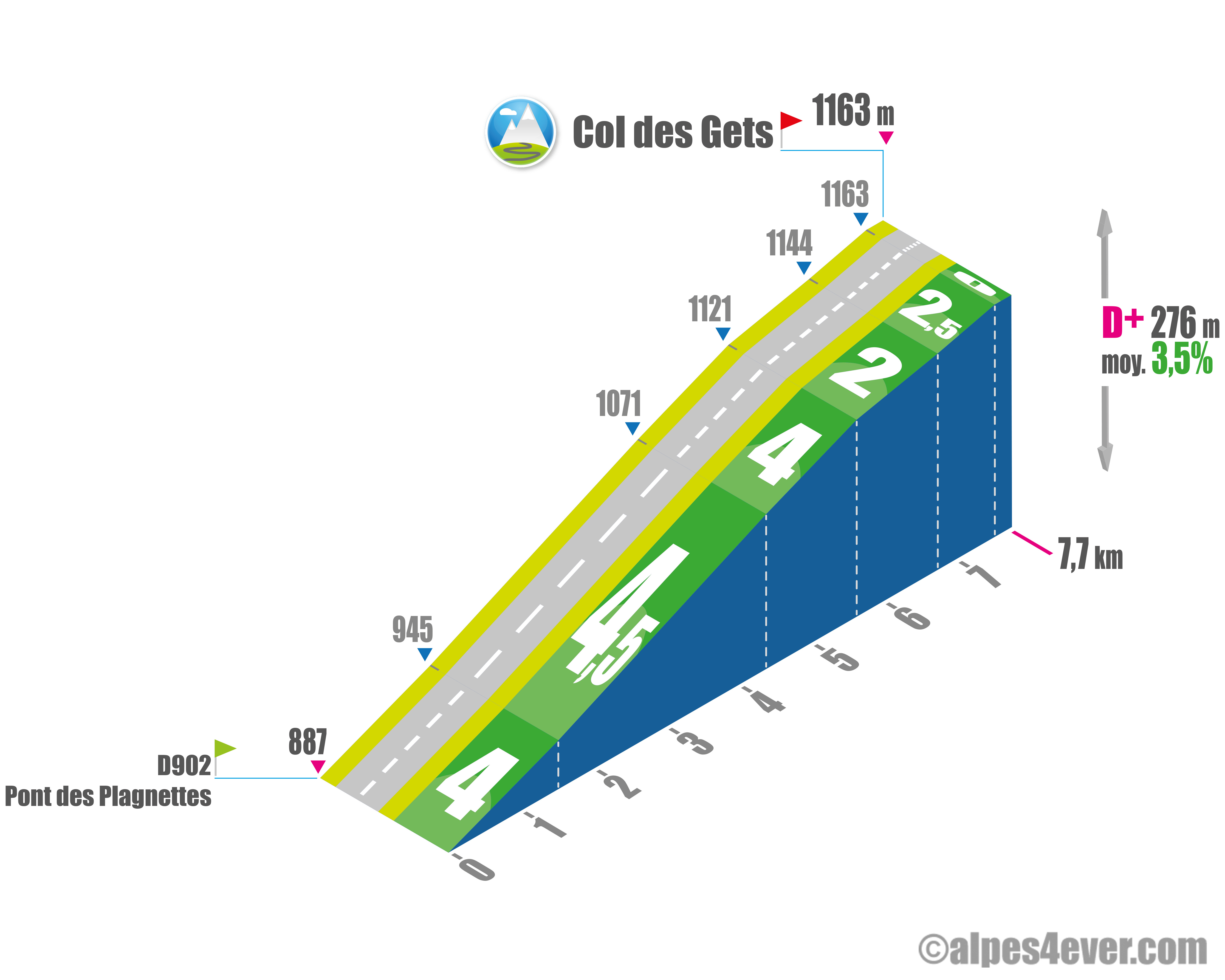 The Col des Gets - 1163 m - is the first pass you'll climb on the Route des Grandes Alpes. It lies at the heart of the resort of Les Gets. The northern slope from the Pont des Plagnettes - just before Montriond - is fairly easy, with an average gradient of no more than 4.5%. Ideal for a first warm-up.
Topo south side
This will be the last ascent of the Route des Grandes Alpes. You'll replay in pictures this fabulous journey from Nice: almost 700 km and 18500 m of D+!
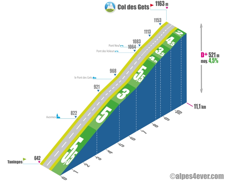
The Col des Gets ascent offers 11.1 km at 4.5%. Leaving Taninges, the gradient is not excessive - 3.2 km at 5.5% - on the first lace, which offers fine views over the wide Vallée du Giffre that guides the eye towards the peaks of the Massif du Giffre. At Avonnex, the road enters the narrow Vallée du Foron. You find yourself in the shade and it's much cooler. The gradient doesn't weaken, but it's steady for 2 km at 5%.
Then a flat section - 1.5 km at 3% - will take you to Pont des Gets. From this hamlet, you leave the Vallée du Foron, which runs towards the Col de l'Encrenaz, and take the Vallon de l'Arpettaz. The road is much narrower, winding its way between a rock face and the Arpettaz, which is mistaken for a small torrent. Another small effort is required, with 1.7 km at 5.5%. At Pont des Voleurs, the slope eases off to Pont Neuf, 400 m at 4.5%. The valley suddenly widens, revealing the first houses of the village-station of Les Gets. Then the road climbs lazily under the gaze of Mont Chéry to the center of Les Gets. You can pick up the pace on a gradient of between 2 and 4.5% over the final 2300 m to reach the Col des Gets at 1163 m.
The map
The map

2 Morzine-Avoriaz / Cluses
2 Morzine-Avoriaz / Cluses
Author
Joris Lesueur
webmaster of alpes4ever.com
contact@alpes4ever.com