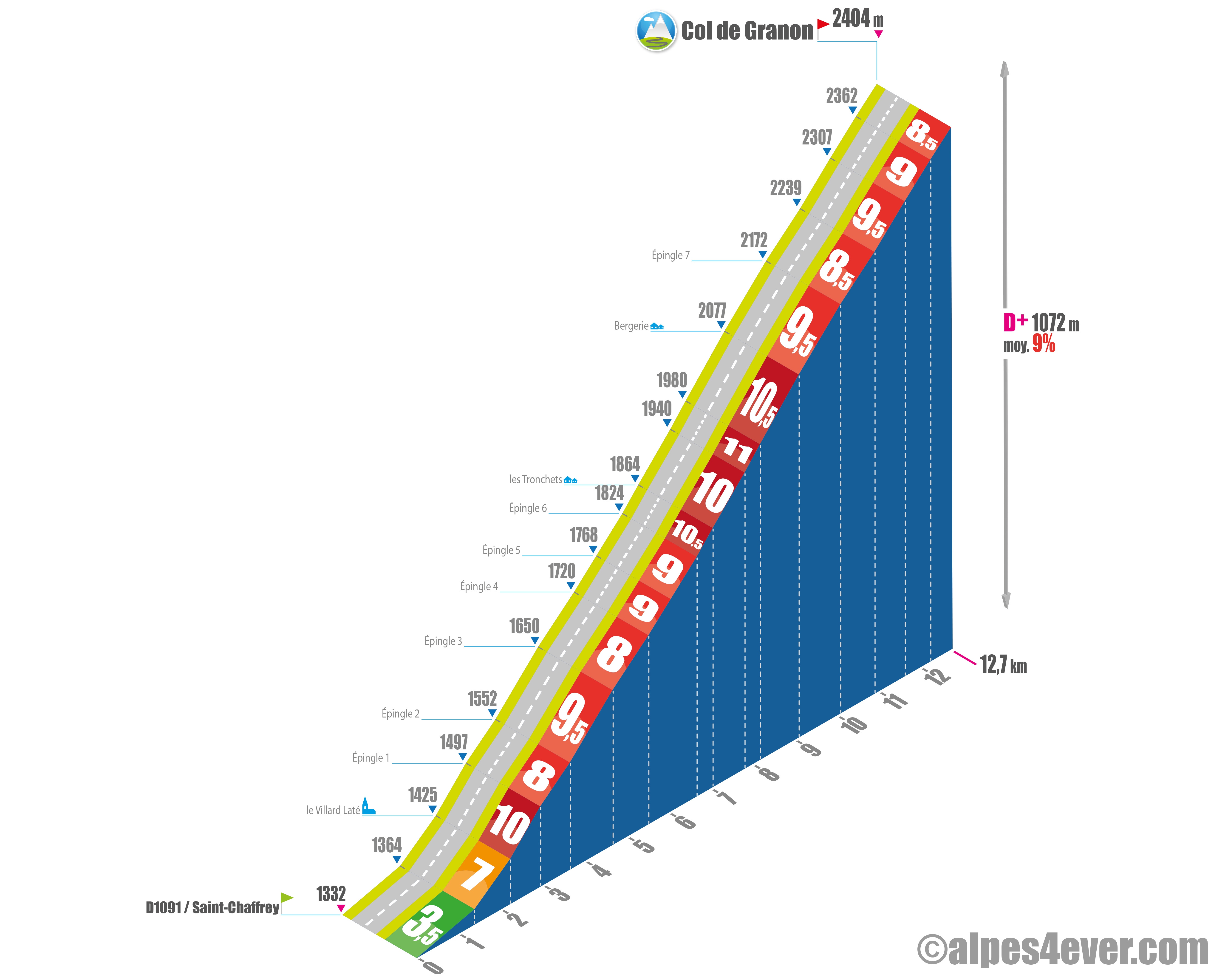
Wikipedia

Granon Pass

formidable!

Altitude 2404 m
Massif des Cerces
Hautes-Alpes department
 

Distance 12.7 km
Start Saint-Chaffrey (Vallée de la Guisane)
D+ 1072 m
average % 9%
% max 11% over 365 m
 

image-20220701150005-3

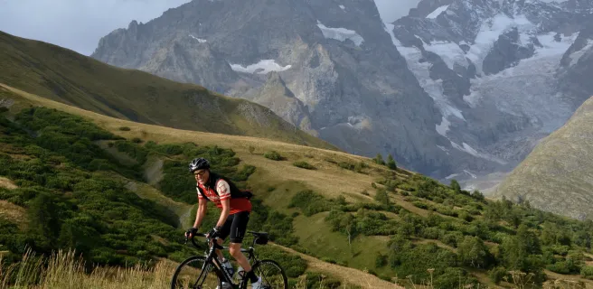
The Col de Granon - 2404 m - is one of the highest road passes in France, but is only accessible by road bike from the south side, the north side being only a track that can still be climbed by mountain bike.
The climb is a formidable one, with a total of 3,000 m of ascent. It's a formidable climb, with 12.7 km and 1072 m of gradient at 9% average going through Saint-Chaffrey off the D1091 if you're coming from Briançon, and even more so if you start a little higher up, still on the D1091 at Chantemerle, as it's shorter, with 11.8 km and less gradient at 1044 m, but with an average gradient that rises to 9.5%!
There's no flat, no vegetation. There are no flat areas, no vegetation to protect you from the wind or the sun, and few hairpin bends in the middle section to get you going again... either it'll be a test of strength between you and the slope, or you'll decide to climb pianissimo to enjoy sensational views over the Guisane Valley and the Massif des Écrins.
 

The map

The map

Valloire / Briançon

15 Valloire / Briançon

54 km
3 h 36 min
Very difficult
If riding south from Valloire along the Route des Grandes Alpes®, you’ll soon understand why the Maurienne’s largest mountain resort has added the word ‘‘Galibier’’ to its name. In contrast, heading north, you first have to tackle the Col du Lautaret pass (2057m) before the Col du Galibier (2642m), after which you can enjoy a giant glide down (descending 1300m in altitude) to the aptly-named Valloire-Galibier. Whichever way you take on this stage, crossing the frontier between France’s Northern and Southern Alps makes for a memorable occasion, with staggering views over the glaciers of the Écrins Range. Briançon, at the start or end of the stage, has been awarded the status of Ville d’Art et d’Histoire for its rich heritage and forms part of a UNESCO World Heritage Site for its Vauban fortifications.
Variante L'Alpe d'Huez / Briançon

18 Variante L'Alpe d'Huez / Briançon

74 km
5 h 03 min
Very difficult
This route we’ve chosen between Le Bourg-d’Oisans and Briançon, going via L’Alpe d’Huez, enables cyclists to avoid the dangerous section of road (including numerous tunnels) between Le Bourg-d’Oisans and Le Chambon Lake. Our alternative delivers stunning views over the Oisans Range and the towering La Meije Mountain. Enjoy many unforgettable discoveries along the way on this magnificent Route des Grandes Alpes® stage: the rough shepherds’ route up to the Col de Sarenne pass (1999m); the village of La Grave and the little valleys around La Meije; the Col du Lautaret pass; the wild landscapes of the Romanche Gorges; the descent of the Guisane Valley; and the arrival in Briançon, designated a Ville d’Art et d’Histoire, its Vauban fortifications part of a UNESCO World Heritage Site.