Valloire / Briançon Route des Grandes Alpes à Vélo
54,05 km cycling route from Valloire to Briançon
Elevation of the stage
Waytypes of the stage
Surface of the stage
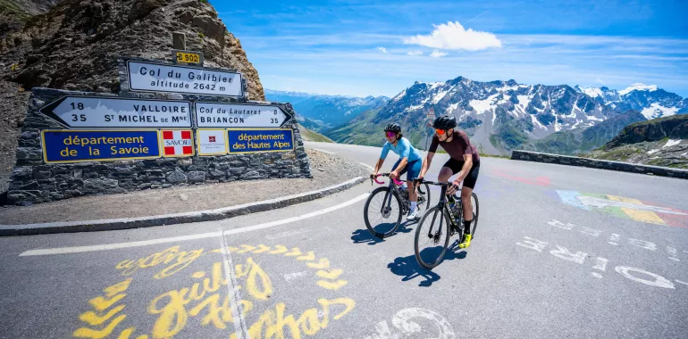
From Valloire to Briançon via the Col du Galibier, the French Alpine cyclists’ Holy Grail
Route North / South
↗ 1233m ↘ 1383m
Leaving central Valloire, you cross several hamlets along a gently climbing road. Then the first hairpin bends up to the Col du Galibier (2642m) appear and the iconic climb begins – along 18km, you confront a shift in altitude of over 1200m, with stretches at a gradient of 10% and a final section that seems to go on for ever... The descent is in two parts: first, 9km of very steep roads taking you down 600m in altitude as far as the Col du Lautaret (2057m); second, a 27km stretch with a 700m descent in altitude. As you go down the broad Guisane Valley road, you get the chance to take a good look at all the villages that make up the greater ski area of Serre-Chevalier.
Route South / North
↗ 1233m ↘ 1383m
From Briançon, reaching the Col du Galibier (2642m) involves tackling a shift in altitude of over 1200m across 35km of cycling. And don’t forget, you get two passes for the price of one here! Heading out from Briançon, you can take a good look at all the Guisane Valley villages that together make up the ski area of Serre-Chevalier before you reach the Col du Lautaret (2057m). Then the really serious climb begins, involving a 600m shift in altitude across 9km. It’s worth the effort. Finally, enjoy the reward of a fabulous 18km descent to the aptly-named resort of Valloire-Galibier.
Don’t miss
- Valloire-Galibier: a big resort in the Maurienne and a very beautiful, extended high-altitude village, made up of 17 hamlets spread out along the road to the Col du Galibier, gateway to the Southern French Alps.
- Briançon: the highest fortified town in Europe, designated a Ville d’Art et d’Histoire for its rich heritage and part of a UNESCO World Heritage Site for its Vauban fortifications. In addition, the mountain resort of Serre-Chevalier 1200 forms part of its territory, the lowest portion of the ski area of Serre-Chevalier, joined to the rest of the domain by cable-car.
- The Vauban fortifications: Briançon’s historic walls, bridge into town and surrounding four forts are part of a UNESCO World Heritage Site dedicated to works designed by Vauban, Louis XIV’s brilliant military architect.
- Serre Chevalier: the mountain resort for the Guisane Valley, stretching between the Col du Lautaret and Briançon and across four communes (parishes). The highest is Le Monêtier-les-Bains, which doubles as a thermal spa resort. The others are La Salle-les-Alpes – Villeneuve, Saint-Chaffrey – Chantemerle, and, of course, Briançon Serre Chevalier 1200.
- The Jardin Alpin du Lautaret: this garden offers a magnificent walk in a truly unique setting, amidst Alpine botanical treasures.


Travellers’ reviews