


Le plus haut col routier des Alpes
Altitude 2764 m
Massif de la Vanoise
Départements Savoie
Sommaire
- Planifiez votre ascension à vélo du col de l'Iseran
- Montée du col de l’Iseran à vélo depuis Bourg-Saint-Maurice ou Val-d’Isère, par le versant nord
- Description de l’ascension du col de l’Iseran à vélo depuis Bourg-Saint-Maurice ou Val-d’Isère, par le versant nord
- Montée du col de l’Iseran à vélo depuis Val-Cenis ou Bonneval-sur-Arc, par le versant sud
- Description de l’ascension du col de l’Iseran à vélo depuis Val-Cenis ou Bonneval-sur-Arc, par le versant sud
- Conseils pour préparer l’ascension du col de l’Iseran
- Conditions météorologiques pour le col de l’Iseran
- Équipement recommandé pour le col de l’Iseran
- Les services au col de l’Iseran
- L'accès au col de l’Iseran
- Témoignages
- FAQ
Planifiez votre ascension à vélo du col de l’Iseran
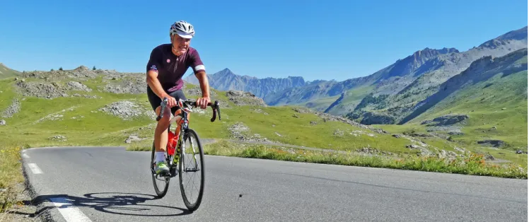
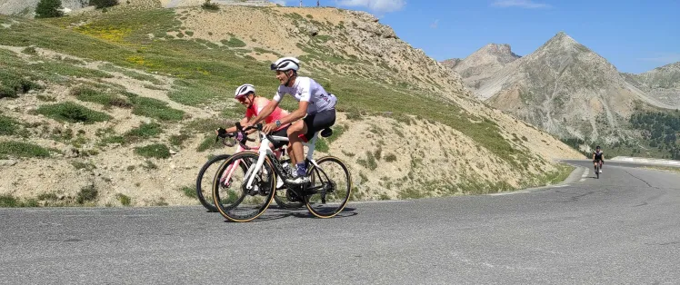
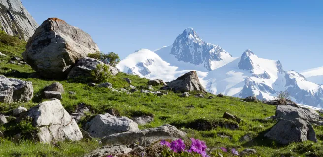
Du haut de ses 2764 m (même si la pancarte dit 2770 m), ce col sur Route des Grandes Alpes® est le plus haut col routier des Alpes françaises. Il n’est d’ailleurs pas rare de le franchir entre deux murs de neige ! Entre Bourg-Saint-Maurice puis Val-d'Isère, en Haute-Tarentaise et Val-Cenis puis Bonneval-sur-Arc, en Haute-Maurienne, ce col est un monument du Tour de France et du cyclisme en général.
Les plus beaux séjours pour gravir l'Iseran


The highest road pass in the Alps
Altitude 2764 m
Massif de la Vanoise
Départements Savoie
Summary
- Plan your bike ascent of the Col de l'Iseran
- Bike up the Col de l'Iseran from Bourg-Saint-Maurice or Val-d'Isère, by the north side
- Description of the ascent of the Col de l'Iseran by bike from Bourg-Saint-Maurice or Val-d'Isère, via the north side
- Cycling up the Col de l'Iseran from Val-Cenis or Bonneval-sur-Arc, via the south side
- Describing how to cycle up the Col de l'Iseran from Val-Cenis or Bonneval-sur-Arc, by the south side
- Conseils pour préparer l'ascension du col de l'Iseran
- Weather conditions for the col de l'Iseran
- Recommended equipment for the col de l'Iseran
- Services at the col de l'Iseran.
- Access to the Iseran pass
- Témoignages
- FAQ
Plan your bike ascent of the Col de l'Iseran
From the top of its 2764 m (even if the sign says 2770 m), this col sur Route des Grandes Alpes® is the highest road pass in the French Alps. In fact, it's not unusual to cross it between two walls of snow! Between Bourg-Saint-Maurice then Val-d'Isère, in Haute-Tarentaise, and Val-Cenis then Bonneval-sur-Arc, in Haute-Maurienne, this pass is a monument to the Tour de France and cycling in general.
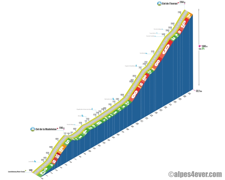
Cycling up the Col de l'Iseran from Bourg-Saint-Maurice or Val-d'Isère, via the north side
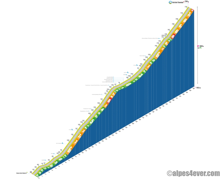
Start: Bourg-Saint-Maurice (815 m), or Val d'Isère (1850 m)
Distance: 47.5 km from Bourg-Saint-Maurice, or 16 km from Val d'Isère
Altitude: 2764 m (2770 m indicated on sign)
Height gain: > 2000 m from Bourg-Saint-Maurice, or 929 m from Val d'Isère
Average gradient: 5.8% from Val d'Isère, 4% from Bourg-Saint-Maurice
Maximum gradient: 8%
Tour de France® rating: hors catégorie
Time to climb (rounded) the Col de l'Iseran via the north side
From Bourg-Saint-Maurice
At 11 km/h: 4 h 20
At 15 km/h: 3 h 10
At 19 km/h: 2 h 30
From Val d'Isère
At 7 km/h : 2 h 15
At 11 km/h : 1 h 25
At 15 km/h : > 1 h
At 19 km/h : > 50'
Map of the route up the Col de l'Iseran by bike from Bourg-Saint-Maurice and Val-d'Isère, via the north side
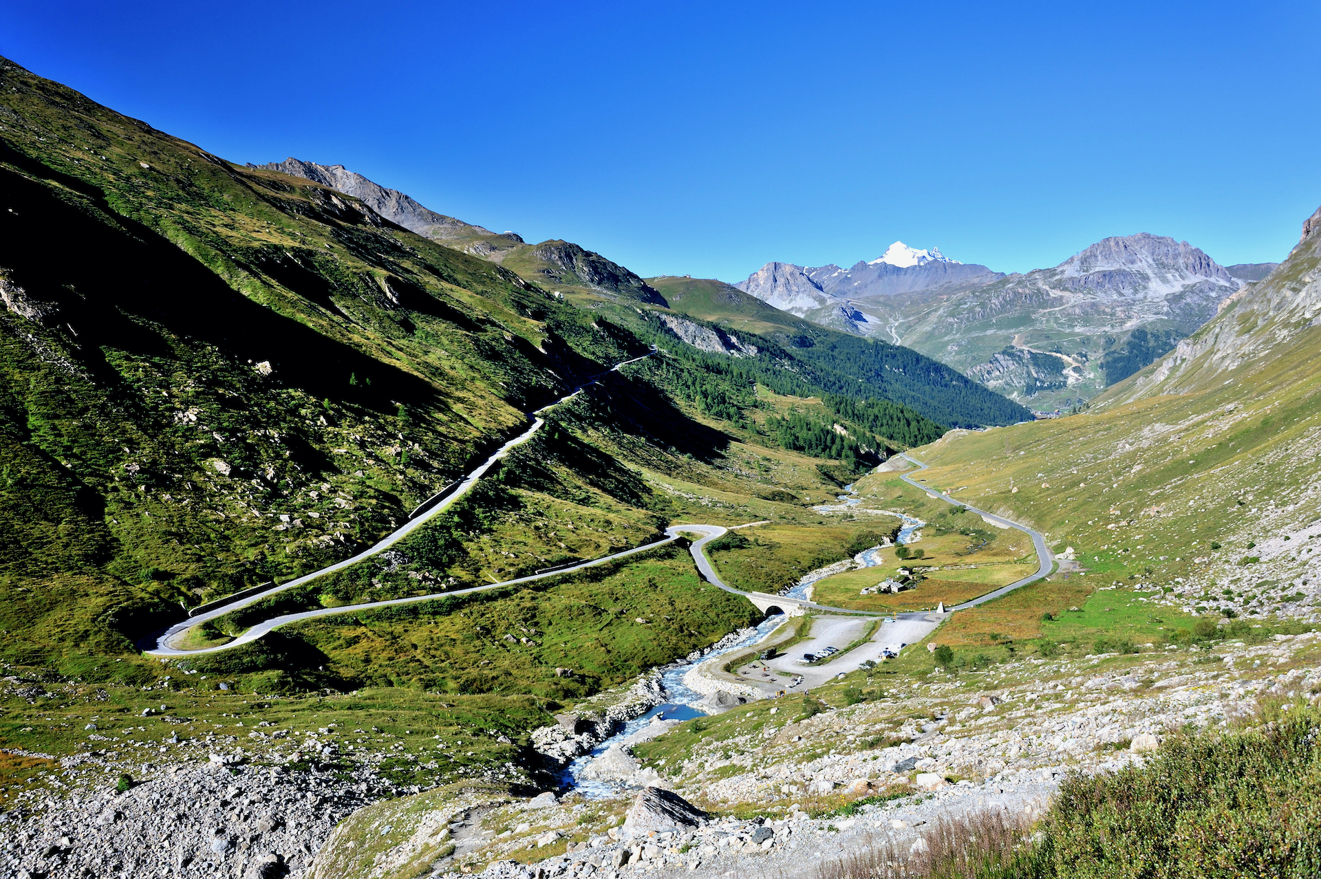
Description of the ascent of the Iseran pass by bike from Bourg-Saint-Maurice and Val-d'Isère, by the north side
From Bourg-Saint-Maurice to Sainte-Foy Tarentaise, i.e. almost exactly the first quarter of the route (around 12 km), you have two options for avoiding the D 902 and its nuisances. The "voie verte", which gently follows the Isère river.
From Sainte-Foy-Tarentaise to Tignes-les-Brévières - another quarter of the total itinerary - it's not so much fun: the climb is harder (several sections at 7/8%) and, between paravalanches and tunnels, the traffic demands your full attention. But don't miss the exceptional views of the Vanoise National Park and the impressively large Mont Pourri (3379 m).
Just after Tignes-les-Brévières, a short stop to photograph the Herculean fresco of the Tignes dam, France's highest hydroelectric dam: 180 m by 300 m wide.
At this point, you're 8 km from Val d'Isère, and you're about to cross a succession of tunnels on a road of rising and falling false flats. Along Lac du Chevril, the Chevril (1320 m), Saut (145 m), Villaret du Nial (280 m) and Rossetti (280 m) tunnels are interspersed with magnificent views over the lake. Finally, in the gorges de la Daille, the Franchet and then de la Daille tunnels (750 m end-to-end) lead to the finish in Val d'Isère. A stopover, or better still, a stopover, is essential in this mythical resort.
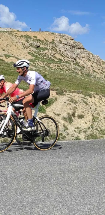
Then remains the piece de roi: 16 km for just under 950 m of ascent. Quite accessible, then! Let's hear it anyway from our friend Joris Lesueur, tireless host of alpes4ever.com and brilliant Route des Grandes Alpes ® finisher. "Oh, you're telling yourself that the finish won't be too hard with only a 6% average... yes, on paper, nothing insurmountable, the steepest sections not exceeding 8%... except that here, we'll be climbing above 2000 m for almost 13 km and beyond that altitude, for the majority of common mortals, the air being rarer, breathing becomes more difficult and the effort to be made greater. "
The first 5 kilometers, between Val d'Isère and Pont Saint Charles, via Le Fornet, the last inhabited place in the valley, are rather quiet, despite a "bummer" at over 7% in the hamlet.
At Pont Saint Charles, you've passed the symbolic 2000 m mark and the road describes an almost hairpin curve. Then come 4 km at 6.5% more or less, which takes you past the high-altitude restaurant "Le Signal", to the arrival of the Fornet cable car. Then a kilometre-long "dos d'âne" with 500 m at 3%, followed by a short descent and an ascent at less than 6%.
A few more hairpin bends and the road enters between the Tête de l'Arolay and the Crête des Lessières. It then takes a wide curve of 900 m at 8%, at the end of which it adopts a trajectory that will be almost rectilinear all the way to the summit.
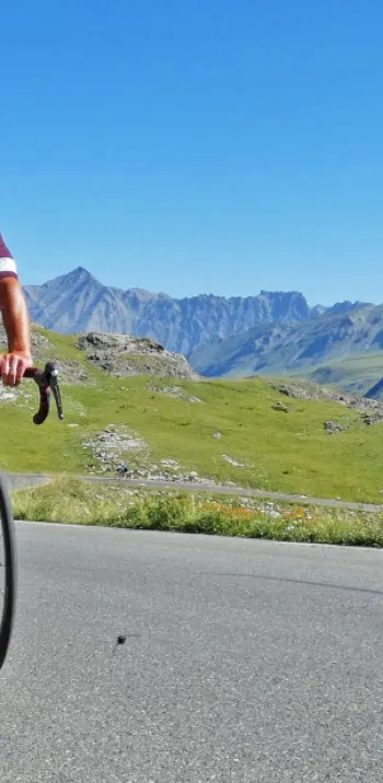
The next 4 km are on a moderate slope (6 to 6.5% average) in the Vallon de l'Iseran. You'll then be riding at an altitude of 2500 m, in a mineral atmosphere, with the pass in your sights.
Warning, the hardest part is yet to come, with two final kilometers at 7.5%. Once you've crossed the final straight at 8%, you can finally get your feet under the table at the Cascade restaurant. Savor the view of the Vanoise glaciers!
Cycling up the Col de l'Iseran from Val-Cenis (Lanslebourg) or Bonneval-sur-Arc, via the south side
Start: Val-Cenis (1405 m), or Bonneval-sur-Arc (1794 m)
Distance: 32 km from Val-Cenis, or 13.5 km from Bonneval-sur-Arc
Altitude: 2764 m (2770 m indicated on the sign)
Elevation gain: 1461 m from Val-Cenis, or 983 m from Bonneval-sur-Arc
Average gradient: 4.5% from Val-Cenis, 7.3% from Bonneval-sur-Arc
Maximum gradient: 9% with a short section at 13%
Tour de France® rating: out of category
Cycling time up the Col de l'Iseran from Val-Cenis (Lanslebourg) or Bonneval-sur-Arc, via the south side
From Val-Cenis
At 11 km/h : 3 h 00
At 15 km/h : 2 h 10
At 19 km/h : 1 h 40
From Bonneval-sur-Arc
At 7 km/h : 2 h
At 11 km/h : 1 h 15
At 15 km/h : 55'
At 19 km/h : 43'
Map of the route up the Col de l'Iseran by bike from Val-Cenis and Bonneval-sur-Arc, via the south side
Description of the ascent of the Iseran pass by bike from Val-Cenis or Bonneval-sur-Arc, by the south side
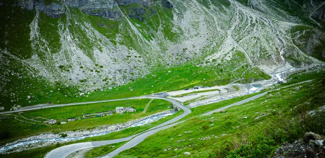
We have chosen to describe the ascent of the south side of the Col de l'Iseran from Lanslebourg-Mont-Cenis (Val Cenis commune), 32 km for just under 1500 m of D+.
If, however, you're coming from Modane, further down the valley, count on an additional 23 km via the main road (D1006) and a little extra elevation gain, including a 5.6 km climb to Pont du Nant and a 1.5 km ramp at 7%, after Termignon. To bypass the D1006, you can opt for a less-frequented route via Aussois.
The first 3 km between Lanslebourg-Mont-Cenis and Lanslevillard are easy, not exceeding 3%.
After Lanslevillard it gets tougher for a few kilometers with the ascent of Collet de la Madeleine (1746 m). While it has nothing to do with the other col of the same name, this namesake is pretty brutal, with gradients of 8, 10 and 11% for the first two kilometers. The next 2.5 km fluctuate between 5 and 6.5%. They are followed by a 2.5 km descent to the plateau of Bessans, a mecca for Nordic skiing.
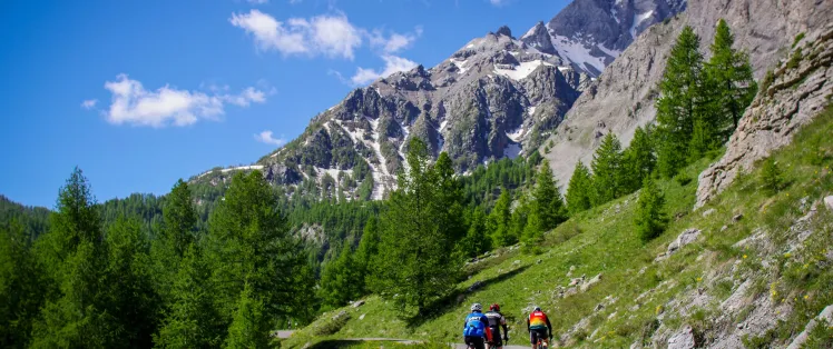
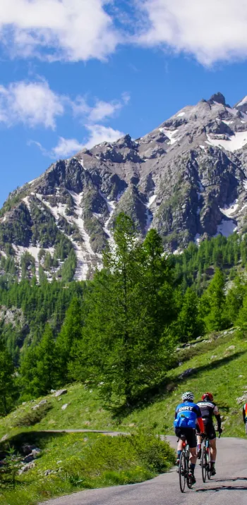
From there to Bonneval-sur-Arc, magnificent scenery, bristling with peaks over 3000 m, accompanies you for 11 km of small up and down false flats.
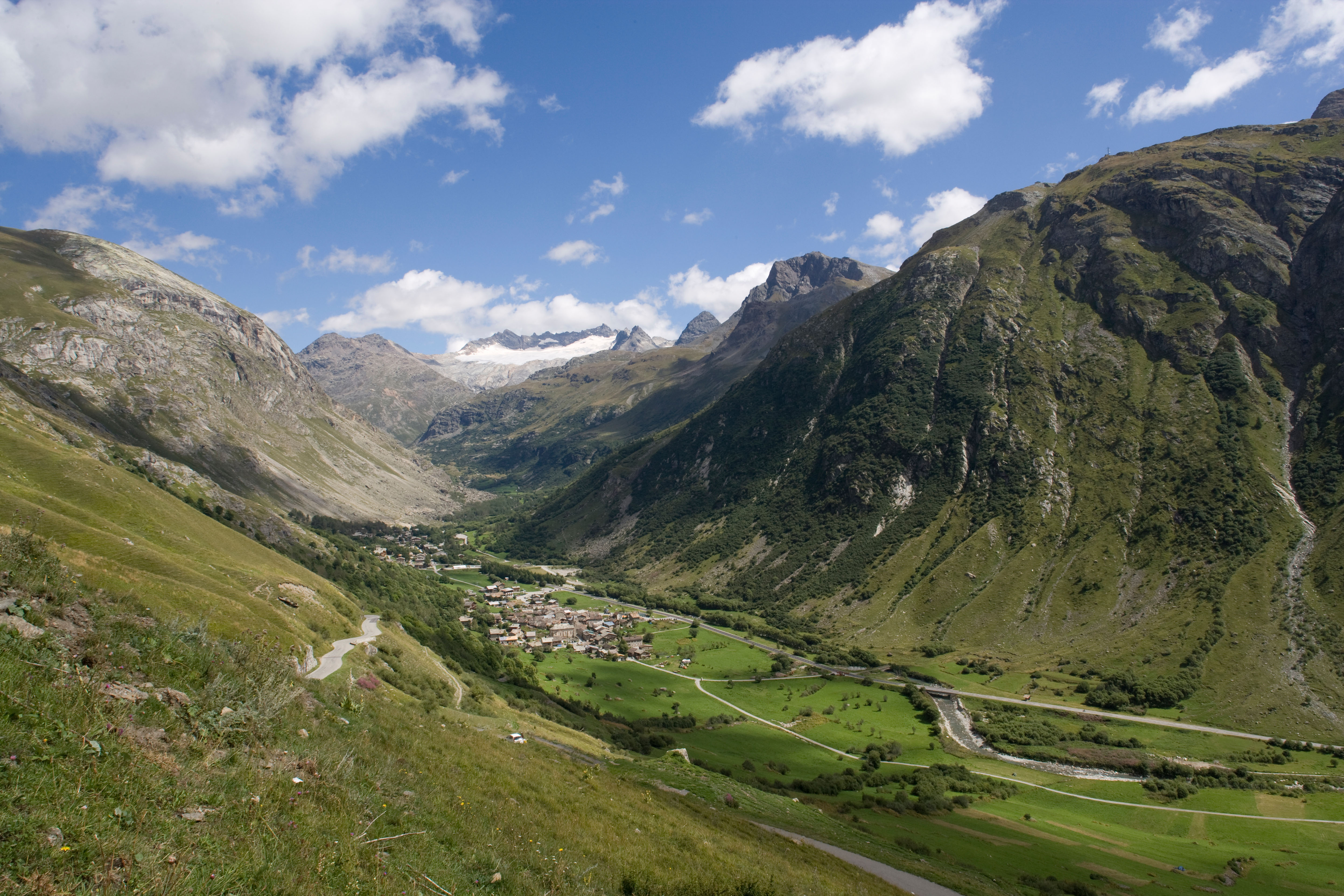
From the stone walls and lauze roofs of Bonneval-sur-Arc (1787 m), listed as the "Most Beautiful Village in France", the ascent of the Col de l'Iseran proper begins: 13.5 km for almost 1000 m of ascent at an average gradient of 7.5%. It's harder than the north side, especially as most of the effort is above 2000 m.
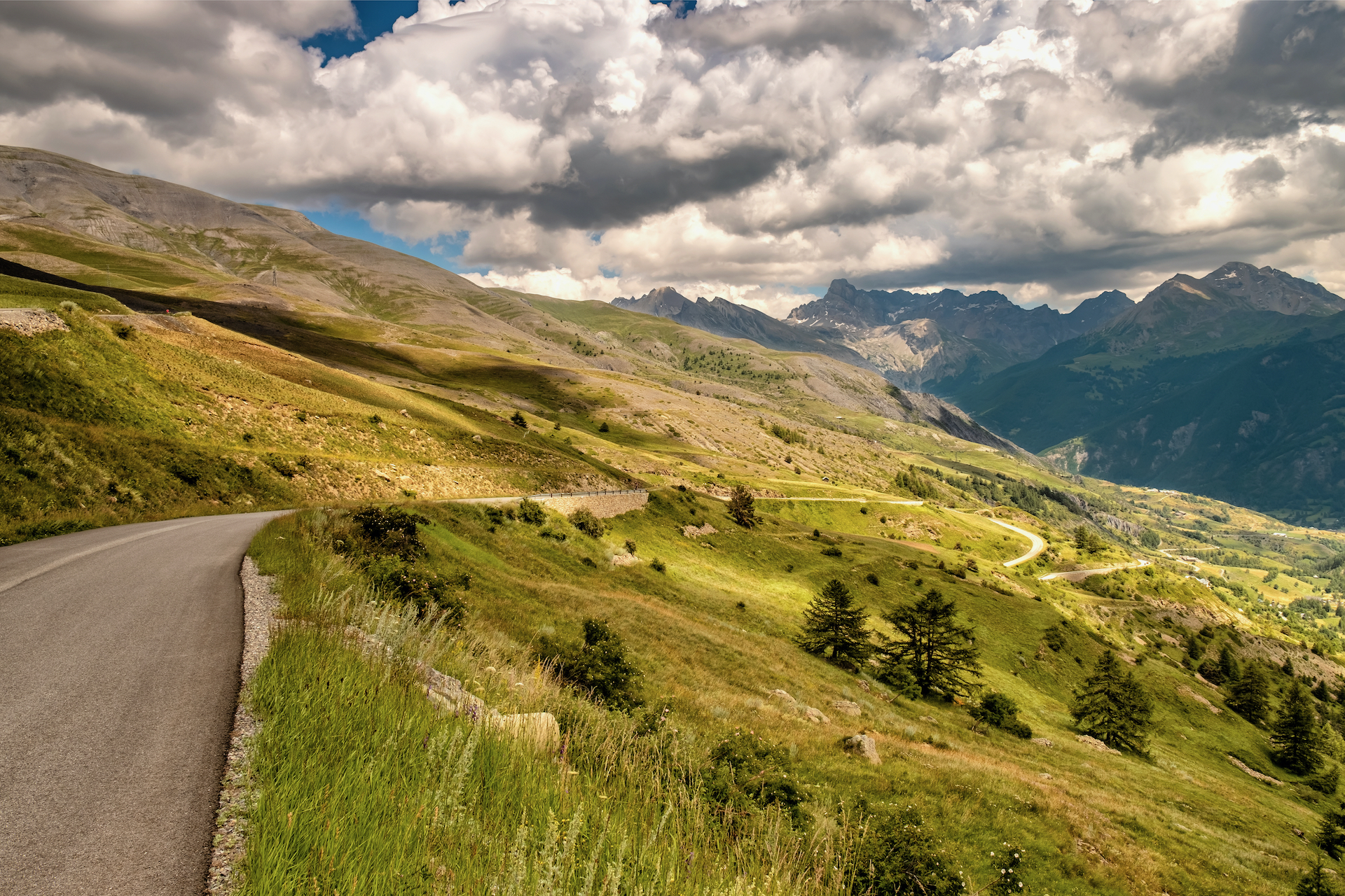
After a leisurely one-kilometer start, you won't have much chance to take a breather. In fact, the final ascent is divided into three very steep segments (between 7 and 10% gradient), fortunately interspersed with two landings at less than 5% gradient.
Landing 1: 5th and 6th kilometers after Bonneval-sur-Arc.
Landing 2: between the Ponts de l'Oulietta and de la Neige (with a short tunnel between the two), i.e. 2 km before the summit.
Happily the scenery, all within the Vanoise National Park, will allow you to suffer in beauty. The views of the glaciers will become more and more beautiful as you ascend, in an increasingly mineral atmosphere.
Save energy for the finale! Almost two kilometers at 9% of the average and another 750 m at 7.5%.
.jpeg)
Conseils pour préparer l'ascension du col de l'Iseran
"If all the people who died on the Iseran joined hands, they'd form a chain all the way to Val-d'Isère. " Not sure if it's true, but that's what they say in Bonneval-sur-Arc and it says a lot about the conditions you can encounter on the ascent of the Col de l'Iseran.
Altitude, extreme cold and even a snowstorm in the middle of summer! It's out of the question to set off with the gun blazing, without having checked the weather and road conditions. Make sure you and your equipment are well prepared. Don't forget that you're in the high mountains of the Northern Alps.
Our advice:
- If you're reluctant to tackle the obstacle alone, don't hesitate to use the services of a specialist travel agency, which will organize everything for you: luggage porterage, accommodation booking, bike rental and accompaniment if required... Find out which specialist to go with on the Route des Grandes Alpes®
- Plan an alternate itinerary, in case the Col de l'Iseran suddenly becomes impassable due to a storm. Should this happen, switch from Tarentaise to Maurienne (and vice versa) via le col de la Madeleine (1993 m): a nice consolation prize!
- Finally, your bike and personal equipment must be carefully chosen, prepared and maintained: discover the equipment you need for the Route des Grandes Alpes®
Weather conditions for the Col de l'Iseran
It's not unusual to cross the Col de l'Iseran between huge snow drifts.
Remember, too, the 1996 Tour de France, which saw the cancellation of the Iseran stage due to a snowstorm. Weather and road conditions are no laughing matter here!
The Col de l'Iseran is generally passable from early June to late October. If you're going early in the season, make sure the pass is open and the roads are passable. You can consult savoie-route.fr (check "État des cols" under "Données cartographiques") or call the tourist offices in Val d'Isère or Haute-Maurienne Vanoise (Savoie).
For weather conditions on the Col de l'Iseran and its access roads, consult the meteoblue website
To find out when to go on Route des Grandes Alpes ®
Recommended equipment for the Col de l'Iseran
Much of the effort is to be produced at altitude, which means less oxygen and more fatigue, possible if not probable wind, low to very low temperatures.
So you'll need to eat and hydrate regularly. Set off with everything you need in water bottles and jersey pockets. At the top of the pass, be sure to stop off at the La Cascade restaurant. Here you can eat, refresh yourself... or warm up.
Expect to encounter snow, even if it's in the form of drifts! Bring warm, windproof clothing, which you'll need on the descent anyway. A little hat to put under your helmet can be useful.
If you're on a VAE, be sure to check the charge of your battery to avoid running out of power!
Finally, take care with your lighting, as you'll have to cross numerous tunnels and paravalanches, especially on the north side, between Bourg-Saint-Maurice and Val d'Isère.
The map
The map
11 Val d'Isère / Val-Cenis
8 Tignes / Bessans
Services at the Col de l'Iseran
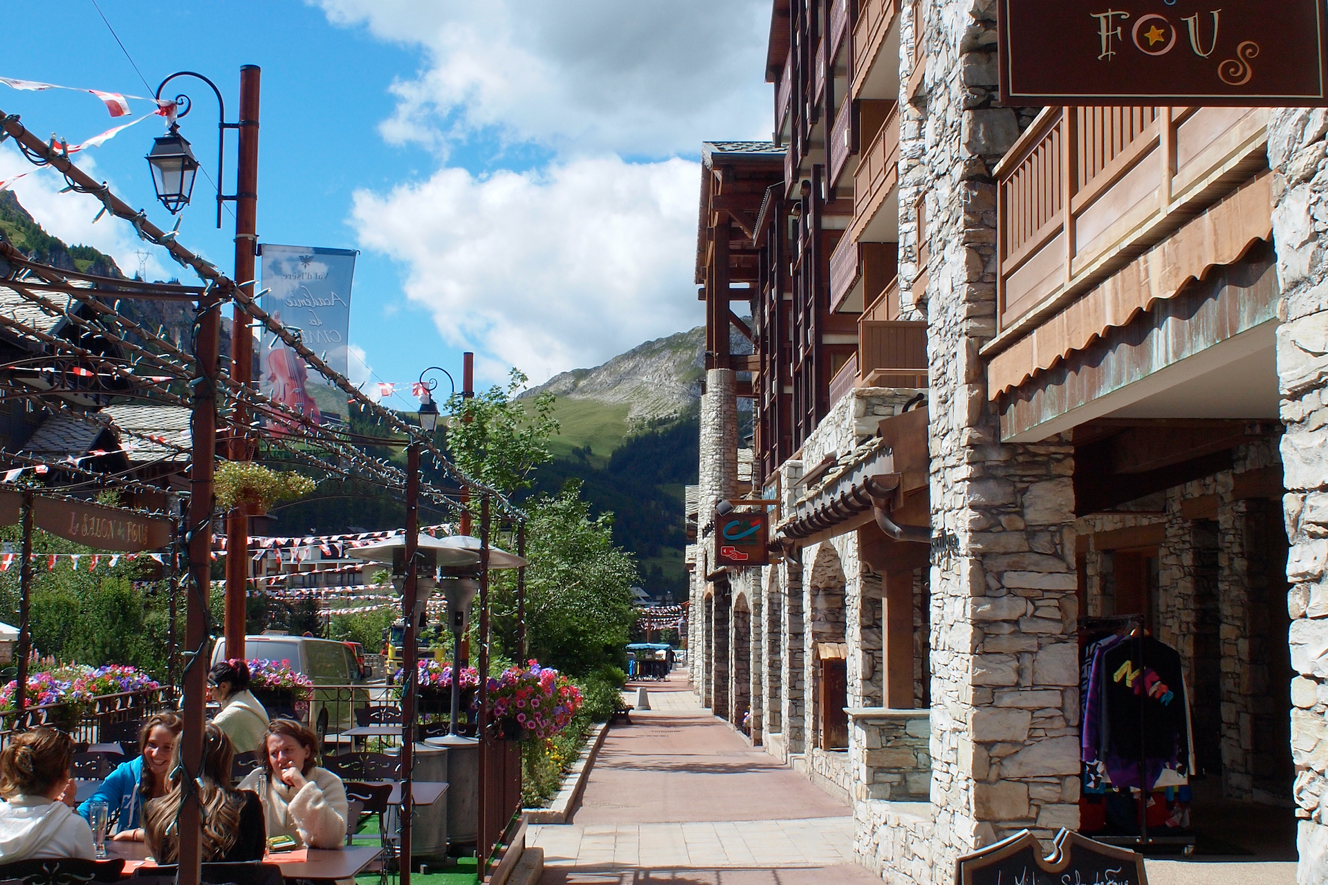
All the necessary services exist at the foot of the pass. On the Tarentaise side, Bourg-Saint-Maurice is a small town, Val d'Isère a major international resort. On the Maurienne side, Val-Cenis and Bonneval-sur-Arc offer just about everything a cyclist needs.
Charging stations: Val d'Isère tourist office
"Obligatory" stop, at least for a coffee or blueberry tart, at the La Cascade restaurant, located at the top of the pass and at the foot of the Pissaillas glacier.
Access to the Col de l'Iseran
SNCF and bus stations
- Albertville
- Bourg-Saint-Maurice
- Modane
- Saint-Michel-de-Maurienne
Road access
- N90 (73) from Albertville to Bourg-Saint-Maurice.
- D902 (73), from Bourg-Saint-Maurice.
- A43, section of the autoroute de la Maurienne (73), from Grenoble, Chambéry or Albertville to Modane.
- D1006 (73), then D902 (73) from Modane.
Those who have done it speak best of it!
L'Iseran for the altitude, its snow walls and its preservation (especially the south side). Louan Gourdel
L'Iseran, the highest and also the longest: nature in its raw state. Dominique
The Iseran pass for its mineral beauty and the view at its summit. Cyrille Papon
The Iseran, the highest and one of the most beautiful. Caroline Hiebel with Lucie and Thierry
My best memory Lake Roselend because it's so magnificent.... Caroline Hiebel with Lucie and Thierry
Best moment? Passing the Pont des Neiges on the descent of the Iseran. Benoit Moreau
Best memory: discovering the hamlet of Monal and climbing the Iseran. Thomas Triquet
Then I'd say the Iseran with its altitude, its sumptuous descent. Pierre Ruelle
Think it was nearly 35 degrees at the Iseran and Galibier passes, at nearly 2700 m altitude!!!!Joris Lesueur
In three, I'd put Cormet de Roselend and Iseran ex-aequo, despite the incredibly complicated weather conditions we encountered there. Gérard Marion-Gallois
The Iseran, which I already knew, is really a different place. Lunar atmosphere, stony landscapes, cold, wind, long ... but a real joy when you're at the top. Louis Mollard
The drive on the road from Bourg to Val d'Isère was long and bland, but the winding climb from Val up to the Col de l'Iseran was so beautiful and enjoyable! Cyril Pliquet
Gravy during my 2022 crossing of the Alpes Sud-Nord, the southern slope of the Iseran made me relive the unforgettable Tour 2019, Thibaut Pinot's retirement, Bernal's attack, Alaphilippe's defense and the neutralization due to hail... which we ourselves took on our heads on the way down to Seez! Lionel Terrail (co-host of Route des Grandes Alpes ®)
FAQ
What is the real altitude of the Col de l'Iseran?
Don't be fooled by the sign that says 2770 m. The Col de l'Iseran culminates at 2764 m, which is enough to make it France's highest road pass. Only the road to the cime de la Bonette is higher (2802 m), but it's not a pass (the Col de la Bonette culminates at 2715 m).
When was the Col de l'Iseran road opened?
The Col de l'Iseran road, inaugurated in 1937 by Albert Lebrun, then President of the Republic, is one of the jewels in the crown of the Grandes Alpes route. Its construction, following in the footsteps of an old mule track, recalls the history of the road conquest of the Alps, first motivated by the need to link Alpine fortifications, then by tourism. Indeed, it was the Touring Club de France that, from the end of the 19th century, became the great instigator of the development, improvement and signposting of the roads, as well as the comfort of their inns. Learn more about the history of Route des Grandes Alpes ®.
How many times has the Tour de France crossed the road to the Col de l'Iseran?
The Col de l'Iseran has been on the program of the Tour du France 8 times. Yet it has only been crossed 7 times! In July 1996, it was indeed by car that the peloton crossed it, due to snow and ice. Let's also recall 2019, when, due to a thunderstorm of rare violence, the race was stopped and judged at the summit of the Iseran, causing Frenchman Julian Alaphilippe to lose his yellow jersey.
What's the name of the church at the top of the Col de l'Iseran?
It's the Notre Dame de Toute Prudence chapel, built in 1938 and inaugurated on August 20, 1939. It was built of local stone and covered with lauze. A ten-metre-high bell tower dominates the main façade. One of the highlights of this chapel, built by architect Maurice Novarina, is its monumental marble statue of the Virgin Mary!
What famous film was shot in 1979, in Val d'Isère, at the foot of the Col de l'Iseran?
"Les Bronzés font du ski". A real-life Val d'Isère ski instructor, Fernand Bonnevie, gave a famous ski lesson to Michel Blanc, aka Jean-Claude Dusse. Everyone remembers the famous line: "le planté de bâton monsieur Dusse, le planté de bâton"!
Other passes near the Iseran passCol de Roselend | The most beautiful passes of Route des Grandes Alpes ® |