
Famous gateway to Italy
Altitude 2350 m
Mercantour-Argentera Massif
Department Alpes-Maritimes department
Distance 20.5 km
Start Isola (Vallée de la Tinée)
D+ 1488 m
average % 7.5%
max % 9% over 3.1 km and 750 m
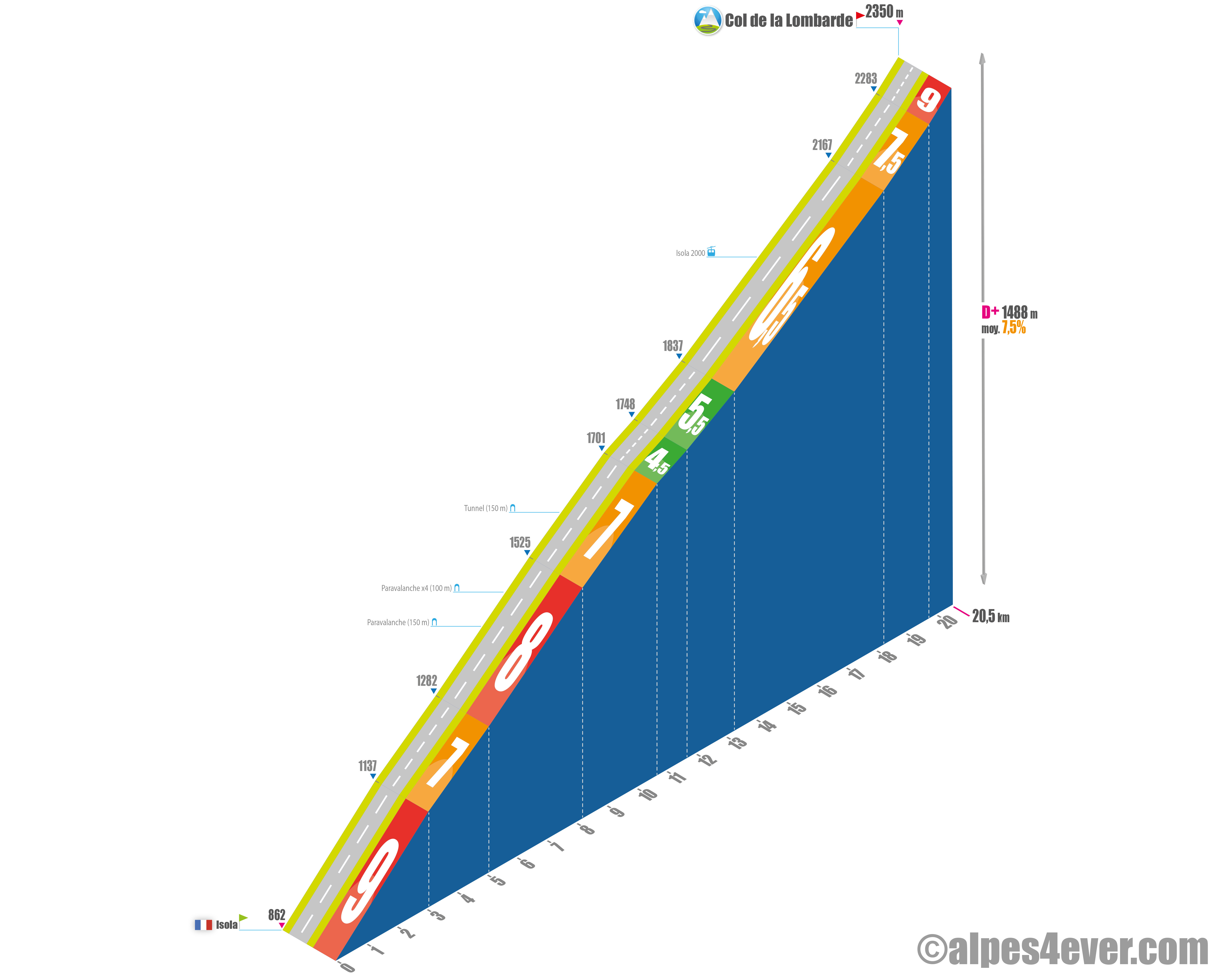
The Col de la Lombarde (Italian: Colle della Lombarda) - 2350 m - is a border pass linking the Vallée de la Tinée in the Alpes-Maritimes in France to the Vallée de la Stura di Demonte, in Piedmont in Italy. It is the 6th highest road pass in France.
The pass has a sustained average gradient of 7.5% for more than 20 kilometers, including several at an average gradient of 9%. It overlooks the resort of Isola 2000. Its former name was Col de la Brasca (of the swamp). Its current name comes from the Provencal loumbardo, north-east wind.
The map
The map
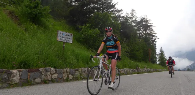
24 Alternative stage Saint-Etienne-de-Tinée / Saint-Martin Vésubie
This section of the Route des Grandes Alpes®, linking the Tinée and Vésubie Valleys, runs alongside the mountain resorts of Auron and Isola 2000 and crosses that of La Colmiane (around the Col Saint Martin pass). It allows you to discover extremely beautiful villages such as Saint-Sauveur-sur Tinée, La Bolline, Saint-Dalmas and Valdeblore, plus the lovely, slightly larger perched settlement of Saint-Martin-Vésubie. Also consider the beautiful high-altitude villages of Roure and Roubion close to Saint-Sauveur-sur-Tinée, although not directly along this section. The Col Saint Martin pass (1503m) marks the point where you switch from Tinée to Vésubie Valley.