Col de la Madeleine
From Tarentaise to Maurienne
Altitude 1993 m
Massif de la Vanoise
Department Savoie
Summary
- Plan your ascent of the Col de la Madeleine
- ascent of the Col de la Madeleineby bike from La Léchère-les-Bains
- Description of the ascent of the col de la Madeleine by bike from La Léchère-les-Bains
- Col de la Madeleine ascentMadeleineby bike from La Chambre
- Col de la Madeleine ascent descriptionCol de la Madeleine ascent descriptionMadeleineby bike from La Chambre
- Conseils pour préparer l'ascension du col de la Madeleine
- Weather conditions for the col de la Madeleine
- Recommended equipment for the col de la Madeleine
- Services at the col de la Madeleine
- Access to the col de la Madeleine
- Témoignages
- FAQ
Plan your bike ascent of the Col de la Madeleine
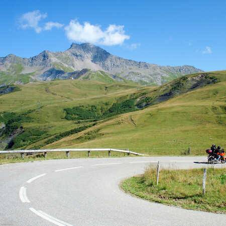
Well better than an alternative solution in case of adverse weather conditions on the flanks and summit of the Iseran, this col sur Route des Grandes Alpes ® is, without doubt, one of the most beautiful Alpine passes. Visited by the Tour de France for the 28th time in 2025, this "almost 2000 m" links the Tarentaise and Maurienne valleys, offering two magnificent climbs.
Cycling up the Col de la Madeleine from La Léchère-les-Bains
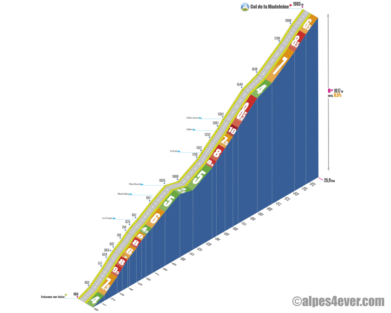
Start: Feissons-sur-Isère (466 m)
Distance: 25.9 km
Altitude: 1993 m
Height gain: 1617 m
Average slope: 6.5%
Maximum gradient: 10%
Tour de France® rating: outside category
Time to climb (rounded) Col de la Madeleine by bike from La Léchère-les-Bains
- At 7 km/h: 3 h 40
- At 11 km/h: 2 h 20
- At 15 km/h: 1 h 45
- At 19 km/h: 1 h 20
Map of the route up the Col de la Madeleine by bike from La Léchère-les-Bains
Description of the ascent of Col de la Madeleine by bike from La Léchère-les-Bains
The Col de la Madeleine links the two major Alpine valleys of Tarentaise and Maurienne. The only road crossing of the Vanoise massif, this "almost 2000" belongs to the family of hors catégorie cols and to the legend of the Tour de France.
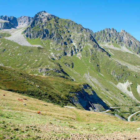
The north side is easier than the south side, even if it has a higher vertical drop (1617 m at 6.5%). It's also very pastoral, traversing landscapes of alpine forests and meadows, before finishing in apotheosis amid alpine meadows offering breathtaking views of the surrounding peaks. Bucolic and affordable, but very long: almost 26 kilometers!
Start at the bottom of the Tarentaise valley, in Feissons-sur-Isère to be exact.
After a few relatively leisurely pedal strokes, the first eight kilometers, up to Villard-Saffray, finally prove to be quite tough on an average gradient of 6.5%, with passages at 8 and 9.5%. Beautiful views from the road as it winds through authentic hamlets.
The next two kilometers, between Villard-Saffray and Villard-Benoît, are on a fairly gentle slope (5%). They are followed by a kilometer and a half of descent, which precedes two further kilometers at 5%. You're almost at La Thuile and that's the end of the playtime!
You've got around 12 km and almost 900 m D+ to go. First things get tough. At La Thuile, in fact, the gradient kicks in again with a long passage of over five kilometers that oscillates between 7.5 and even 10% near Celliers-dessus.
Returning to calm with around 1700 m at 4%, as you enter the 20th kilometer. Enough to recover before a final series of 6 laces, at 7, then 8.5%.
The last 1500 meters at 6.5% bring you to the pass in an armchair. You can then serenely enjoy the terrace of La Banquise, "le bistro du col", an institution!
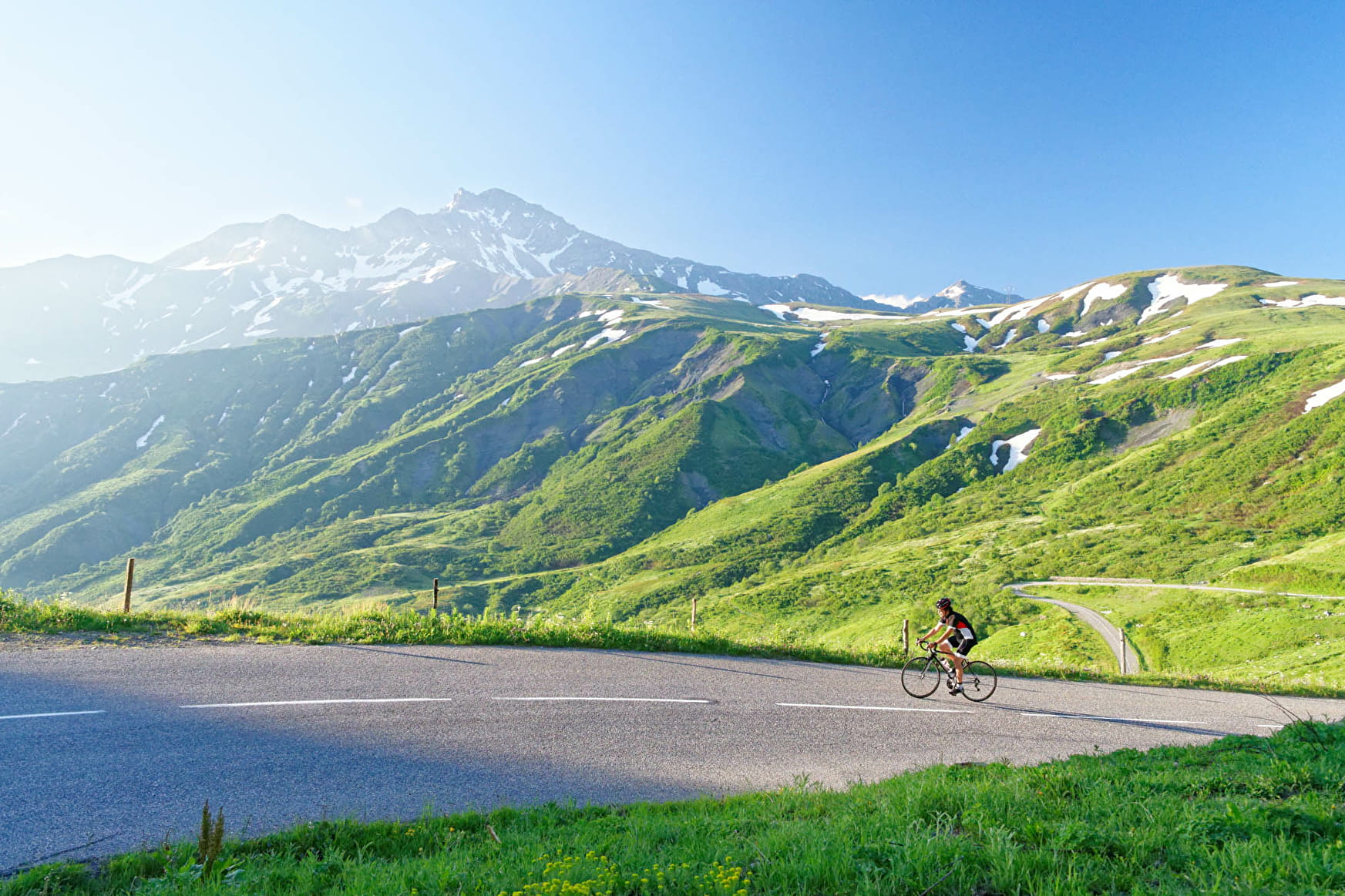
Bicycling up the Madeleine pass from La Chambre
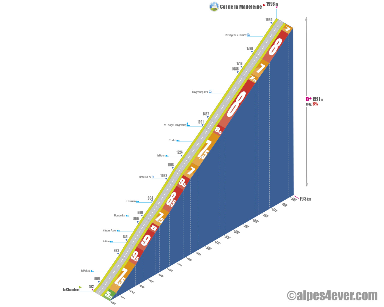
Versant sud direct

South side via Montgellafrey
Start: La Chambre (472 m)
Distance: 19.3 km
Altitude : 1993 m
Elevation: 1521 m
Average gradient: 8%
Maximum gradient: 9.5%
Cotation Tour de France® : outside category
Time to climb the Col de la Madeleine by bike from La Chambre
- At 7 km/h: 2 h 45
- At 11 km/h: 1 h 45
- At 15 km/h: 1 h 15
- At 19 km/h : 1 h 00
Map of the route up the Col de la Madeleine by bike from La Chambre
Description of the Col de la Madeleine ascent by bike from La Chambre
From La Chambre, at the bottom of the Maurienne valley, you can choose between two distinct routes to Longchamp 1650, the resort of Saint-François-Longchamp. Here, about five kilometers from the Col de la Madeleine, the two routes merge on the D213. Note that the distances and gradients of the two options are virtually identical. We call them "Versant sud direct" and "Versant sud par Montgellafrey".
Versant sud direct
This route, slightly more difficult (8% vs. 7.5% via Montgellafrey), starts from La Chambre, a Basse-Maurienne market town crossed by the Arc. The first section, around 1.5 km, leads to the village of St-Martin-la-Chambre. The initial 5.5% gradient soon becomes 7.5%. From here, the gradient is steady, varying from 7 to 9.5% all the way to the summit.
After St-Martin-la-Chambre, you go from 7.5 to 9.5% in just over three kilometers and 6 turns to the chalets de la Côte. No respite after La Côte: 1.6 km at 8/9% to the hamlet of Montoudras, where you're only on the fifth kilometer of the climb.
Slight respite for the next kilometer: 7.5% to the chalets of Colombin.
At Colombin the road rises again with a big two kilometers at over 8.5% average. Notable features on this section: passing under a paravalanche and crossing the second hardest passage of the climb: 700 meters at 9.5%.
The slope then softens with just over 900 meters at 7% to the Planet. The aptly named, as you benefit from a short 700-meter false flat at 5.5%. Enough to get you going again for the second half of the route, where you'll find no more 9%. Phew!
But it's still serious all the same. After 2.2 kilometers at 7.5%, where you cross Epalud, known for its fairy chimneys, you reach the first settlements of St-François-Longchamp. A steep ramp marks the start of a 2.8 km section at 8% to the Longchamp 1650 station. Beware, as the day progresses, this almost shade-free section becomes an oven.
Then you've got 14.5 km of intense climbing under your belt. And there's almost 5 more to go, with 375 m of D+ at 7.5%. A final section you share with colleagues who opted for the southern slope via Montgellafrey.
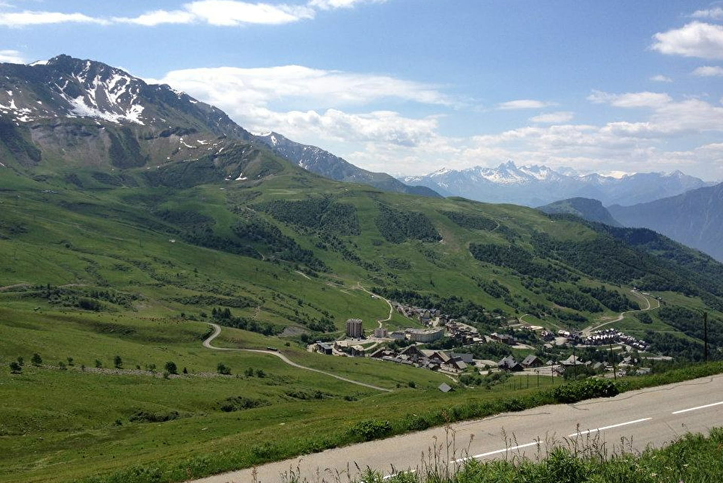
It starts with 880 m at 8% to lift you above the resort. And suddenly the landscape unfolds, with sublime views of the Massifs des Grandes Rousses-Galibier, de Belledonne and the Aiguilles d'Arves. You can also see the climb to the Col du Glandon.
You're now riding through alpine meadows, enjoying a 1.5 km section at 7% maximum. The difficulties aren't over, however. After a left-hand switchback, the slope steepens to 1200 m at 8%. The altitude and the wind make the effort harder.
When you reach the Lauzière chairlift yaw, there's just 1300 m at 8%, then at 7% for the conclusion. Breathtaking views of Mont-Blanc at the top of the pass and a nice terrace to recover on!
South side via Montgellafrey
There is another option for climbing the south side. It takes you up through the hamlet of Montgellafrey, The distance (19.7 km) and elevation gain (1519 m) are almost equivalent to the "Versant Sud Direct".
From La Chambre, follow the signs for Notre-Dame-du-Cruet. The start is pleasant, with a gentle 1% gradient for 430 m. Once through Notre-Dame-du-Cruet, the road straightens out, reaching between 5.5 and 6.5% for 1.1 km.
After a left-hand bend, things really get tough: 4.9 km at an average of 9.5%, with a final pass of 230 m at 11.5%. This slope, more open than the classic route, offers fine views of the Belledonne peaks and the Maurienne and Bugeon valleys. Enough to keep your mind occupied during this demanding climb! Just before Montgellafrey, a 900 m level at 5.5% offers a brief respite in this mountain village of authentic charm.
At the entrance to Montgellafrey, a hairpin leads to another steep section: 3.8 km with an average gradient of 9%, including a final 900 m segment at 11.5%!
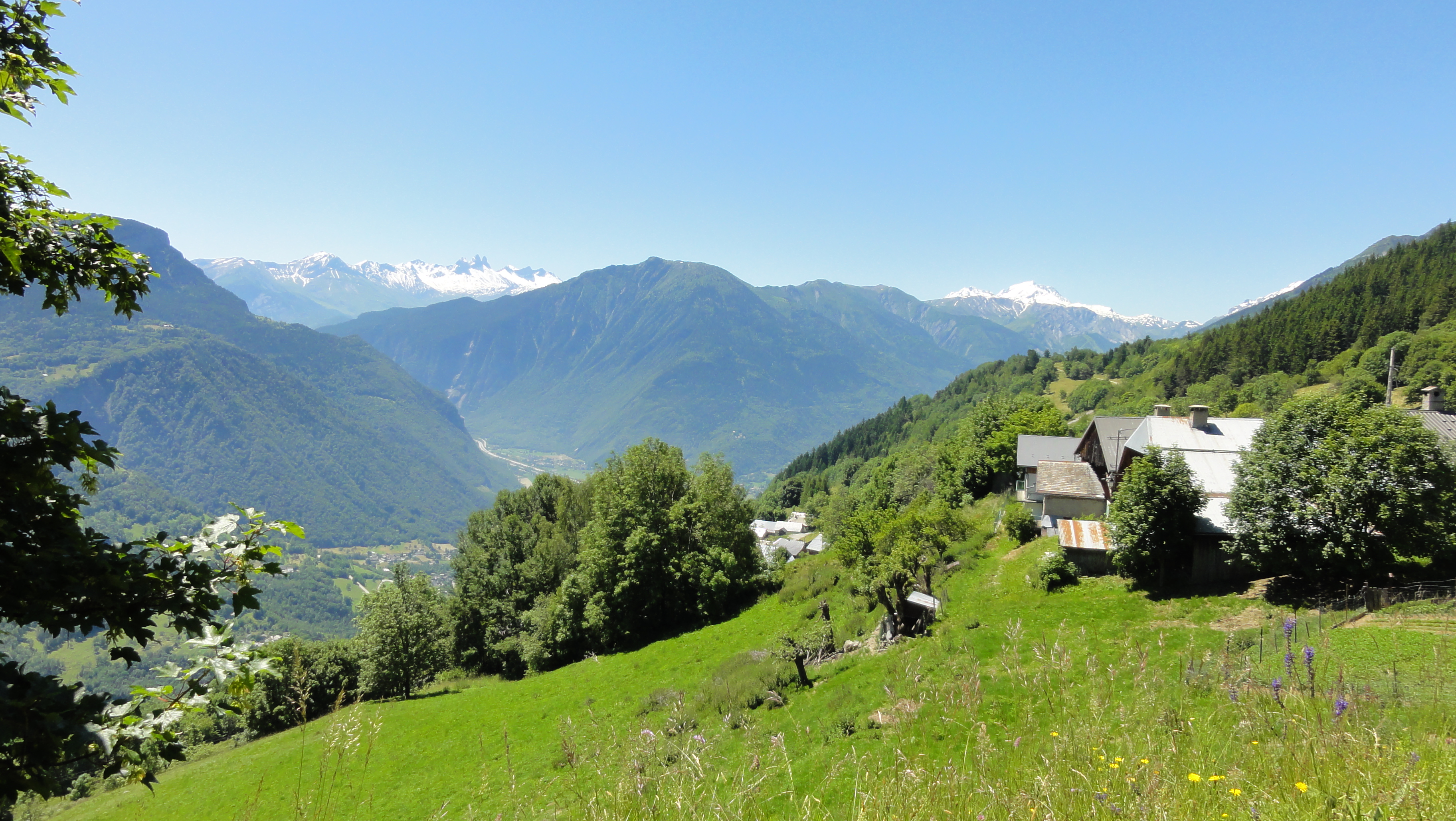
Just before reaching the hamlet of Le Replat, you'll enjoy another respite, with the gradient gradually easing from 5.5% to 4.5% over 2.2 km. Then the road resumes a more leisurely pace (1.1 km at 6.5/7%) to the Longchamp 1650 resort.
Then you'll have to pass the resort's last dwellings to rejoin the D213, with a final stretch of 1.2 km at 7.5%. You'll then reach the final stretch leading up to the col, which is described in "Versant sud direct".
Conseils pour préparer l'ascension du col de la Madeleine
On both its north and south sides, the col de la Madeleine offers significant distances and gradients. You'll need to be in excellent physical condition to tackle it on a muscle bike. And don't forget that the pass is almost 2000 metres high. All the meteorological precautions required for high-mountain biking apply. Watch out for bad weather, but also for heatstroke. Some passages can be real ovens when the sun is beating down.
Our advice:
- You start at less than 500 meters and arrive at nearly 2000 meters. Make sure you have clothing that can cope with every conceivable temperature variation.
- On both sides the climbs are long. Take two cans of water, remember to stay hydrated and eat, eat, eat! It's the only way to avoid draining your internal battery.
- If you want to go with a professional bike tour operator, we recommend our partners Vélorizons and LaRébenne. They'll organize everything for you: luggage porterage, accommodation booking, possibly accompaniment and bike hire... Discover which specialist to go with on Route des Grandes Alpes®
Weather conditions for the Madeleine Pass
The Madeleine Pass opens to traffic in late May or early June. It generally closes in November. Between these two periods, it is a solid alternative for crossing from Tarentaise to Maurienne. That's why Route des Grandes Alpes® has made it the keystone of its main variant.
To check that the pass is open and that the roads are passable, visit savoie-route.fr (check "État des cols" under "Données cartographiques").
To find out what time of year to set off on Route des Grandes Alpes ®

Recommended equipment for the col de la Madeleine
Choose quality equipment and above all don't forget anything! Check out our section dedicated to your equipment
For VAEs go to this page: follow all these tips dedicated to electrics and above all don't forget to check your bike's charge before setting off up the slopes of the Madeleine. It's a long way up, especially on the north side; this is no time to run out of fuel!
Services near Col de la Madeleine
On the north side, you can stock up on supplies in La Léchère-les-Bains, a small town and spa resort. On the south side, you'll find everything you need at the start of the climb, in La Chambre. A few kilometers before the summit, you'll also find resources at Saint-François-Longchamp and Longchamp 1650.
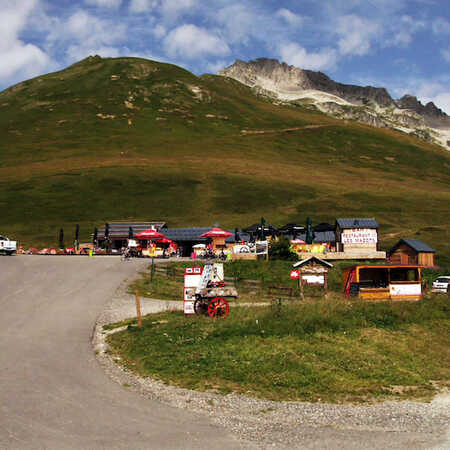
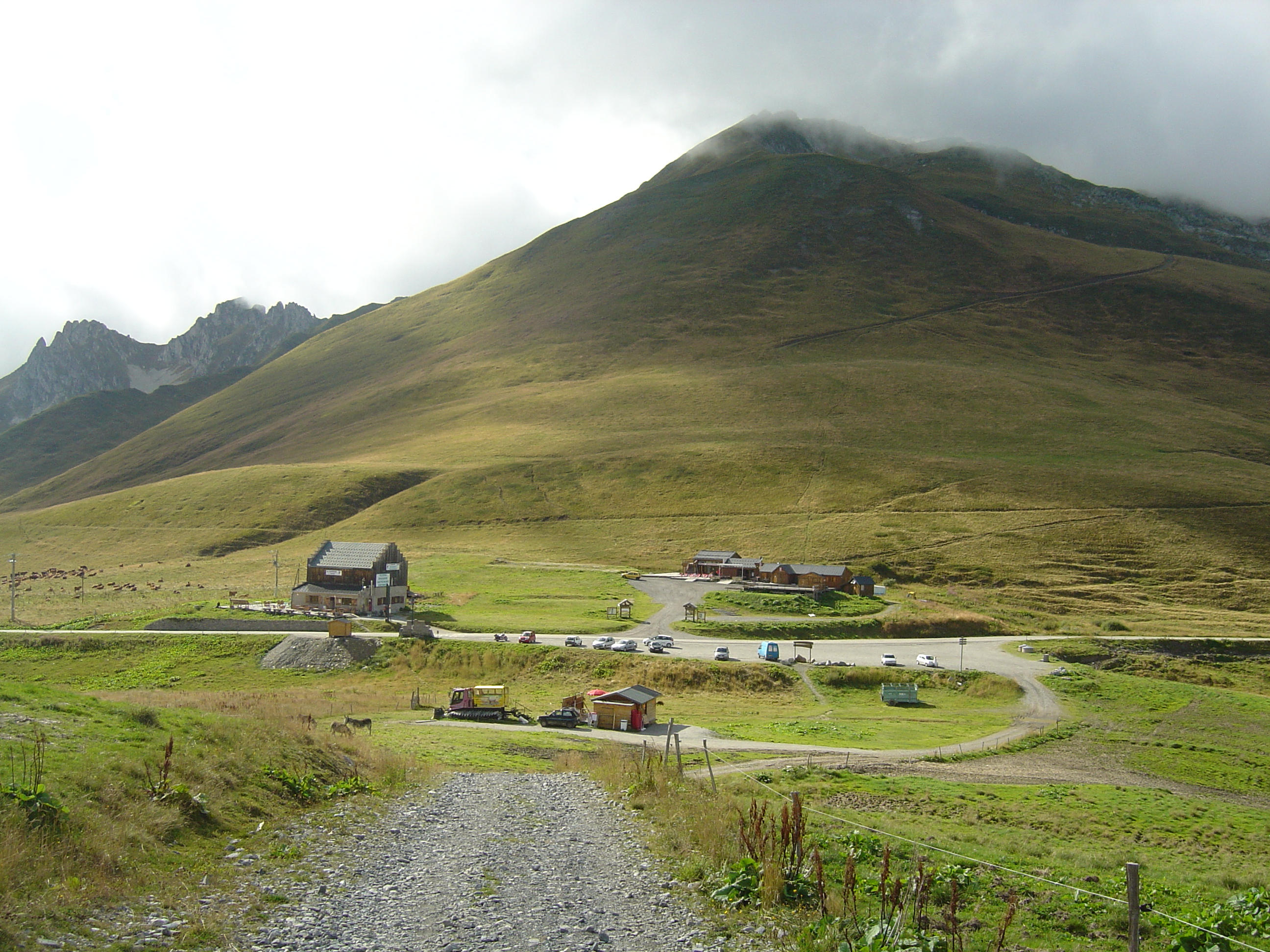
Two café-restaurants await you at the pass, including the famous Banquise 2000, the "bistro du col".
Access to Col de la Madeleine
SNCF and bus stations
- Albertville (73)
- Moûtiers - Salins - Bride-les-Bains (73)
- Bourg-Saint-Maurice (73)
- Saint-Jean-de-Maurienne (73)
Road access
N90 in the Tarentaise Valley
A43 (autoroute de la Maurienne)
D213 from La Léchère-les-Bains (Tarentaise) and La Chambre (Maurienne)
Those who have done it speak best of it!
"Climbing the Col de la Madeleine on the south side really put me to the test. The first few kilometers went well, despite some very steep slopes. But after Montgellafrey, my thighs were burning and every pedal stroke was a battle. It was the spectacular views that pulled me up!"Martin.
"With the late opening of the Col de l'Iseran this year, well glad we were able to go through the Madeleine. It saved our route from the big Alps. And it turned out to be much better than a consolation prize!" Martine, cyclo alsacienne.
"Coming from the Haute Maurienne, I chose the alternative via the Col du Chaussy and the Montvernier lacets. Magnificent sequence that I recommend!" Steve, from Lausanne.
"More beautiful from the north, I find where the views are more unobstructed..."A Cevenol who wouldn't have missed this "episode" for the world.
"One of my worst memories? The climb to the Col de La Madeleine, on a deserted Saturday with a punctured inner tube, a faulty pump and an under-inflated tire, at less than 1 kg, when it should have been at least 2.2 - 2.5 kg! That day, I covered more than 1,600 m D+ and 75 km in these conditions (a very complicated descent!). Fortunately, the bellowing of the stag accompanied me for much of the climb." Laurent de Bruyn.
FAQ
But what is really the altitude of the Col de la Madeleine?
The stele, at the top of the pass, indicates 2000 m. The old sign put it at 1,984 m. Today, everyone, including us, agrees on 1,993 m.
When did the Tour de France first pass over the Col de la Madeleine?
It dates back to 1969, the year the road was tarred. The Col de la Madeleine will be crossed for the 28th time by the Tour de France, in 2025, during the Vif - Col de la Loze stage. Breakdown: 15 climbs on the south side, 13 on the north side.
Which resorts link the Col de la Madeleine?
Valmorel, on the Tarentaise side, and Longchamp 1650, on the Maurienne side. The pass and the road leading to it are closed to traffic in winter... but open to skiers. The two resorts then share a linked ski area: Le Grand Domaine.
Where does the name Col de la Madeleine come from?
This name comes from the chapel dedicated to Marie-Madeleine, built several centuries ago on the Maurienne side, on the banks of the Arc. Travellers used to place candles here before starting their journey over the pass. In ruins, the chapel was closed in 1761.
The other passes near the Col de la Madeleine
| The most beautiful passes of Route des Grandes Alpes ®
|
Places to visit near Col de la Madeleine
