19 stages · 839 km

Gradients and elevation

Ascents: 26130m
Descents: 26547m
Lowest point: 0m
Highest point: 2798m

19 stages used

Thonon-les-Bains / Morzine-Avoriaz

1 Thonon-les-Bains / Morzine-Avoriaz

51 km
5 h 00 min
Difficult
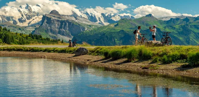
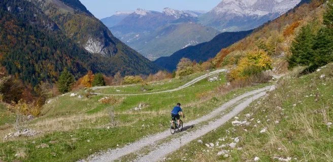
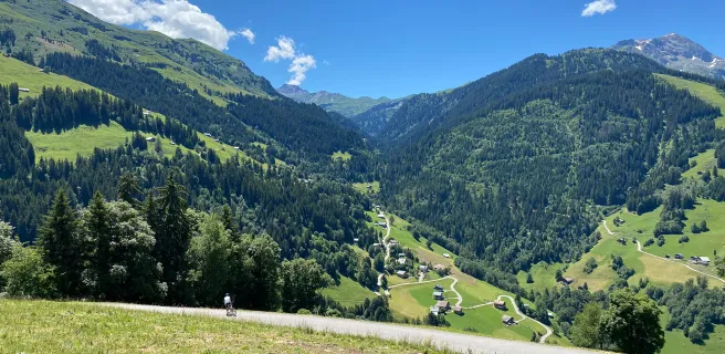
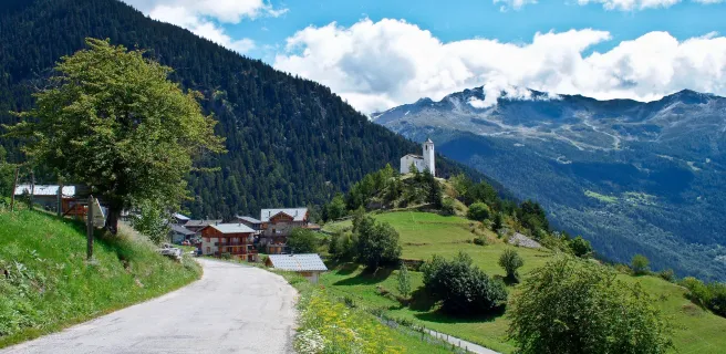
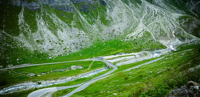
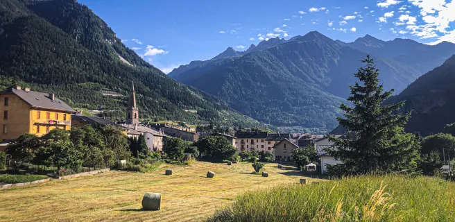
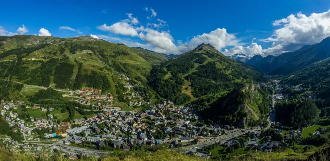
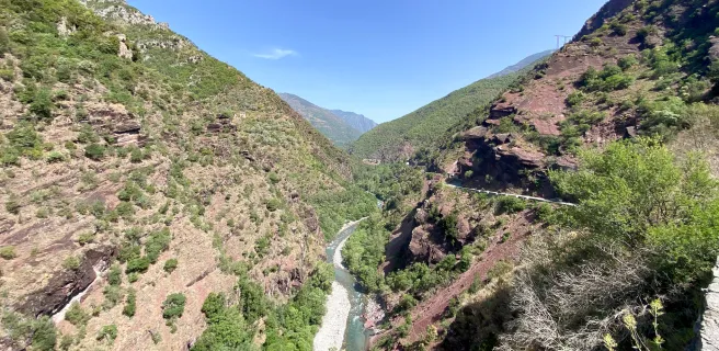
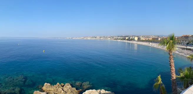
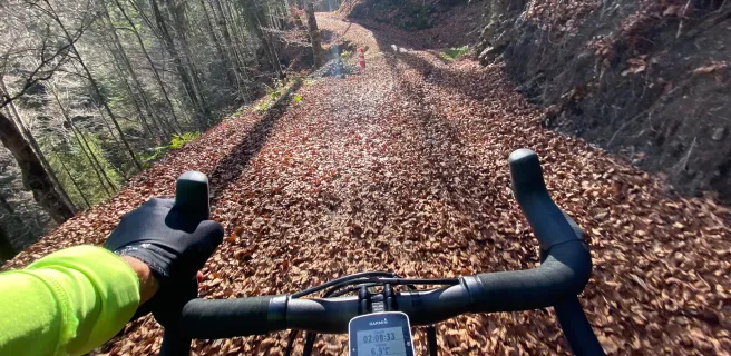
This stage leads you close to, or even at times along, the classic Route des Grandes Alpes® cycle route, but it guides you, where possible, along tracks adapted to gravel bikes. After riding along a portion dominating Lake Geneva from on high, enjoying unforgettable views, you then turn in the direction of Lullin and the peaceful Vallée Verte via the Col du Feu (a pass at 1,120m in altitude). Head on for the Dranse Gorges, in the heart of the Chablais UNESCO Global Geopark. We recommend a stop to visit the site of the Gorges du Pont du Diable before you ride on to Saint-Jean-d’Aulps, then Montriond and its lake (the short detour is worth it), followed by Morzine-Avoriaz, the views opening up as you progress, high Alpine pastures becoming visible.
Morzine-Avoriaz / Cluses

2 Morzine-Avoriaz / Cluses

53 km
5 h 00 min
Very difficult
On this cycling stage, you cross from the Chablais to the Haut-Giffre area before heading for the Arve Valley and Cluses, considered its industrial capital. First, leaving Morzine and going via Les Gets, the route leads you to tackle two high passes, the Col du Ranfolly, followed by the Col de Joux Plane (the latter at an altitude of 1,691m). Next comes the long descent to Samoëns, recognized as one of the most beautiful villages in the département (French county) of Haute-Savoie. After Samoëns, head for the Nordic ski area of Agy / Saint-Sigismond before the descent to Cluses, down in the Arve Valley’s bottom. The way along this stage is almost exclusively for gravel bikes, taking you through forests, high Alpine meadows and unspoilt, traditional villages. You stay close to the classic Route des Grandes Alpes®, but only actually join it on the descent from La Côte and Châtillon-sur-Cluses to Cluses.
Cluses / Le-Grand-Bornand

3 Cluses / Le-Grand-Bornand

40 km
4 h 30 min
Very difficult
You start this stage riding along a track high above the Arve Valley, then you cycle along beside the Bargy chain of mountains before tackling the Col de la Colombière (a pass at 1,613m in altitude) to enter the heart of the Massif des Aravis Range. Leaving from Cluses, follow the alternative Nancy-sur-Cluses / Romme route off the classic Route des Grandes Alpes®, taking you up via Le Reposoir, with its famed chartreuse (charterhouse), to the Col de la Colombière (at 1,613m). Coming down from this pass, break your descent towards Le Grand-Bornand - Le Chinaillon, turning in the direction of the Lac du Maroly and the Col des Annes, then continue descending to the bottom of the Vallée du Bouchet to reach the centre of Le Grand-Bornand village.
Le Grand-Bornand / Flumet

4 Le Grand-Bornand / Flumet

42 km
4 h 30 min
Difficult
This stage takes you across the Massif des Aravis Range and its two village-resorts, Le Grand-Bornand and La Clusaz, before making you plunge down into the Val d’Arly, on the border between the two départements (French counties) of Haute-Savoie and Savoie. First, climbing a portion of the Vallée du Bouchet from Le Grand-Bornand village, enjoy the lovely hilly, up-and-down route to the Vallée des Confins and its little lake, at the foot of the typical coombs (steep dry valleys) of the Aravis Range. From here, continue on to La Clusaz, then follow the road up to the Col des Aravis (a pass at an altitude of 1,486m). In the midst of the array of chalet–restaurants at the pass, turn right onto the Route de la Soif, a splendid road perched on high, providing easy cycling and preceding a splendid wild descent to Saint-Nicolas-la-Chapelle, followed by Flumet.
Flumet / Arêches-Beaufort

5 Flumet / Arêches-Beaufort

41 km
4 h 00 min
Difficult
This gravel bike cycling stage sticks close to the classic Route des Grandes Alpes®, but proves almost wholly original, as you’ll rarely use that well-trodden route itself! Heading out from Flumet and through Notre-Dame de-Bellecombe, enjoy the exceptional natural landscapes of the regional nature reserve of La Tourbière des Saisies – Beaufortain – Val d’Arly, which you’ll climb through, heading up to the ski resort of Les Saisies. Next, plunge into the heart of the Beaufortain area to reach Arêches via the exquisite villages of Hauteluce and Beaufort. From Beaufort, or from Arêches (going via the Col du Pré), those of you intent on ticking off as many high mountain passes as possible can branch off from our proposed route to climb the famed Cormet de Roselend (at an altitude of 1,968m), guarding the way to the valley town of Bourg-Saint-Maurice and the mighty Tarentaise Valley.
Arêches / Bourg-Saint-Maurice

6 Arêches / Bourg-Saint-Maurice

39 km
4 h 00 min
Difficult
Now, here’s a wild stage leading you into the midst of high mountains and involving riding beside Saint-Guérin Lake and tackling the high Cormet d’Arêches pass. Leaving from Arêches, you follow the Poncellamont mountain stream up to Saint-Guérin Dam and Lake. Do dismount to cross the impressive footbridge suspended 80m above the water. Having enjoyed a breather here, time to tackle the way up to the Cormet d’Arêches, at 2,018m in altitude. Next, you descend towards Bourg-Saint-Maurice via Montgirod (in the commune, or parish, of Aime-La-Plagne) and Vulmix, the latter marked by its fortifications.
Bourg-Saint-Maurice / Tignes

7 Bourg-Saint-Maurice / Tignes

42 km
5 h 00 min
Very difficult
This stage includes a stop at the hamlet of Le Monal (at 1,874m in altitude), a listed site, given its exceptional natural and heritage features. First, you leave Bourg-Saint-Maurice via a greenway leading to Séez, followed by Villaroger. Alternatively, you can take a different route via Montvalezan. Next, it’s on to Sainte-Foy-Tarentaise, then Le Monal, before joining the D902 road, two kilometres before Tignes-les-Brévières. From Les Brévières, after a stop to take a phot of Le Chevril Dam, decorated with a monumental image of Hercules, you start the climb across the ski area and high summer meadows leading to Tignes and Tignes Lake.
Tignes / Bessans

8 Tignes / Bessans

52 km
6 h 00 min
Very difficult
From Tignes Val Claret, our cycle route leads you across a part of the Tignes – Val d’Isère ski area. This way, you bypass the unpleasant stretch of road, along with its many tunnels, that links Le Chervil Dam and Lake to Val-d’Isère; instead, admire the spectacular, wild setting as you advance. However, please take careful note, if you have the slightest doubt about your physical fitness, your bike or your weather on this portion, then do opt for the D902 road to reach Val d’Isère. Next, you’ll need to stick to the road for the fabulous climb to the Col de l’Iseran (a pass at 2,764m in altitude), followed by an equally fabulous descent to Bonneval-sur-Arc, a beautiful traditional village, a gem of the Haute-Maurienne Vanoise area, the buildings roofed with stone slates. To reach Bessans, follow the Chemin du Petit Bonheur, offering easy riding perfectly suited to gravel bikes.
Bessans / Modane

9 Bessans / Modane

38 km
3 h 15 min
Difficult
On this stage, you’ll quickly notice it’s far more about descents than climbs for once! Now it’s time to explore the Haute-Maurienne Vanoise area further. You’ve already admired the stone slate roofs of the traditional buildings of Bonneval-sur-Arc, at the foot of the Col de l’Iseran. You’ve stopped at Bessans, reputed for its cross-country skiing. So, head off from Bessans along the path delightfully known as the Chemin du Petit Bonheur, a little delight… in grandiose settings. Coming up, you’ll cross the fine villages of Val Cenis: Lanslevillard, Lanslebourg, Termignon, Sollières and Sardières. There follow Aussois, the steeply stepped fortifications of the Barrière de l’Esseillon, Villarodin-Bourger (overflow commune, or parish, for the ski resort of La Norma) and, finally, Modane (overflow commune, or parish, for the ski resort of Valfréjus), the latter a valley-bottom town providing plenty of services and infrastructure of all kinds.
Modane / Valloire

10 Modane / Valloire

36 km
3 h 30 min
Difficult
Leaving Modane, the cycle route runs beside the Arc River and the motorway until you join the Route Forestière de la Grande Roche up to Valmeinier, the most recently created mountain resort in the Maurienne, its ski area linked in winter to that of Valloire. Here, between the Parc de la Vanoise and Mont Thabor (a distinctive mountain), the landscapes are magnificent. After leaving Valmeinier, your route runs alongside the Route du Col du Télégraphe and the classic Route des Grandes Alpes®. You will join this route to descend to Valloire.
Valloire / Briançon

11 Valloire / Briançon

52 km
5 h 30 min
Very difficult
Watch out, this high-altitude stage may take you through spectacular wild parts, but there’s a very technically challenging 5km stretch from Le Seuil (or Col) des Rochilles to the Refuge des Drayères – you will need to dismount and push your bike at times. It’s a magical challenge, but if you prefer to avoid it, you can reach Briançon via the “normal” route from the Col du Galibier. Leaving Valloire, follow the valley bottom to the start of the ascent to the Col du Galibier, but here you need to branch off in the direction of the heart of the Massif des Cerces Range. Early on, you’ll ride past the Camp des Rochilles, a fort built as part of the Maginot Line (a series of defences constructed in the 1930s to try and protect France from bellicose Fascist countries to the east), then past the mountain refuge of the same name. Enjoy glimpses of the Lac du Grand Ban, then Lac Rond, as the great obstacle of Le Seuil des Rochilles (or Col des Rochilles) rises up in front of you. Expect to have to push your bike for c.1.5km along the next stretch, but it’s well worth the effort. Having passed the Refuge des Drayères, you enter the Clarée, or Névache, Valley, a natural gem in the département (French county) of Hautes-Alpes. Coming out onto the Route du Col de Montgenèvre, there are just a few more kilometres on tarmacked road to ride down to reach the fortified historic town of Briançon.
Briançon / Guillestre

12 Briançon / Guillestre

51 km
5 h 10 min
Very difficult
This stage does follow the classic Route des Grandes Alpes®, via Cervières and the Col de l’Izoard. Its originality lies in the fact that it begins in the midst of Briançon’s fortifications, thanks to which the town gained its UNESCO listing. Next, this stage leads you to the summit of the Col de l’Izoard (at 2,360m in altitude). On the descent, you pass via La Casse Déserte, with its impressive mineral landscapes, very curious rocky peaks sticking out here and there. Next come Brunissard, Arvieux and, at the end, the crossroads for the Route de Guillestre, a mountain town you’ll reach by following the Guil River for several kilometres.
Guillestre / Crévoux

13 Guillestre / Crévoux

27 km
3 h 00 min
Difficult
On this stage leading you into the Massif du Parpaillon Range, you first pass the village of Risoul, followed by the ski resort of Risoul 1850. Having advanced across this ski area, and having reached the Col de Valbelle (a pass at 2,374m in altitude), you then plunge straight westwards towards the renowned Bergerie, after which you descend a piste towards Saint-André-d’Embrun to get around the range. Finally, you can then climb in the direction of Crévoux, riding alongside the Torrent de Crévoux, a mountain river.
Crévoux / Barcelonnette

14 Crévoux / Barcelonnette

35 km
2 h 30 min
Difficult
The highpoint on this magnificent stage through the heart of the Massif du Parpaillon is without doubt the stretch via the Tunnel du Parpaillon (at 2,367m in altitude), along a crest dividing the Ubaye Valley in the département (French county) of Alpes-de-Haute-Provence from the Durance Valley in the département of Hautes-Alpes. Originally created in the late 19th century by French military engineers (as with so many other high-altitude engineering works dotted along the Grande Traversée des Alpes®), the way here was never tarmacked (in contrast to the route up to the neighbouring Col de Vars). Descending the other side, the route takes you into the Ubaye Valley and along one bank of the Ubaye River at La Condamine Châtelard, before you slip over to the other bank as far as Jausiers, after which you continue to the town of Barcelonnette.
Barcelonnette / Saint-Dalmas-le-Salvage

15 Barcelonnette / Saint-Dalmas-le-Salvage

53 km
6 h 00 min
Very difficult
A splendid stage linking the Ubaye Valley to the Tinée Valley, with as joint potential additional highlight the Col de la Bonette, (a pass at 2,715m in altitude) along with the Cime de la Bonette (a summit at 2,802m)… You leave Barcelonnette and ride towards an exit from the Ubaye Valley by riding south and up towards the Col de la Cayolle, heading for the Bachelard Valley and Gorges. At the level of the Bayasse hotel-refuge, branch off the road towards the Col de la Cayolle to climb into the mountains to the east. A little before the Col de la Moutière (a pass at 2,454m in altitude), there’s the opportunity of a memorable additional return journey to and from the Col and Cime de la Bonette, via the “false pass”, then the real pass, of the Col de Restefond. This detour is very much worth the while. Afterwards, continue along the stage, descending on tarmac to Saint-Dalmas-le-Selvage.
Saint-Dalmas-le-Selvage / Marie

16 Saint-Dalmas-le-Selvage / Marie

45 km
2 h 15 min
Medium
Soon after starting out on this stage, at Saint-Dalmas-le-Selvage, the cycle route joins the alternative Bonette route of Route des Grandes Alpes®. It follows this alternative way up to Saint-Étienne de Tinée, followed by Isola, a pretty village located at 870m in altitude, at the confluence of the Tinée River and the Torrent de la Guercha, a mountain stream. Next, you set out on the 17km climb up to Isola 2000, a ski resort whose name indicates clearly its high altitude. For a fine way to end this stage, extend your ride further by tackling the climb to the Col de la Lombarde (a pass at 2,350m in altitude), looking down on Isola 2000 from the French frontier with Italy’s Piedmont Region.
Marie / La Bollène-Vésubie

17 Marie / La Bollène-Vésubie

43 km
3 h 30 min
Difficult
In the heart of a wooded mountain landscape, you leave the village of Marie, whose castle overlooks the Tinée valley. To reach Saint-Martin-Vésubie, you'll take a route that passes over the Col de Clamia, Saint Dalmas, the oldest of Valdeblore's three villages, and then Venanson, built on a rocky spur, a veritable eagle's nest that, at 1164m, dominates the Vésubie Valley. At Saint-Martin-Vésubie, you return to the classic Route des Grandes Alpes® route. Heading south, it passes through Roquebillière, the spa town of the Alpes-Maritimes, before reaching La Bollène-Vésubie, a magnificent village perched in a chestnut grove, on the left bank of the Vésubie.
La Bollène Vésubie / Coaraze

20 La Bollène Vésubie / Coaraze

55 km
6 h 00 min
Very difficult
From the level of the Col de Turini, the highpoint of this stage, our cycle route takes a radically different route from the classic Route des Grandes Alpes®, the latter leading riders via Moulinet to Sospel in the Bévéra Valley. You, however, will turn off for the Paillon Valley, following it all the way down as far as Nice. Setting off from the Turini Pass, you’ll descend through Mediterranean forests from 1,800m to 1,000m in altitude, riding along tracks that follow a ridge made up of peaks that get gradually lower: the Tête de la Fougassa, the Cime de l’Escaillou, the Tête du Pin, the Cime de Peïra Cava, the Cime du Pra de Court, the Cime de Rocaillon, the Cime du Tournet and the Cime du Savel. Following the Paillon de Contes tributary from on high, you’ll reach the medieval village of Coaraze, perched on a rocky outcrop at 650m in altitude, surrounded by mimosas, pines and chestnut trees.
Coaraze / Nice

21 Coaraze / Nice

47 km
3 h 07 min
Difficult
Don’t expect any let-up on this last mountainous, wild, very steep and challenging final stage, leading you on via the Col du Dragon and Col de Fuont Blanca passes! Just 24km from Nice, Levens is a little town of some 5,000 inhabitants, perched at 600m in altitude in a natural mountain setting. It makes a lovely refreshing tourist destination in summer. Closer still to Nice, just 12km away, Aspremont is a circular perched village standing at some 554m in altitude, closing off the gorges of its valley above Nice. Either Levens or Aspremont would make a lovely last halt before the grand town of Nice on the Mediterranean.
Afficher les étapes