Saint-Dalmas-le-Selvage / Marie
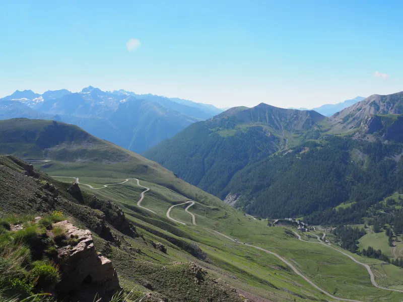
Soon after starting out on this stage, at Saint-Dalmas-le-Selvage, the cycle route joins the alternative Bonette route of Route des Grandes Alpes®. It follows this alternative way up to Saint-Étienne de Tinée, followed by Isola, a pretty village located at 870m in altitude, at the confluence of the Tinée River and the Torrent de la Guercha, a mountain stream. Next, you set out on the 17km climb up to Isola 2000, a ski resort whose name indicates clearly its high altitude. For a fine way to end this stage, extend your ride further by tackling the climb to the Col de la Lombarde (a pass at 2,350m in altitude), looking down on Isola 2000 from the French frontier with Italy’s Piedmont Region.
Gradients and elevation
Passage points
SAINT-DALMAS-LE-SELVAGE > M63 > M2205 > SAINT-ETIENNE-DE-TINEE > Ancienne route d’Isola > Le Bourguet > M 2205 > ISOLA > M 2205 > SAINT-SAUVEUR-SUR-TINÉE > M 2205 > LA BOLLINETTE > M 58 > MARIE
Don't miss
- Saint-Dalmas-le-Selvage : ‘Là où culmine l’authenticité !’ (‘Where tradition reaches its peak!’), says the slogan. Saint-Dalmas-le-Selvage is a commune (parish) at 1,500m in altitude, set for two-thirds within the boundaries of the Parc National du Mercantour and offering a complete escape from it all. It’s a wonderful place for nature-lovers, given its truly exceptional setting. It’s also a paradise for hikers, rock climbers and mountain bikers… as it is for the most hardened cyclists! The Course des 3 Cols challenges riders to take on, one after the next, three iconic passes, the Col de la Bonette, the Col de Larche and the Col de la Lombarde. All told, ot makes a fine circuit, going from Saint-Étienne de Tinée!
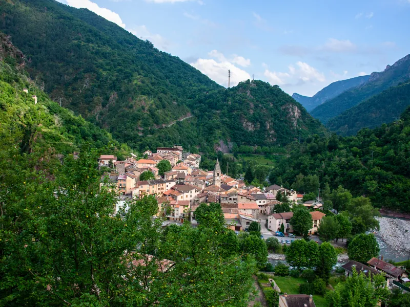
- Saint-Etienne-de-Tinée and the Tinée Valley : Crossing the Mercantour National Park heading south towards the Mediterranean, the Tinée River has cut a path through steep cliffs topped by forests and high Alpine meadows. Its valley presents a splendid mix of unspoilt natural landscapes and extremely beautiful villages. Set at 1,140m in altitude, Saint-Étienne-de-Tinée is a traditional mountain village whose homes, religious edifices and lanes bear witness to a richly fascinating past. A cable car service links it to the ski resort of Auron.
- Mercantour National Park : One of France’s 11 national parks, and one of the most unspoilt. Since 1992, in fact, wolves have been returning, crossing the border from Italy. The park is divided between two départements (French counties), the Alpes-de-Haute-Provence and Alpes-Maritimes. The landscapes vary considerably from one end of it to the other, going from distinctly Alpine summits to parts with a much more Mediterranean feel. To remind you, tackling the whole Route des Grandes Alpes® means crossing or riding alongside three national parks (the Vanoise, the Écrins and the Mercantour), two regional nature parks (parcs naturels régionaux – the Bauges and the Queyras) and two geoparks (in the areas of Chablais and Les Bauges).