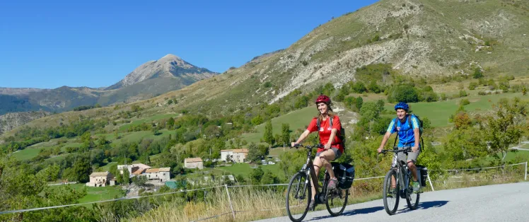
Bavante sur le Mont-Chauve
Altitude 1910 m
Massif du Mont-Ventoux
Département Vaucluse
Sommaire
- Planifiez votre ascension à vélo du Mont-Ventoux
- Ascension du Mont-Ventoux à vélo depuis Bédoin
- Description de l’ascension du Mont-Ventoux à vélo depuis Bédoin
- Ascension du Mont-Ventoux à vélo depuis Sault
- Description de l’ascension du Mont-Ventoux à vélo depuis Sault
- Ascension du Mont-Ventoux à vélo depuis Malaucène
- Description de l’ascension du Mont-Ventoux depuis Malaucène
- Conseils pour préparer l’ascension du Mont-Ventoux
- Conditions météorologiques pour le Mont-Ventoux
- Équipement recommandé pour le Mont-Ventoux
- Les services au Mont-Ventoux
- L’accès au Mont-Ventoux
- Témoignages
- FAQ
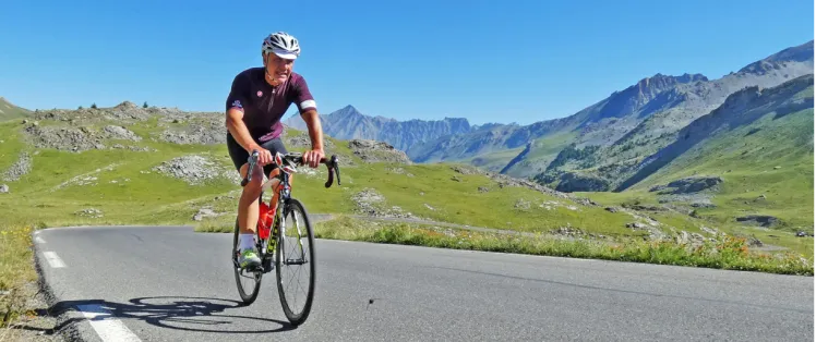
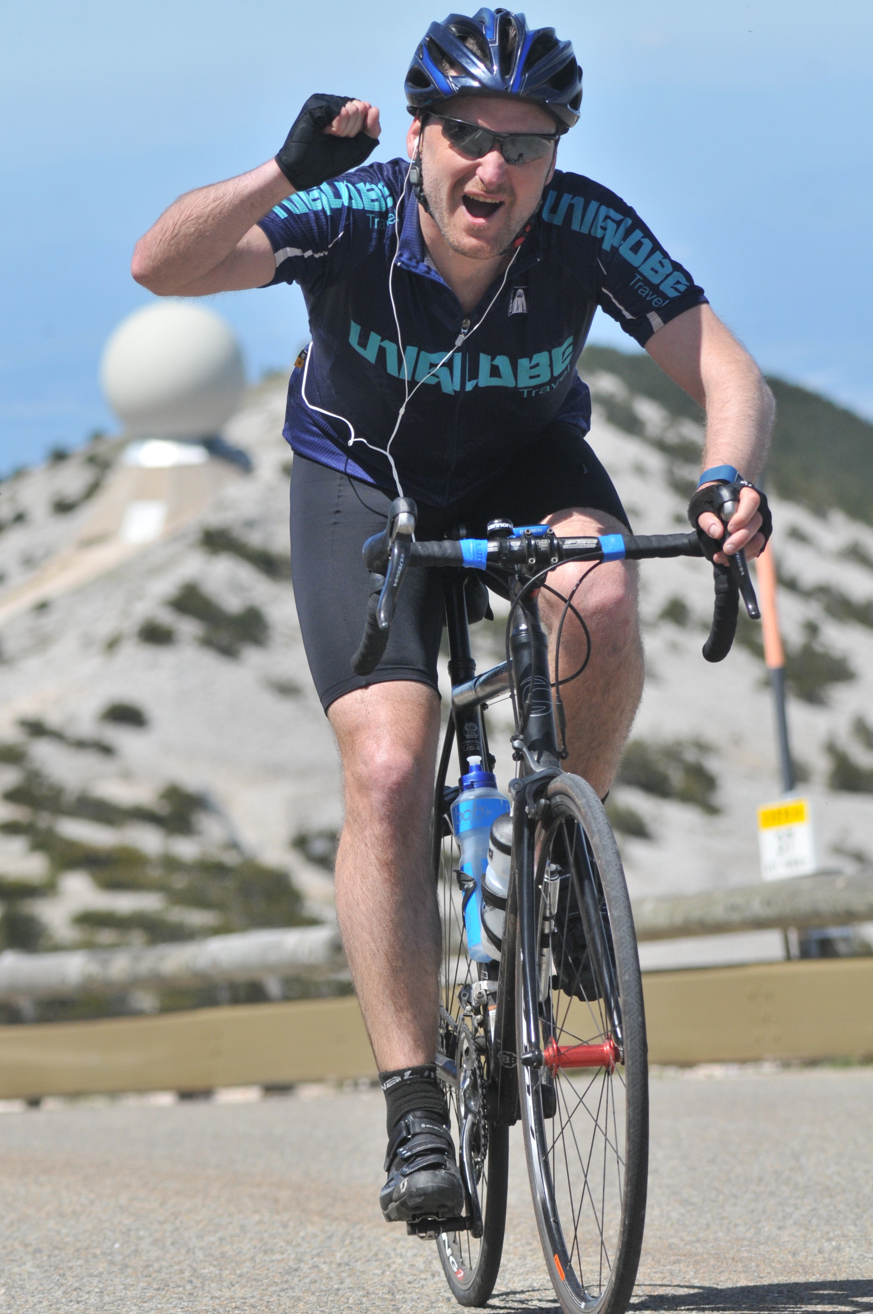
Planifiez votre ascension à vélo du Mont Ventoux
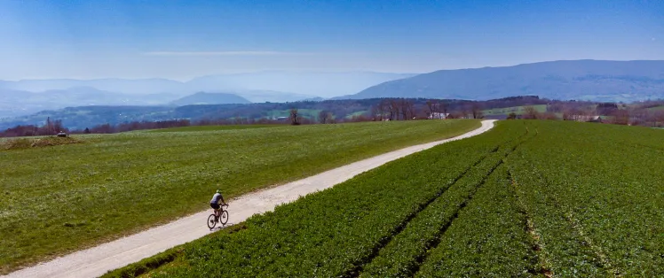
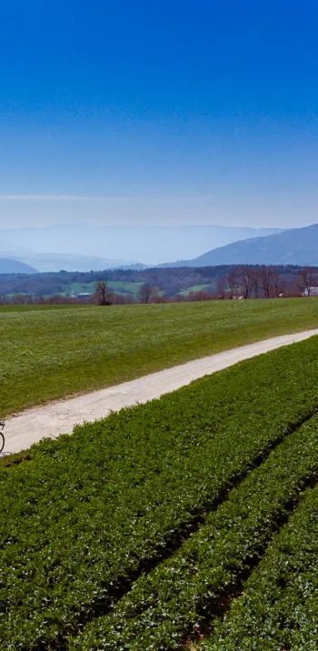
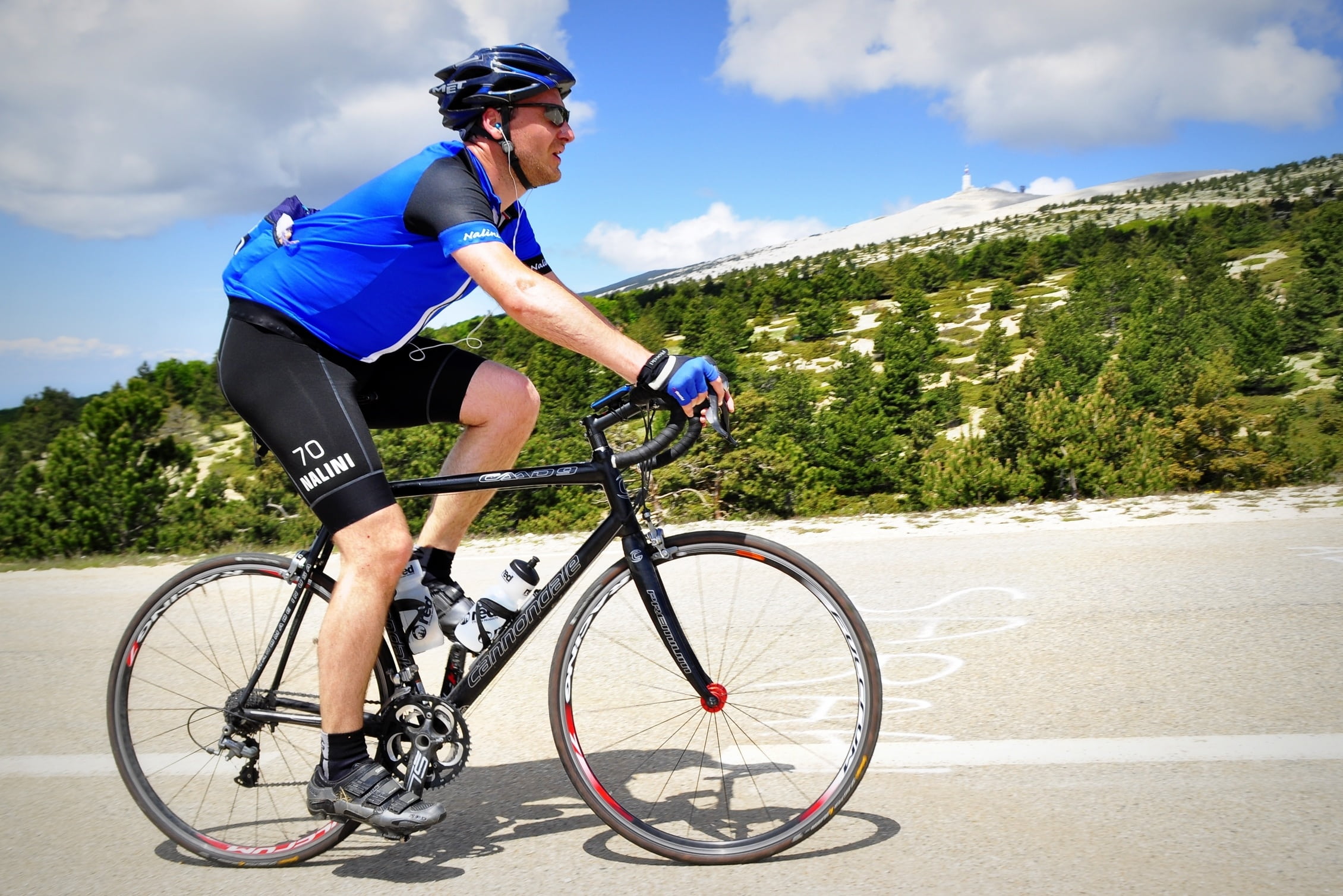
Le Mont Ventoux, qui domine la Provence de ses presque 2000 mètres d’altitude, ne se dresse pas directement sur notre itinéraire. Il demeure cependant un monument des Préalpes de Provence, aisément reliable à nos P’tites Routes du Soleil® et nos P’tites Routes du Soleil® Gravel. Donc, si l’envie d’un défi hors du commun vous titille, un détour s’impose. Car le « Mont Chauve », ou le « Géant de Provence », fait partie de ces ascensions légendaires qui marquent à jamais une vie de cycliste.
Les meilleurs séjours pour en profiter


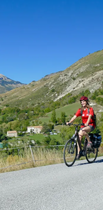
Bavante on Mont-Chauve
Altitude 1909 m
Monts de Vaucluse
Département Vaucluse
Summary
- Plan your ascent of Mont-Ventoux by bike
- Ascend Mont-Ventoux by bike from Bedouin
- Description of the ascent of Mont-Ventoux by bike from Bedouin
- Ascend Mont-Ventoux by bike from Sault
- Description of the ascent of Mont-Ventoux by bike from Sault
- Ascension of Mont-Ventoux by bike from Malaucène
- Description of the ascent of Mont-Ventoux from Malaucène
- Tips for preparing to climb Mont-Ventoux
- Weather conditions for Mont-Ventoux
- Recommended equipment for Mont-Ventoux
- Services at Mont-Ventoux
- Access to Mont-Ventoux
- Testimonials
- FAQ
Plan your bike ascent of Mont Ventoux
Mont Ventoux, which dominates Provence at an altitude of almost 2,000 meters, is not directly on our itinerary. It remains, however, a monument of the Pre-Alps of Provence, easily relatable to our P'tites Routes du Soleil® and our P'tites Routes du Soleil® Gravel. So, if you're in the mood for an unusual challenge, a detour is in order. Because the "Mont Chauve", or the "Géant de Provence", is one of those legendary climbs that leave an indelible mark on a cyclist's life.
Bicycling up Mont Ventoux from Bédouin
Start: Bédouin (314 m)
Distance: 21.3 km
Altitude: 1909 m
Elevation: 1589 m
Average gradient: 7.46%
Maximum gradient: 12.5%
Tour de France® rating: hors catégorie
Cycling time up Mont Ventoux (rounded) from Bedouin
- At 7 km/h: 3 h
- At 11 km/h: 2 h
- At 15 km/h: 1 h 25
- At 19 km/h: 1 h 10
Map of the Mont Ventoux bike climb from Bédouin
Description of the ascent of Mont Ventoux by bike from Bédouin
The ascent of Mont Ventoux from Bédoin is the most mythical and feared of the three routes leading to the summit. It's the one that has written the legend of the Giant of Provence, not least thanks to the Tour de France. With a length of 21.3 km and a vertical drop of almost 1600 m, it has an average gradient of 7.5%, but the central 10 km are of formidable intensity.
The start from Bédoin: a deceptive warm-up
We leave the village of Bédoin on a wide, rolling road. The first 5-6 kilometers to Saint-Estève are relatively gentle (3-5%), giving you time to find your rhythm. But this part is deceptive: the real climb begins after the famous bend in the forest
The hell of the forest: 10 km at over 9%
As soon as you enter the Ventoux forest, the scenery changes abruptly. The gradient immediately rises to 9-10%, and hardly ever drops again before Chalet Reynard. There's no respite, no breathing space. The air is often heavy and the heat can be oppressive in summer. This passage is a real mental and physical test, where every pedal stroke demands considerable effort.
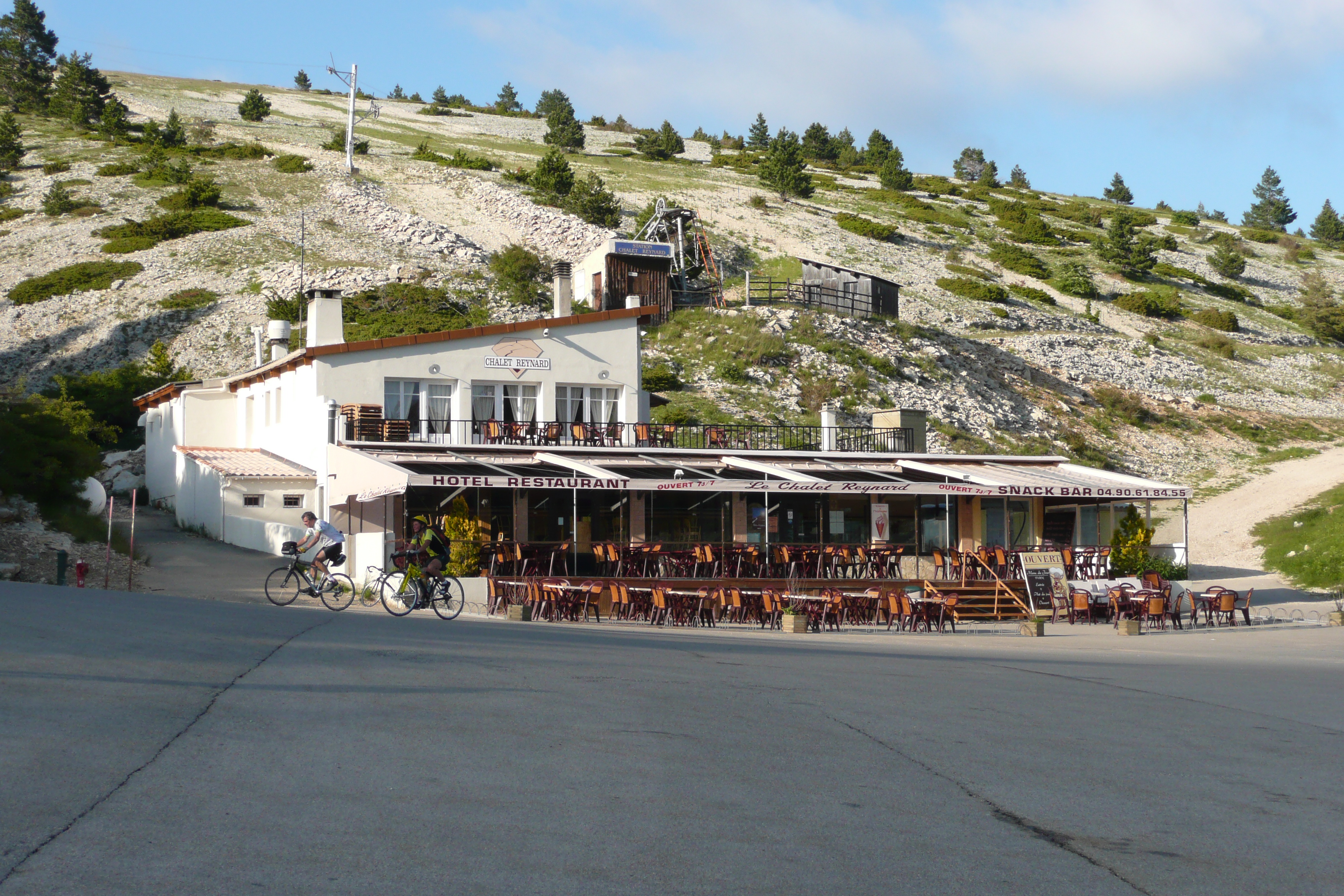
Chalet Reynard (1417 m): a little flat
The arrival at Chalet Reynard, where the ascent joins the road from Sault, allows you to recover a little. The landscape changes completely: the forest is gone, replaced by the lunar desert of the Ventoux.
The last 6 kilometers: a battle against the wind and the slope
The slope remains difficult (7-9%), but it's above all the wind that can make this final epic and even push you to give up. The summit observatory seems close, but each bend seems endless. The final curves, under the stele of Tom Simpson, who died on the flanks of the Ventoux during the 1967 Tour de France, and the passage over the Col des Tempêtes are the ultimate challenges before crossing the summit line at 1909 m altitude.
Cycling up the Mont Ventoux pass from Sault
Start: Sault (760 m)
Distance: 25.50 km
Altitude: 1909 m
Vertical rise: 1145 m
Average gradient: 4.5%
Maximum gradient: 12.5%
Tour de France® rating: hors catégorie
Cycling time up Mont Ventoux from Sault
- At 7 km/h: 3 h 40
- At 11 km/h: 2 h 20
- At 15 km/h: 1 h 45
- At 19 km/h : 1 h 25
Map of the Mont Ventoux ascent by bike from Sault
Description of the Mont Ventoux ascent by bike from Sault
The ascent of Mont Ventoux from Sault is the longest of the three routes to the summit, but also the most accessible. With 25.5 km and a vertical drop of almost 1,200 meters, it offers an average gradient of 4.5%, much gentler than the climbs via Bédoin or Malaucène. It's the ideal route for a first attempt, or for those who prefer a steadier, less brutal climb.
A gentle start in a Provencal setting
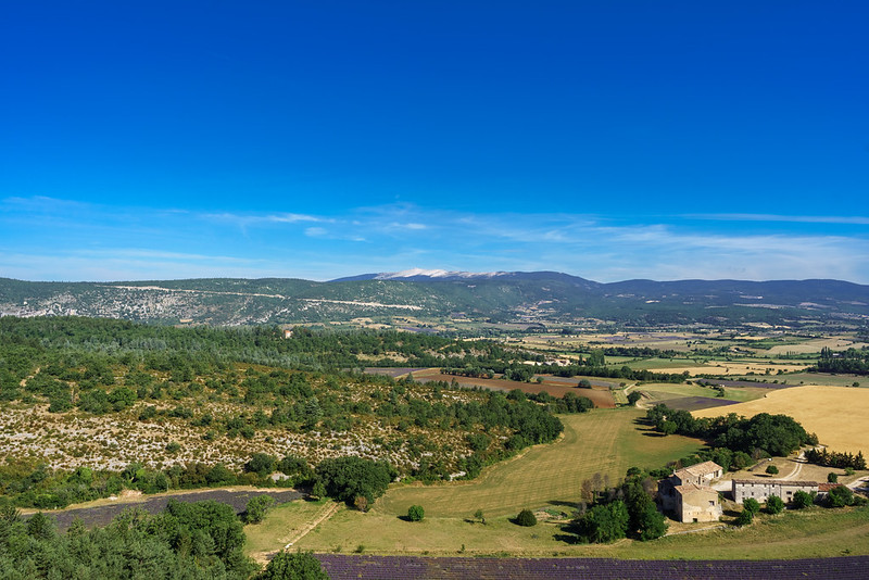
The route begins in the charming village of Sault (760 m), where the atmosphere is more peaceful than in the other valleys leading to the Ventoux. From the very first kilometers, the road winds through magnificent lavender fields and oak forests. The gradient fluctuates between 2 and 5%, offering a pleasant upward slope for admiring the scenery.
A steady climb to Chalet Reynard
After 15 km of steady climbing, you reach Chalet Reynard (1417 m), where the route joins the road from Bédoin. So far, the climb has never exceeded 6%, making progress smooth and enjoyable.
The lunar desert crossing, the real challenge
From Chalet Reynard, the atmosphere changes radically. The last 6 kilometers are formidable: the slope steepens abruptly with sections between 7 and 9%, and the landscape becomes mineral and arid. The wind can be a formidable enemy, making the effort more difficult and sometimes forcing you to give up. The summit observatory, visible in the distance, seems close, but the final laces are demanding.
In summary, a gentler, more gradual ascent, perfect for a discovery of the Ventoux, but with a demanding finale that reminds us that this pass remains a cycling giant.
Cycling up the Mont Ventoux pass from Malaucène
Start: Malaucène (377 m)
Distance: 21.2 km
Altitude: 1909 m
Height difference: 1532 m
Average gradient: 7.2%
Maximum gradient: 15%
Tour de France® rating: hors catégorie
Cycling up Mont Ventoux from Malaucène
- At 7 km/h: 3 h
- At 11 km/h: 2 h
- At 15 km/h: 1 h 25
- At 19 km/h : 1 h 10
Map of the Mont Ventoux ascent by bike from Malaucène
Description of the Mont Ventoux ascent by bike from Malaucène
A magnificent alternative, the ascent of Mont Ventoux via Malaucène is just as testing as the climb from Bedouin. At 21 km long and with a vertical drop of around 1,500 m, it has an average gradient of over 7.5%, with several sections exceeding 10%. Less exposed to the wind, it is characterized by its irregularity and long, demanding segments.
Starting from Malaucène
The start is in the village of Malaucène, where you'll find all the services you need before the effort: fountains, cafés and cycling stores. After a short warm-up, the gradient rises sharply from the very first kilometers, with sections at 9-10%.
An irregular and demanding climb
In contrast to the ascent via Bédoin, where the Ventoux forest imposes a constant rhythm, the route from Malaucène alternates difficult portions with brief respites. At around kilometer 5, you pass through a wooded area with severe ramps of over 11%. Further on, a short descent allows you to take a breather before attacking a terrible passage around Chalet Liotard (km 12-13), where the gradient reaches 12% for several hundred meters.
The last few kilometers, a mental and physical challenge
After the Mont Serein station (km 16, alt. 1,400 m), the last few kilometers are extremely tough. The landscape opens up, revealing the famous lunar road leading to the observatory. The wind can be a decisive factor, and the gradient always oscillates between 8 and 10%.
The arrival at the summit
The finish is a unique moment. The panoramic view over Provence and the Alps is a reward worthy of the effort. A photo in front of the summit stele is a must, before a cautious descent, as the road is fast and sometimes exposed to the wind.
Tips to prepare for the ascent of Mont Ventoux
Climbing Mont Ventoux can't be improvised. Be vigilant: in summer, many vehicles will cross your path. Cohabitation with motorcycles and cars makes the descent dangerous. Don't forget to check the weather forecast: there's a big difference in temperature between the bottom and the top, and the wind can be very strong at the summit. We strongly advise against climbing in thunderstorms, strong winds or very hot weather. Don't be reckless!
Our advice:
- Unless you're a super-trained cador, take it easy. Watch out for the group effect! 1500 meters of D+, with sometimes very steep slopes, must be negotiated with profound humility.
- Take two water bottles with you, as it can get very hot on the climb.
- Think about taking enough food with you: bars, gel, bananas, etc.
- And above all, eat all the time. And above all, eat all the time... or almost!
- If you don't "feel" it without assistance, go with a specialist who will organize everything for you: carrying luggage, booking accommodation, possibly accompanying you and renting a bike... We recommend the Alpes secrètes et Ventoux tour, organized by Vélorizons
Weather conditions for Mont Ventoux
Mont Ventoux is closed in winter from mid-November, reopening in part in mid-April and in full in mid-May. Access roads remain open all year round as far as Chalet Reynard (Bédouin, Sault) and Mont-Serein (Malaucène). Voir aussi inforoutes 84.
To find out the weather at the summit of Mont Ventoux
To find out what time of year to cycle on P'tites Routes du Soleil ® and in the Pre-Alps
Recommended equipment for Mont Ventoux
Warning: it can be very hot on the climb and very cool, even cold at the summit. And don't forget that the wind almost always blows in the final kilometers. Equip yourself accordingly. This advice is all the more important given the long descent that awaits you in any case.
Equipment:
- A lightweight road bike with a good gear ratio (50/34 + 11-32) is the best choice for climbing without blowing up.
- An electric bike can be a great option for a more accessible climb. Check that the battery holds at least 1,500 m of D+ to avoid running out of fuel before the summit.
Muscular or VAE, in either case, there are rental stores in the three villages at the foot of Mont Ventoux.
Services near Mont Ventoux
You'll find just about everything in Bédouin, Malaucène or Sault, including bike and VAE rental and repair services. If you fancy it, you can even buy your new bike there!
There are few refreshment points on the climb, apart from Chalet Reynard on the Bédouin and Sault sides, and Chalet Liotard and the Mont Serein station on the Malaucène side. When open, of course.
Access to Mont Ventoux
SNCF train and bus stations
- Avignon TGV stations, then TER connection to Carpentras
- Carpentras TER station (20 km from Bédouin)
Road access
- South: D974 to Bédouin
- North: D938, then D974 to Malaucène
- East: D942, then D1 to Sault
Those who have done it speak best of it!
We've unearthed a small selection of videos that will make you drool...
The climb via Bedouin and Chalet Reynard
Mélanie on the climb from Bedouin
Elisabeth on the climb from Sault
Lucas on the climb from Malaucène
The Cinglés du Ventoux challenge: all three sides in the same day!
FAQ
What are the 3 itineraries to climb Mont Ventoux?
From Bédoin (south side). This is the most famous ascent, and the one used by the Tour de France. From Malaucène (north side). A challenging, more irregular alternative. Less frequented than Bédoin, this slope offers a step-by-step ascent, with moments of respite. From Sault (east side). The gentlest ascent. The most accessible option, for those who want to discover the Ventoux without suffering too much. Up to Chalet Reynard, the slope is gentle (3 to 5%) before reaching the end of the route shared with the ascent from Bédoin.
Which is the most difficult route up Mont Ventoux?
The ascent via Bédoin is the most formidable! After the famous bend that marks the end of the vineyard and the entrance to the forest, the gradient never drops below 8-9% all the way to Chalet Reynard. The final stretch after Chalet Reynard is less steep, but the wind and fatigue make the last 6 kilometers very difficult.
What is the challenge des Cinglés du Ventoux?
The sequence of three climbs, by the three sides, in the same day. Are you tempted?
Can you rent a bike at the foot of Mont-Ventoux?
Mont-Ventoux is to cycling what a major alpine resort is to skiing! In Bédoin, Malaucène and Sault, a number of specialist stores rent out bicycles and electric bikes to all would-be climbers. This can even be an opportunity to try out a new model before buying it. It's advisable to reserve your bike in advance, especially during high season, to guarantee availability of the model you want.
The map
The map
16 Sisteron / Digne-les-Bains
Other passes near Mont VentouxPas de Bonnet | The most beautiful passes on Ptites Routes du Soleil®Mont Salève |
Places to visit near Mont Ventoux
Découvrez également


P'tites Routes du Soleil