


In the Drôme, from Vercors to Diois
Altitude 1245 m
Vercors Massif
Département Drôme
Summary
- Plan your ascent of the Col de Rousset by bike
- Ascent of the col de Roussetby bikefrom Saint-Agnan-en-Vercors
- Description of the Col de Rousset ascent by bike from Saint-Agnan-en-Vercors
- Bicycling up Col de Rousset from Die
- Describing the ascent of Col de Rousset from Die
- Advice to prepare for the ascent of the Col de Rousset
- Weather conditions for the Col de Rousset
- Recommended equipment recommended for Col de Rousset
- Services at Col de Rousset
- Access to Col de Rousset
- Témoignages
- FAQ
Plan your bike ascent of Col de Rousset
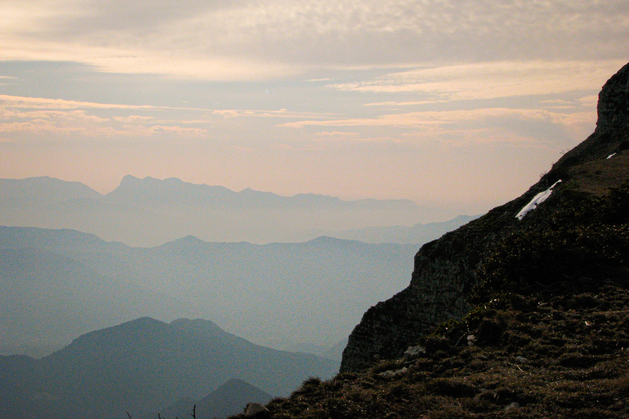
More than a pass, very pleasant to climb, especially from Die, the Col de Rousset (1245 m), also a ski resort, is a climatic barrier. Linking the southern Vercors plateau to the Diois, this pass on P'tites Routes du Soleil ® marks the boundary between the Alpine world and the Mediterranean universe characterized by the first lavender fields. The contrast is all the more striking as you pass from one to the other through a 769-meter tunnel.
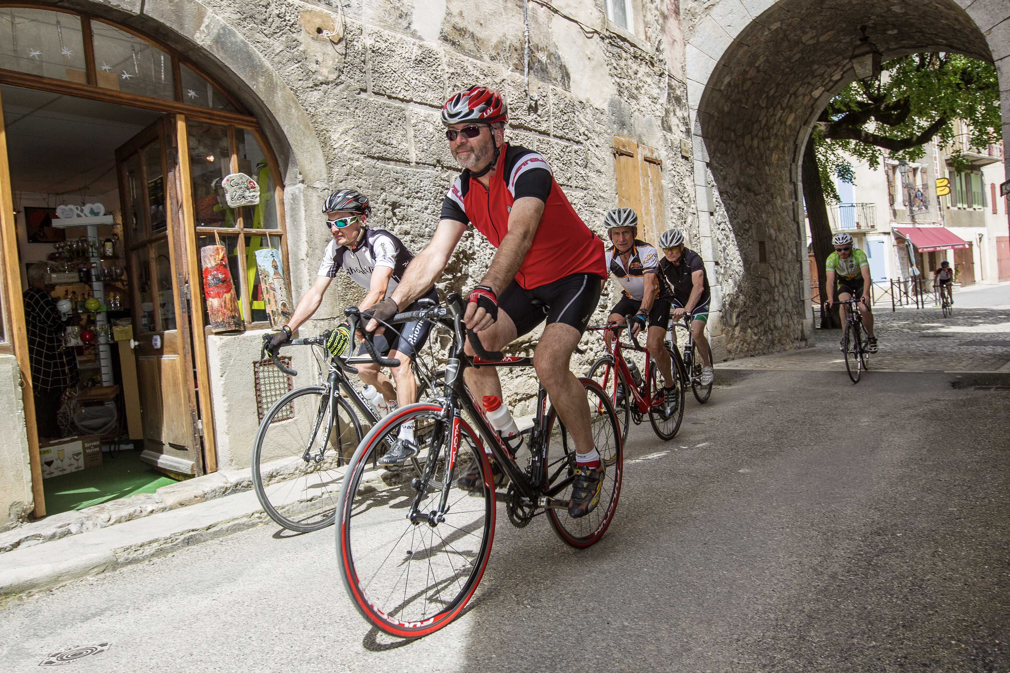
Bicycling up the Col de Rousset from Saint-Agnan-en-Vercors
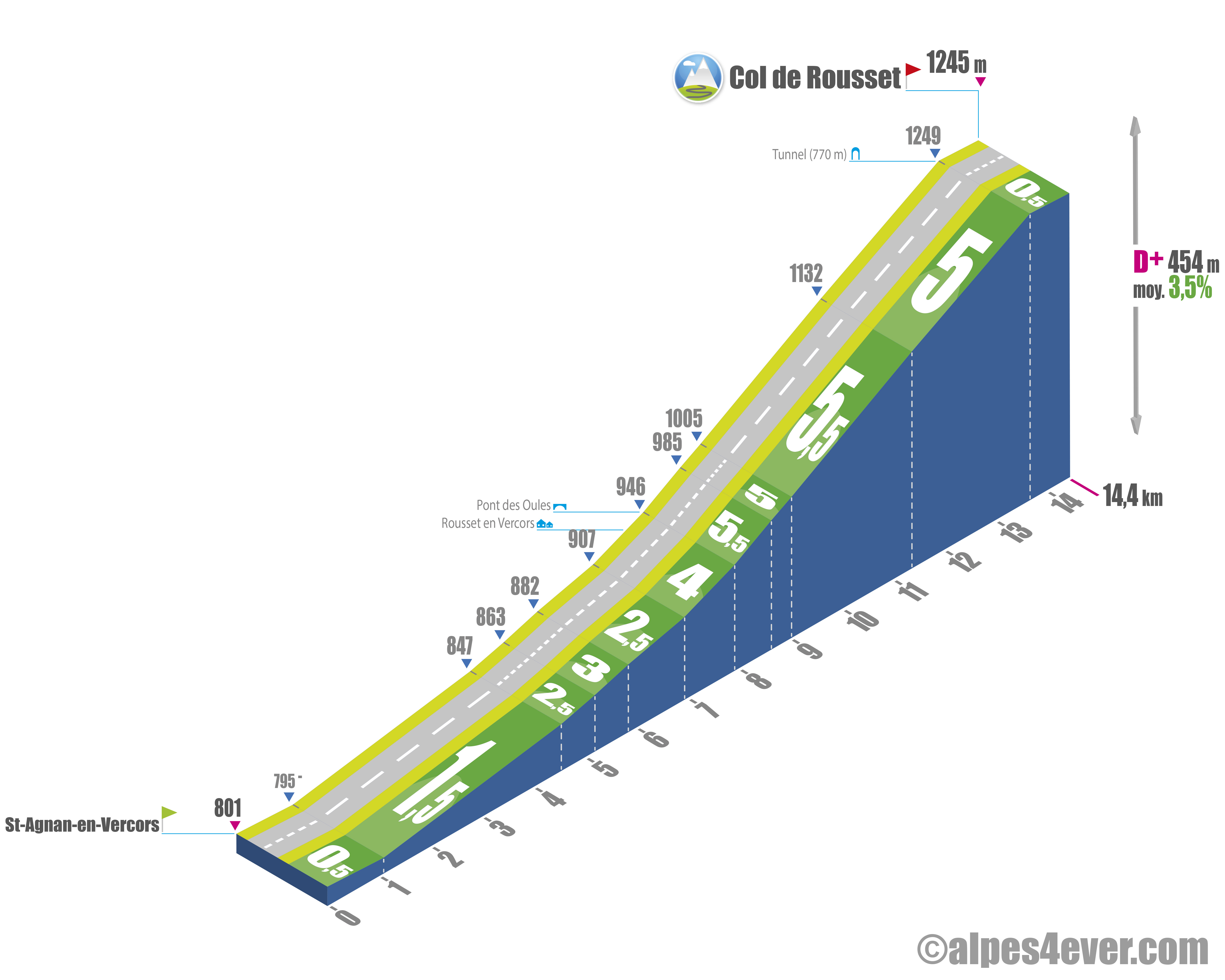
Start: Saint-Agnan-en-Vercors (801 m)
Distance: 14.4 km
Altitude: 1245 m
Derivation: 454 m
Average slope: 3.5%
Maximum gradient: 5.5%
Tour de France rating: category 2
Time to climb (rounded) Col de Rousset by bike from Saint-Agnan-en Vercors
- At 7 km/h: 2 h 05
- At 11 km/h : 1 h 20
- At 15 km/h : 1 h 00
- At 19 km/h : 45'
Course map of the ascent of Col de Rousset by bike from Saint-Agnan-en Vercors
Description of the ascent of the Col de Rousset by bike from Saint-Agnan-en-Vercors
From Saint-Agnan-en-Vercors, the ascent to the Col de Rousset stretches for around 14.4 km, with a positive vertical drop of 454 meters and culminates at 1,245 meters at the summit tunnel.
First part: the Vernaison valley
The first 6.9 kilometers of this climb follow the course of the Vernaison valley. This section, marked by a straight ascending false flat, has a moderate gradient of no more than 3%.
Second section: towards the Col de Rousset
After this warm-up, the climb continues for 7.5 km from the outskirts of the village of Rousset-en-Vercors. The gradient becomes a little steeper, reaching 4% as far as the Pont des Oules. After this, the road twists and turns in two hairpin bends where the gradient is very regular, fluctuating between 5 and 5.5%. This constant profile allows you to maintain a sustained effort all the way to the Col de Rousset station.
Tunnel crossing
To officially reach the Col de Rousset at an altitude of 1,245 meters, you have to pass through a 769-meter-long tunnel. This passage, inaugurated in 1979, replaces an earlier tunnel dating from 1866. For hikers, the natural pass, at 1,367 meters, is accessible via a footpath.
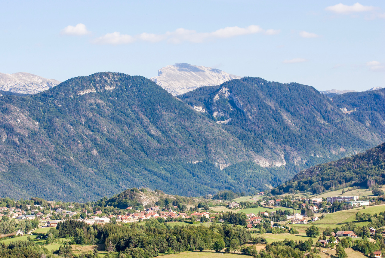
Landscapes and points of interest
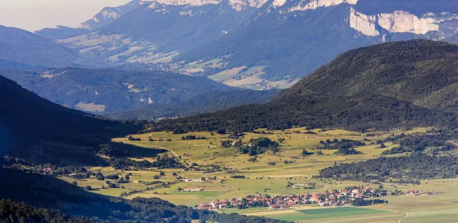
All along the ascent, the road reveals varied panoramas, characteristic of the Vercors massif reliefs. At the tunnel exit, an orientation table offers a breathtaking view of the Diois countryside and surrounding mountain ranges. The Col de Rousset is also a transition point between the northern Alpine and southern climates, revealing a striking contrast between the two sides.
Col de Rousset climb by bike from Die
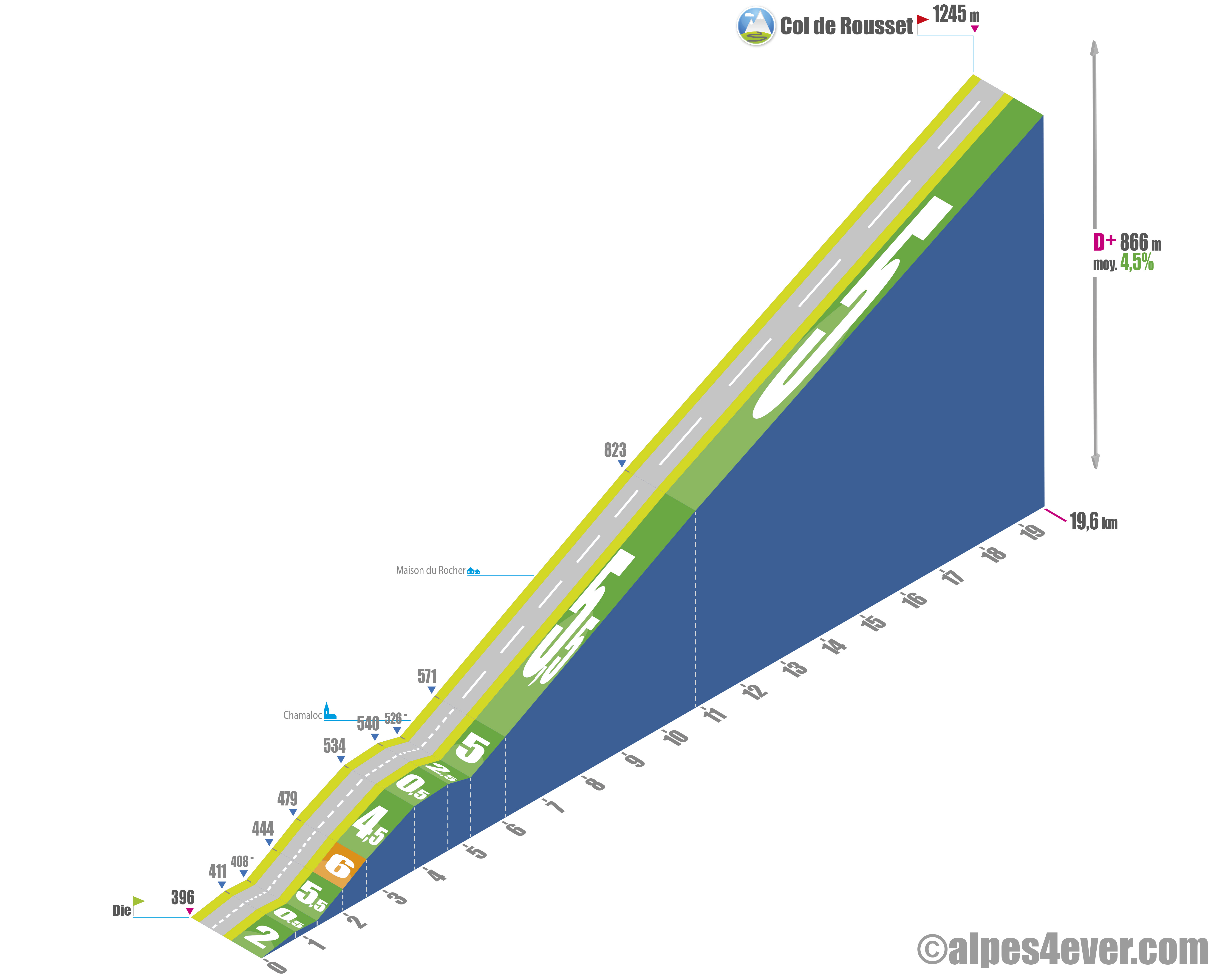
Start: Die (396 m)
Distance: 19.6 km
Altitude: 1245 m
Elevation gain: 866 m
Average gradient: 4.5%
Maximum gradient: 6%
Tour de France rating: category 2
Cycling time up Col de Rousset from Die
- At 7 km/h: 2 hrs 50 mins
- At 11 km/h: 1 hr 45 mins
- At 15 km/h: 1 hr 20 mins
- At 19 km/h: 1 hr 00 mins
Map of the route up Col de Rousset by bike from Die
Description of the Col de Rousset ascent by bike from Die
Starting from Die, a charming town nestled in the Drôme valley, the ascent to the Col de Rousset represents 19.6 km of effort as pleasant as it is affordable. The route offers a positive vertical drop of 866 meters, culminating at an altitude of 1,245 meters at a tunnel that marks the symbolic entrance to the Vercors.
Part 1: Die to Chamaloc
The first 5.5 km of the ascent leads to the village of Chamaloc. This section alternates between flat and steeper slopes, reaching up to 6%, as well as a few downhill sections. These variations make for gentle progress, while offering magnificent views of the Vercors peaks. It's an ideal warm-up before tackling the more demanding sections.
Part Two: en route to the Maison du Rocher
Leaving Chamaloc, the route enters the foothills of the Vercors highlands. This 3.1-km section has a steady gradient of between 5% and 5.5%. The effort remains steady but constant until you reach the Maison du Rocher, an emblematic crossing point before beginning the final section of the climb.
Third section: the winding Rochers de Chironne
The final section of the climb, which stretches over 11 km, is the most spectacular. The road winds through eight hairpin bends, nestled beneath the impressive Rochers de Chironne. The gradient, always steady between 5 and 5.5%, allows you to maintain a comfortable pace. This section offers spectacular panoramas, where imposing rock formations add a touch of grandeur to the sporting challenge.
The Col de Rousset and its tunnel
At an altitude of 1,245 meters, the Col de Rousset stands out for its 769-meter-long tunnel, bored in 1979 to facilitate passage to the Diois region. This modern structure replaces an old tunnel dating back to the 19th century. For hiking enthusiasts, the natural pass, at 1,367 meters, is accessible on foot and offers even more breathtaking views of the region.
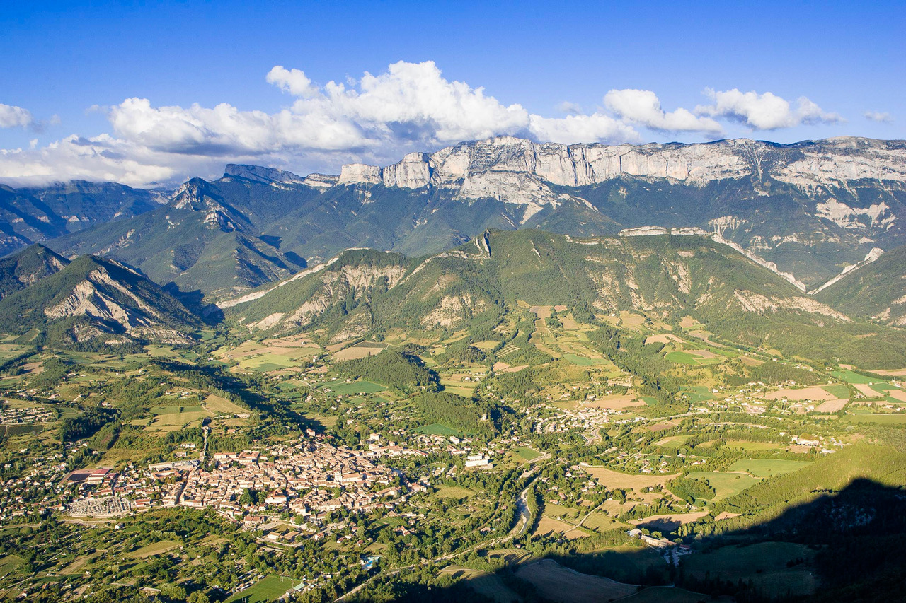
Landscapes and atmospheres
All along the ascent, the diversity of landscapes amazes cyclists. The Col de Rousset also lies at the crossroads of Alpine and Mediterranean climates, a contrast that can be seen in the vegetation and relief on both sides
Tips for preparing the ascent of the Col de Rousset
North or south side, the climb is very accessible, with gradients that rarely exceed 5%. The road surface is in good condition and traffic is generally calm, even in summer. Bring plenty of water, as refreshment points are few and far between along the route, and it can get very hot.
Our advice
On P'tites Routes du Soleil®, the Col de Rousset is the tipping point between the northern and southern Pre-Alps. You can of course undertake the journey solo or with friends, but if you're looking for an organization to go with we recommend two:
- LaRébenne offers the Grande Traversée des Alpes de l'Ouest which you can find here
- Vélorizons invites you on La Grande Traversée des Préalpes, which you can read about here
Weather conditions for Col de Rousset
The Col de Rousset is a medium mountain pass open all year round. It can, however, be closed very temporarily in the event of unexpected problems. Click here for information
To check the weather at the top of the Col de Rousset, you can use the services of Météo France
To find out when to go on P'tites Routes du Soleil ®
Recommended equipment for the Col de Rousset
The Col de Rousset is a mid-mountain pass, no special equipment is required to climb it. It represents well the type of pass you can encounter on P'tites Routes du Soleil®.
Everything you need to know about P'tites Routes du Soleil®
How to equip yourself on P'tites Routes du Soleil®
How to equip yourself on P'tites Routes du Soleil® with an electric bike
.Services near Col de Rousset
Saint-Agnan-en-Vercors is just 30 kilometers from Villard-de-Lans, the "capital" of the Vercors plateau, and close to the Col de Rousset resort. The small town of Die has a population of just under 5,000. So you'll easily find everything you need for accommodation, food, recharging your electric bike and even entertainment.
Access to Col de Rousset
SNCF and bus stations
- Grenoble and Valence TGV stations
- Die TER station
Road access
- D518 from Die and the Vercors plateau.
Those who have done it speak best of it!
The southern slope, from Die, is a nugget! Long and easy with incredible panoramas... What fun! Georges, Toulouse
When you've just crossed the Vercors plateau and come out of the tunnel, you feel like you've changed region and season. The colors, almost the smells, are different. It's a real sensory experience... Michèle, Grenoble
The descent of the Col de Rousset, on the Diois side, is as exhilarating as a ski descent where you trace great curves. The sensations are truly intoxicating. Florent, Annemasse
FAQ
In which natural park is the Col de Rousset located?
The Col de Rousset is in the Vercors Regional Natural Park. Created in 1970, it comprises 83 communes in 8 natural regions: the northern Piedmont, the Quatre-Montagnes, the Coulmes, the Diois, the Vercors Drômois, the Royans, the Trièves and the Gervanne. The Col de Rousset station is also the gateway to the Hauts-Plateaux du Vercors Nature Reserve.
Is the Col de Rousset tunnel open all year round?
The tunnel, and therefore the Col de Rousset, is open all year round, barring any unexpected incidents reported by Inforoutes Drôme.
How many times has the Tour de France crossed the Col de Rousset?
Three times, in 1984, 1996 and 1998.
How to see the ascent of the Col de Rousset (south side)?
Watching this video, produced by the program "Des racines et des ailes"
The map
The map
10 Villard-de-Lans / Die
Other passes near Col de RoussetMontée de Saint-Nizier-du-Moucherotte | The most beautiful passes on P'tites Routes du Soleil®Mont Salève Montée de Saint-Nizier-du-Moucherotte |