
Altitude 1100 m
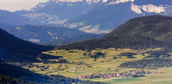
Massif du Vercors
Département Drôme
Topo North slope
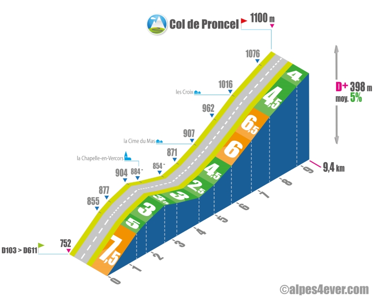
The Col de Proncel - 1100 m - is located in the center of the Vercors Massif. It links La Chapelle-en-Vercors and Vassieux-en-Vercors. The ascent takes place in a tranquil setting surrounded on all sides by the sheer rock faces of the Vercors Massif.
Leaving the D103 for the D611, you'll first have to make a good effort with a 1.4 km ramp at an average gradient of 7.5% to reach La Chapelle-en-Vercors in a more leisurely fashion.
From La Chapelle-en-Vercors onwards, you'll have to make a good effort with a 1.4 km ramp at an average gradient of 7.5%. From La Chapelle-en-Vercors onwards, you think it's going to be easy when the first 1,700 metres consist of a descent followed by an uphill false flat.
The gradient picks up on the approach to the Cime du Mas, with 800 m at 4.5%, then increases to 1.8 km at 6/6.5%.
Then the route continues to undulate on a 4/4.5% gradient all the way to the Col de Proncel at 1100 m.
The map
The map
10 Villard-de-Lans / Die
Author
Joris Lesueur
webmaster of alpes4ever.com
contact@alpes4ever.com