
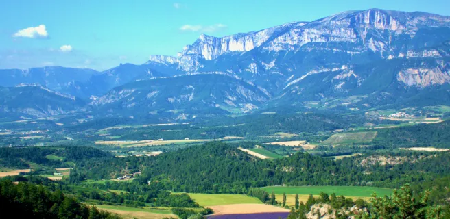
The village amidst the lavender fields
Altitude 1020 m
Massif du Diois
Département Drôme
West slope topo
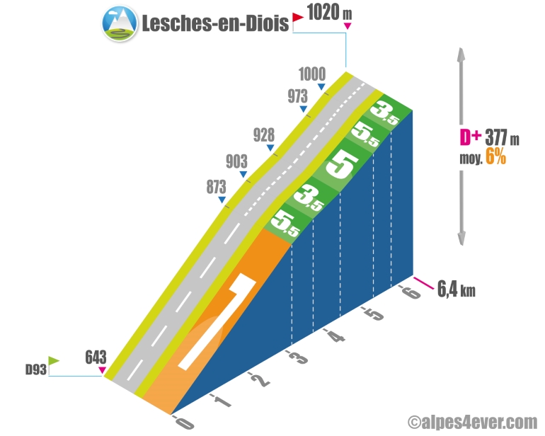
Once again, it's not a pass you'll be climbing, but a climb to the village of Lesches-en-Diois. Situated off the main road on the heights of the Montagne du Puy at 1020 m altitude, the climb up its western side - 6.4 km - will not be easy! In fact, a 3.2 km ramp at an average gradient of 7%, spread over 5 hairpin bends, catches you right from the start. You think you're done, but the gradient won't let you go - between 3.5% and 5.5% - all the way to the village of Lesches-en-Diois, very representative of the region with its country aspect set amid lavender fields.
Topo east side
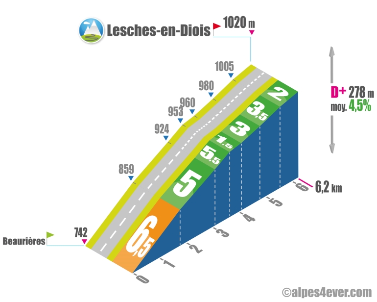
The east side - 6.2 km - is almost the twin of the west side. Here too, a good 1.8 km ramp at 6.5%, spread over ten or so switchbacks, catches you right from the start at Beaurières. The slope continues for the next 1,900 meters, with gradients varying between 5 and 5.5%. A little slack will be offered on the long straight that will guide you to Lesches-en-Diois.
The map
The map
11 Die / Valdrôme
Author
Joris Lesueur
webmaster of alpes4ever.com
contact@alpes4ever.com