
Altitude 1222 m
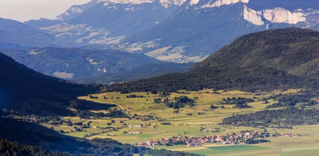
Massif du Vercors
Département Drôme
West slope topo
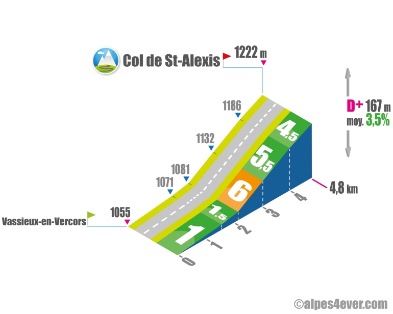
The Col de Saint-Alexis - 1222 m - serves as a link between Vassieux-en-Vercors and the Col de Rousset. This interest alone and an often obstructed view make it an anonymous climb.
The western slope is short and not too difficult, with a maximum gradient of 6% for 885 m.
.
Please note: the descent on the opposite side takes you directly to the Col de Rousset.
The map
The map
10 Villard-de-Lans / Die
Reaching the Diois area via the P’tites Routes du Soleil® promises a complete change of scenery and a southern feel… but before that, time to ride right across the natural fortress of the Vercors. Hostilities begin as you leave Villard-de-Lans and climb the small Col d’Herbouilly (a pass at 1,370m). Further on, the Col de Proncel (at 1,100m) links the villages of La Chapelle-en-Vercors and Vassieux-en-Vercors. After Vassieux, the Col de St-Alexis (1,222m) allows you to carry on to the Col de Rousset (1,245m). As to the Tunnel du Rousset, 769m in length, note that it requires lights to cycle through it. As you descend off the Vercors Plateau towards Die, the contrast is extraordinary. Before long, you’ll spot your first lavender fields, a foretaste of Provence. For a challenging, interesting alternative to the Col du Rousset as a way down from the Vercors Plateau, opt for the Col de la Bataille (1,313m), then descend towards Die via the Gervanne Valley and the Col de la Croix.
Author
Joris Lesueur
webmaster of alpes4ever.com
contact@alpes4ever.com