
Just above Grenoble
Altitude 1159 m
Massif du Vercors
Département Haute-Savoie
Topo versant Est
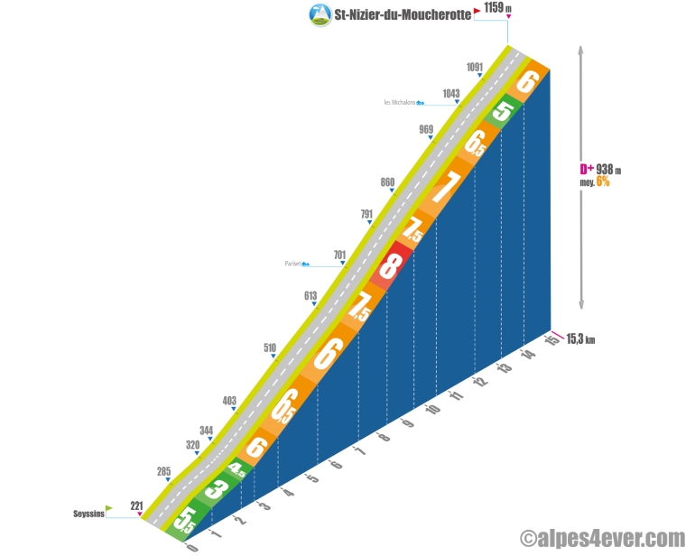
For this first ascent in the Massif du Vercors, it's not a pass but a small commune called St-Nizier-du-Moucherotte that will be the final destination at 1139 m altitude.
Starting from Seyssins near Grenoble, the climb will be a long one at 15.3 km, and despite its modest altitude, will offer a nice positive vertical drop of 938 m at 6% average. However, the gradient is fairly even, and the most difficult section will not exceed 8% for 1125 m.
The actual start is at the traffic circle near Parc Lesdiguières. Take the D106B to climb the first 1,200 m ramp at 5.5%, which will take you gradually out of an urban environment and to an intersection where you can choose between the D106A and D106B, following the latter. After 4.4 km, the gradient rises from 3.5% to 6.5%.
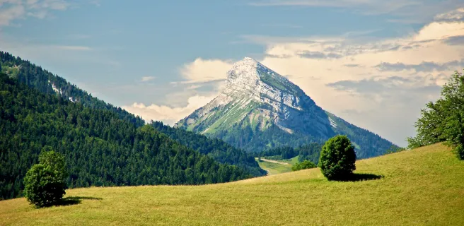
This first section offers fine views of the Grenoble conurbation, the Chartreuse and Belledonne Massifs and a number of peaks in the Vercors Massif, such as Moucherotte (1901 m) and, above all, the spectacular Trois Pucelles, which you pass close by.
From Bel-Air (alt. 510 m), follow the D106 to St-Nizier-du-Moucherotte, crossing the first natural barrier marked by the extension between Moucherotte and Trois Pucelles. Count on 9.7 km on a steady slope averaging 6.5%, with the most difficult part of the climb - 1125 m at 8% - just after the Pariset. At St-Nizier-du-Moucherotte (alt. 1159 m), you're finally in the heart of the Vercors Massif.
The map
The map
8 Saint-Pierre-d'Entremont / Grenoble
Author
Joris Lesueur
webmaster of alpes4ever.com
contact@alpes4ever.com