
Altitude 886 m
Massif des Préalpes de Digne
Département Alpes-de-Haute-Provence
Topo North side
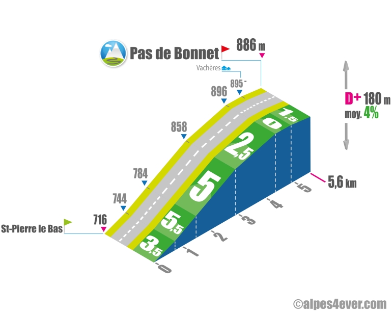
The Pas de Bonnet, at an altitude of 886 m and with a gradient not exceeding 5.5%, offers a short and very pleasant ascent.
Topo south side
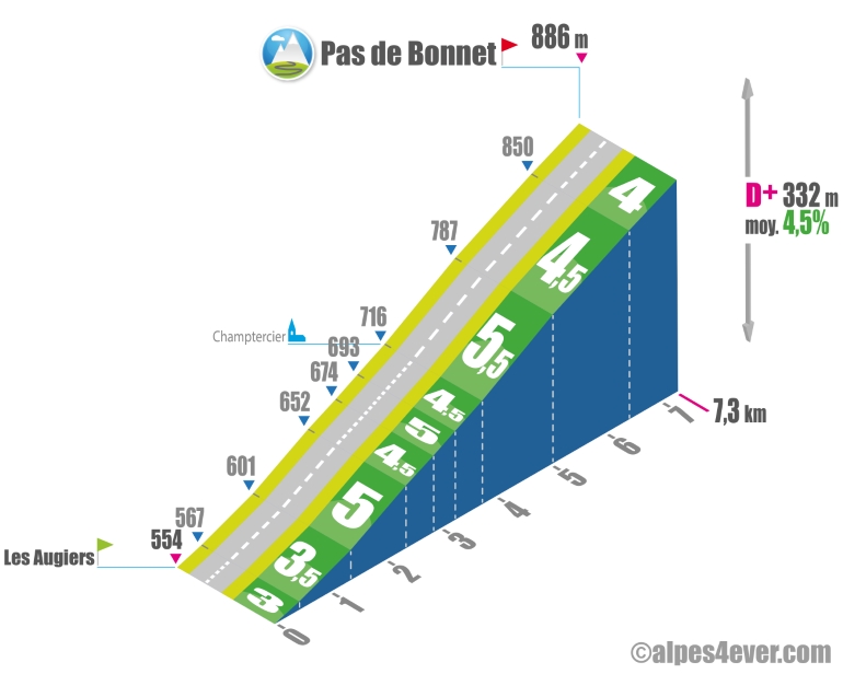
Long at 7.3 km, the ascent to Pas de Bonnet shouldn't pose too many difficulties, with only one section averaging no more than 5.5% over 1.3 km. The first part up to Champtercier will be fairly urban, you'll find tranquility and anonymity in the second part in a rural setting.
The map
The map
16 Sisteron / Digne-les-Bains
From Sisteron, embark on one of the longest climbs along the whole P’tites Routes du Soleil® cycle route. Why not use it as an excuse to go and visit the animal park at Saint-Geniez or to stop for a bite there or in Authon. After riding along close to the Monges Range and crossing the Col de Font-Belle (a pass at 1,304m), you’ll discover the Duyes Valley. Enjoy the lovely views both from the Col d’Hysope (1,236m), which you come to on a descent, and all along the road leading down to Thoard and then Digne-les-Bains. Note that there is a short but quite lovely climb to the Pas de Bonnet (886m) a short distance before arriving at the town of Digne.
Author
Joris Lesueur
webmaster of alpes4ever.com
contact@alpes4ever.com