On the Route des Grandes Alpes®, there are many ways to plot your route and plan your itinerary.
The variants, while sometimes allowing you to bypass certain passes that are impassable at the start of the season, are above all an opportunity to discover new territories and new landscapes. Route des Grandes Alpes® offers you six of them, some with interesting extensions. The variants are Route des Grandes Alpes® in augmented reality: follow us, from north to south...

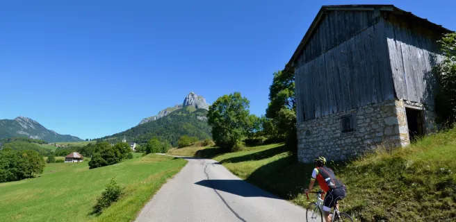
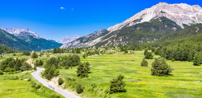
Variant no. 1: Le Grand-Bornand - Annecy - Lescheraines - Albertville - Beaufort-sur-Doron
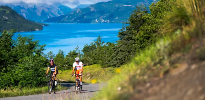
This is the Route des Grandes Alpes® variant of Annecy and its lake! A pure wonder. This almost 130 km route takes you from the Aravis massif to the Bauges massif (UNESCO World Geopark), then on to the Beaufortain, via the Olympic city of Albertville. Three small passes are on the program: Col de Bluffy (630 m), Col de Leschaux (897 m) and Col du Frêne (950 m). To these can be added a very small variant via the Col des Cyclotouristes (1330 m), which avoids the main road between Albertville and Beaufort-sur-Doron.
A possible extension: the ascent of the Col des Bluffy.
A possible extension: the ascent of the Semnoz (1699 m), from Annecy or the Col de Leschaux.

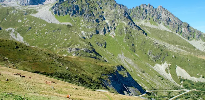
Alternative 2: Bourg-Saint-Maurice - Moutiers - La Léchère-les-Bains - Saint-François-Longchamps - Saint-Jean-de-Maurienne - Saint-Michel-de-Maurienne - Valloire
A route of just over 130 km on the Route des Grandes Alpes®, with two very serious cols on the menu. Col de la Madeleine (1993 m), between the Tarentaise and Maurienne valleys. Col du Télégraphe (1566 m), above Saint-Michel-de-Maurienne and just a few kilometers from Valloire, the first step on the road to Galibier!
For those with strong calves, ready to do anything to add to their record of achievements, we recommend extending from Moutiers to the Col de la Loze (2304 m). This high-altitude green route, between Méribel and Courchevel, was one of the most spectacular finishes of the 2020 Tour de France.

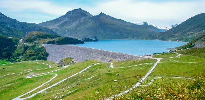
Variant no. 3: Val-Cenis - Oulx - Névache - Briançon
The Italian variant of Route des Grandes Alpes® is just 108 km long. Two passes on the program: the Col du Mont-Cenis (2081 m) and, innovatively, the Col de l'Échelle (1762 m). On the menu: magnificent panoramas, the Lac du Mont-Cenis and its Pyramide museum to discover the history of the pass, the fortresses of Ronce and Exilles, the charming little towns of the Val de Suze, Italian mountain charcuterie, pasta, cappuccino and more. And don't forget to discover the Clarée valley and Briançon, a "Ville d'Art et d'Histoire" on UNESCO's World Heritage list, for its Vauban fortress.

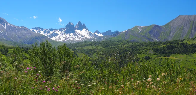
Variant no. 4: Val-Cenis - Saint-Michel-de-Maurienne - Saint-Jean-d'Arves - Bourg-d'Oisans - L'Alpe d'Huez - La Grave - Briançon
199 km of fun! Route des Grandes Alpes® takes you down the Maurienne, then up to Saint-Jean-d'Arves, before climbing the Col de la Croix de Fer (2064 m). One more glance at the emblematic silhouette of the Aiguilles d'Arves and you're on your way down to Bourg-d'Oisans, via the Grand'Maison and Verney dams. Watch out, it's (almost) only just begun! Soon, 21 twists and turns that have gone down in Tour de France legend will take you to l'Alpe d'Huez (1860 m). Passing through this major resort, then over the Col de Sarenne (1999 m), you'll avoid the dangerous and tricky stretch of road (numerous tunnels) between Bourg-d'Oisans and Lac du Chambon. Then there's the Col du Lautaret (2057 m), where the wide Guisane valley road takes you all the way to Briançon, passing through the villages of Serre-Chevalier.
.
Variant no. 5: Guillestre - Embrun - Barcelonnette
75 km to see Lac de Serre-Ponçon! A swim if you wish, as there are plenty of beaches to choose from! To complete the menu: the pretty town of Embrun, famous for its "XXL" triathlon, the strange geology of the Demoiselles coiffées, the dam... To add a little elevation gain to this pleasant stage, you can "cut the cheese" from the pretty village of Pontis, a few kilometers from Savines-le-Lac, to Église-d'Ubaye, almost at the end of Lac de Serre-Ponçon.

Variant no. 6: Barcelonnette - Saint-Étienne-de-Tinée - Saint-Martin-Vésubie
A 113 km variant of the Route des Grandes Alpes®. Through the Mercantour National Park and close to the Italian border, it links the Ubaye, Tinée and Vésubie valleys. On the program: the legendary Cime de la Bonette (2802). It's short, it's high, it's steep... and it doesn't have to be, because the Col de la Bonette (2715 m) is all you need to switch to the Tinée valley and its beautiful villages. All that remains is to climb the Col Saint-Martin (1503 m), or Colmiane, named after the small ski resort where it is located, before reaching Saint-Martin-Vésubie.
.The map
The map
5 Alternative section Le Grand-Bornand / Lescheraines
6 Variante Lescheraines / Beaufort-sur-Doron
9 Alternative stage Bourg-Saint-Maurice / Saint-François-Longchamp
10 Alternative stage Saint-François-Longchamp / Valloire
13 Alternative section Val-Cenis / Oulx
14 Variante Oulx / Briançon
16 Alternative stage Val-Cenis / Saint-Jean-d'Arves
17 Alternative stage Saint-Jean-d'Arves / L'Alpe d'Huez
18 Variante L'Alpe d'Huez / Briançon