arrow_back
Les Ferres / Nice P'tites Routes du Soleil
63,94 Km
4 h 15 min
Medium
63,94 km cycling route from Les Ferres to Nice
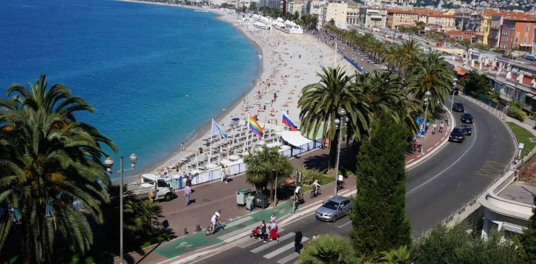
From the Col des Ferres (a pass at 596m), the P’tites Routes du Soleil® leads you over to the south side of Le Cheiron Mountain. The high-perched road offers far-reaching open views over the Var Valley and the Nice urban area. You’ve almost made it, the Mediterranean in the background calling out to you! Once you’ve negotiated the climb towards the Oratoire Saint-Marc (1,016m), near Coursegoules, the descent towards the sea via the Col de Vence (a pass at 963m) goes swiftly. Now, you’re reaching the end of the route, riding along the coast up to Nice’s famed Promenade des Anglais, at the end of the P’tites Routes du Soleil.
Elevation of the stage
1618 m m
Waytypes of the stage
Cycle path: 11,99 km By road: 51,95 km
Surface of the stage
Smooth: 63,60 km Unknown: 0,34 km
↗ 595 m ↘ 1221 m
Don't miss:
- Nice: the Baie des Anges, Nice’s famous bay; the Promenade des Anglais, Nice’s famous exceptionally long and broad pedestrian promenade; plus a thousand and one other attractions. Nice hardly needs introducing as the cultural, artistic, economic capital of the Côte d’Azur, as well as a major tourist and student city…
- Le Train des Pignes: for over 100 years, the Chemins de Fer de Provence has linked the southern French Alps to the Mediterranean. Bikes are accepted on board.
- Vence and Saint-Paul de Vence: neighbouring town and village, both known far and wide as highly picturesque, artistic haunts, neither to be missed.
- Coursegoules: a very beautiful, architecturally harmonious village at the foot of Le Cheiron mountain range. Most of the houses date back to medieval times and were built in regional grey stone with tinges of other colours and topped with Roman tiles.
Accommodation on the stage
Cycling route ideas on the stage

Did you like this?
You may also be interested in this...


Travellers’ reviews