arrow_back
Saint-Auban / Les Ferres P'tites Routes du Soleil
50,31 Km
5 h 45 min
Medium
50,31 km cycling route from Saint-Auban to Les Ferres
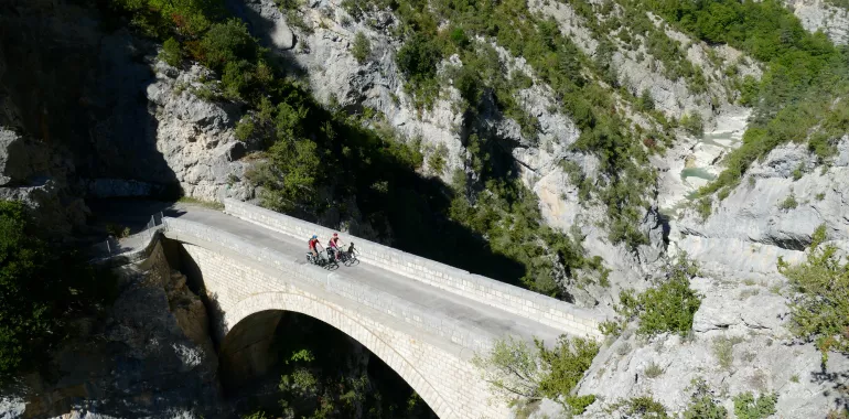
The P’tites Routes du Soleil® here makes use of the Tour des Préalpes d’Azur cycle route, crossing the regional natural park carrying the same name. You follow the Estéron River along this stretch, with its vertiginous canyons and turquoise waters. Along the way, you’ll pass by Provençal villages set against rockfaces all bathed in southern light. Much of this stage consists of descents heading south. The route leads you gently and safely to the Var’s natural balconies looking down towards the Mediterranean, your ultimate destination. Note that the Col de Pinpinier (1,136m) is one of the easiest passes over 1,000m to tackle along the whole P’tites Routes du Soleil cycle route!
Elevation of the stage
1726 m 1315 m
Waytypes of the stage
By road: 50,31 km
Surface of the stage
Smooth: 50,31 km
↗ 1062 m ↘ 1493 m
Don't miss:
- Aiglun: a perched village in the Estéron Valley, in the Haut-pays Grassois area. It’s Clue, a narrow, twisting canyon, is a little natural gem. It’s great fun to go canyoning down the Estéron River here. After all the physical effort, the Auberge de Calendal, an inn designated a Bistrot de Pays, offers a warm and friendly atmosphere in which to taste local produce.
- The Route des Clues: leading you via perched villages and steep little canyons, this road takes you through the heart of Provence’s limestone mountains around the Upper Estéron Valley. The way sticks to quiet, unspoilt county roads little used by traffic. The route is exceptionally rich in terms of natural and cultural heritage.
- Parc Naturel Régional des Préalpes d’Azur: located within the département, or French county, of Alpes-Maritimes and the Préalpes de Grasse, this area serves both as the natural water tower of the Côte d’Azur and as one of the largest zones for grazing in the county.

Travellers’ reviews