
Altitude 1120 m
Massif des Préalpes de Castellane
Département Alpes-Maritimes
Topo North side
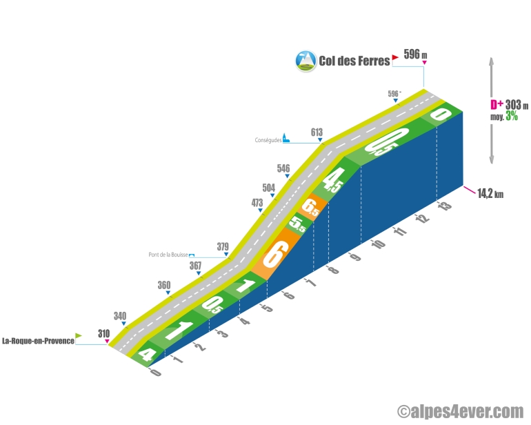
The Col des Ferres will take you well below 1000 m in altitude at 596 m. At this stage of the journey, it will be a mere formality for this ascent, which is admittedly 14.2 km long, but only features a slightly sustained 4.2 km passage with its 6% gradient. This will take you to Conségudes, beautifully set against Mont Saint-Paul, which even marks the highest point of the climb at 613 m altitude. It's a very easy finish!
The map
The map
20 Saint-Auban / Les Ferres
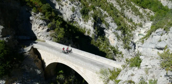
The P’tites Routes du Soleil® here makes use of the Tour des Préalpes d’Azur cycle route, crossing the regional natural park carrying the same name. You follow the Estéron River along this stretch, with its vertiginous canyons and turquoise waters. Along the way, you’ll pass by Provençal villages set against rockfaces all bathed in southern light. Much of this stage consists of descents heading south. The route leads you gently and safely to the Var’s natural balconies looking down towards the Mediterranean, your ultimate destination. Note that the Col de Pinpinier (1,136m) is one of the easiest passes over 1,000m to tackle along the whole P’tites Routes du Soleil cycle route!
Author
Joris Lesueur
webmaster of alpes4ever.com
contact@alpes4ever.com