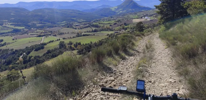
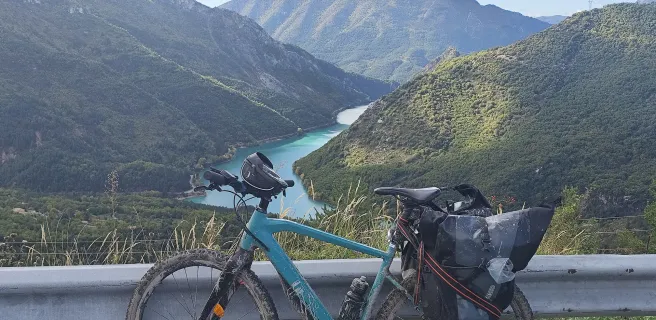
P'tites Routes du Soleil Gravel
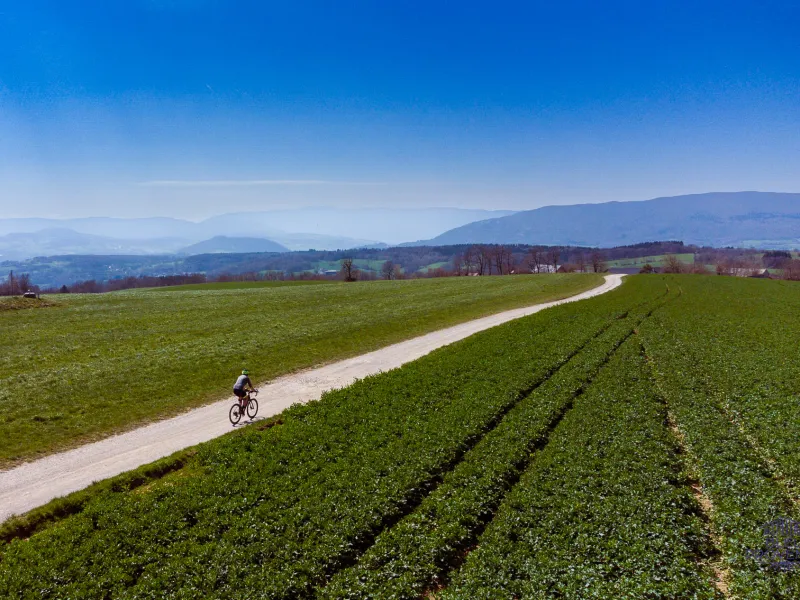
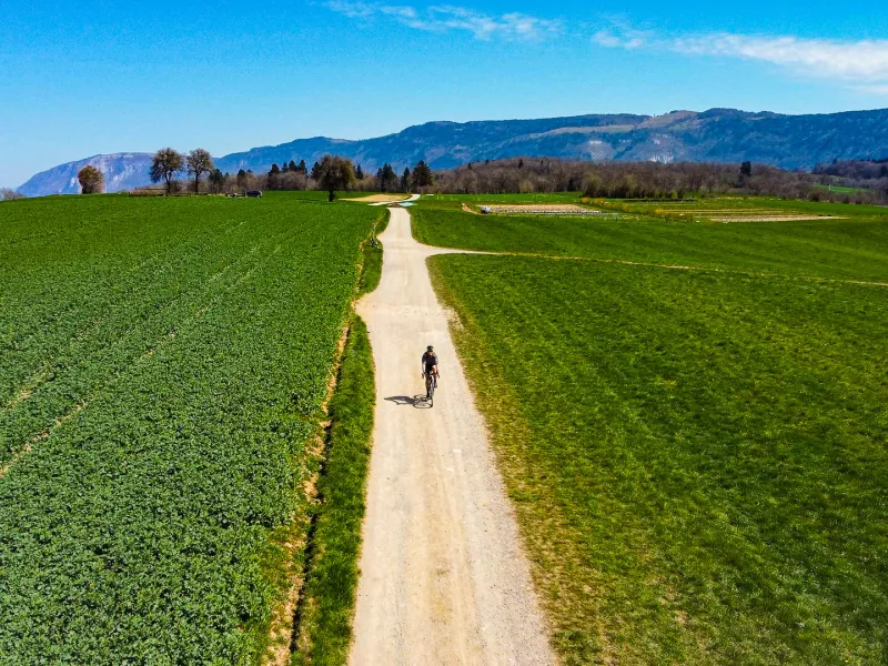
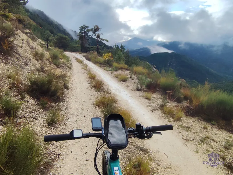
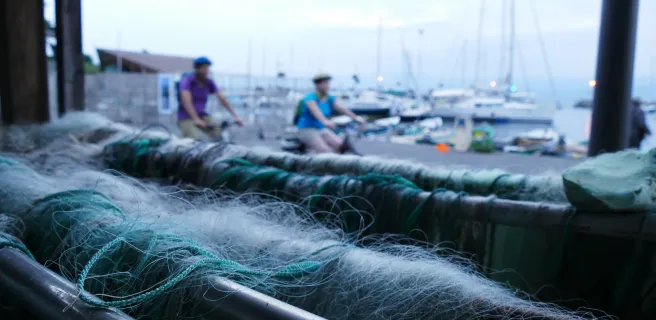
Like P'tites Routes du Soleil® in road bike mode, P'tites Routes du Soleil® Gravel links Thonon-les-Bains (Haute-Savoie) to Nice (Alpes Maritimes), crossing the Alps. With just over 17,500 meters of positive vertical drop on almost 845 kilometers of variously surfaced trails, it's a little more challenging than its road counterpart. Through the Chablais, Monts de Genève, Avant-Pays Savoyard, Chartreuse, Vercors, Diois, Buëch, Monges, Préalpes de Digne, Verdon, Haut-Var, Haut-Pays Niçois, P'tites Routes du Soleil® Gravel takes you along quiet roads to wild landscapes, authentic villages and lost passes. The electrically-assisted bike makes this unique outdoor experience affordable for everyone.
Gradients and elevation
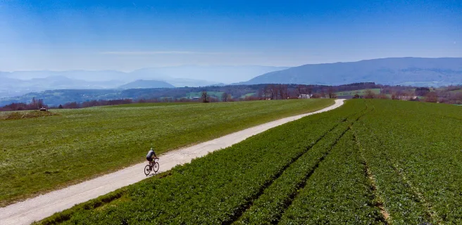
Road types
Surface
Which way to ride P'tites Routes du Soleil® Gravel?
In Gravel, not all climbs and descents are interchangeable. This route has been designed to run north-south. We recommend that you ride it on the Thonon-les-Bains - Nice axis.
How many days?
We've divided the route into 15 sections, ranging from 43 to 67 kilometers (56 km on average). Minimum/maximum positive altitude differences range from 496 to 1,743 meters. Ideally, you should have 10 to 15 days to complete the route in the best possible conditions and discover all its secrets.
When to set off?
The highest sections of P'tites Routes du Soleil® Gravel are at over 1500m altitude at Herbouilly or on the Cheiron. There's also the Mont-Salève (1335 m), the Col Saint-Barnabé (1365 m), and the Gréolières resort at 1400 m altitude. The route can therefore be taken from spring to late autumn. As long as you check beforehand that the snow won't make it impassable in certain places, and that there's enough accommodation open.
Difficulty
P'tites Routes du Soleil® Gravel is an itinerary that we class as "Difficult".
This "Difficult" classification, necessarily subjective, is justified:
- By the length and altitude difference of the route.
- By the presence of some technical passages close to mountain biking.
It is of course possible to reduce the difficulty by using an electric Gravel bike or an electric VTC and avoiding certain portions like the Cheiron passage in the Alpes Maritimes.
Don't hesitate to try out a small part of the route, rather than taking on the whole thing!
Easier, thanks to the VAE!
Gravel bikes are available in electric versions, which will make life easier, or allow you to bring friends of different levels on board for the adventure. The P'tites Routes du Soleil ® Gravel itinerary we propose has been designed so that you'll always find charging stations (see maps for each stage).
Together, let's map out the best itinerary possible
P'tites Routes du Soleil® Gravel is an itinerary that can be perfected. By reporting your experience, you'll help us improve it and map out variants. Tell us about your trip
About Gravel and road safety
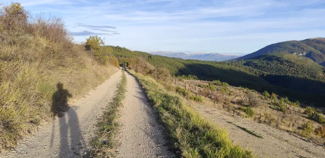
Between road and mountain biking, Gravel is a specific activity in terms of the routes taken, equipment and gear, preparation and organization. The uniqueness of the experience lies in the wilder areas covered. Away from the roads too busy with cars and motorcycles, Gravel offers a different approach to the natural and cultural heritage of the Alps. To find out more about the practical aspects and new Alpine horizons of the Gravel: https://www.routedesgrandesalpes.com/le-gravel-c-est-quoi
Reviews for P'tites Routes du Soleil Gravel
"Accueil Vélo" accommodation on P'tites Routes du Soleil Gravel
39 Accueil Vélo accommodations await you on P'tites Routes du Soleil Gravel!
View accommodations on the map
The 15 stages of P'tites Routes du Soleil Gravel
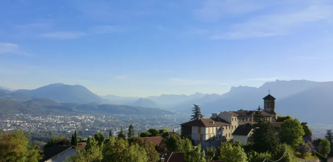
1 Thonon-les-Bains / Annemasse
You then leave the shores of Lake Geneva and head out of town towards the Col du Feu (1120 m), the first obstacle on the route. Up to the pass, the route is shared with the Route des Grandes Alpes® Gravel. The ascent of the Col du Feu, where the Tour de France 2023 passed through, is fairly short but rather tough. Including the final section on the road, where you'll find a 10% gradient. Beautiful panoramic views of Lake Geneva and the Chablais massif at the summit.
From the pass, pleasant paths wind through a green, perched valley to the Col des Moïses aerodrome (1121 m), reserved for gliders. The Menoge, which you'll be following, rises in nearby marshland. At first, you drive a little away from its right bank on a forest track. After passing Habère-Poche, you rejoin the stream at Habère-Lullin. The trail is well laid out and very pleasant. There are many changes of direction which slow down progress. Those in a hurry can take the road.
The banks of the Menoge lead to Boëge, then Bonne. At the crossroads with the D1205, you're very close to Vétraz-Monthoux and the Annemasse conurbation, where you'll find accommodation to suit all tastes and budgets. To continue towards the Salève, pass under the freeway at Arthaz-Pont-Notre-Dame.
2 Annemasse / Seyssel
After the cable car, the gradients become more reasonable, sometimes easy. You pass successively the Col de Grande-Gorge (1286 m) and the Col de la Croisette (1176 m) before reaching the Col des Pitons (1335 m), the end of the ascent. From here, you can take a few steps up to the true summit of the Salève (1379 m). From the Tour des Pitons, you'll enjoy a unique panorama of Geneva, the Jura and Lake Geneva...
On the Salève plateau, leave the road on your right to recover the view by taking a path with stony passages. It's a bit mountain-biking, but it goes well.
You'll then glide towards Mont Sion and Saint-Blaise on a network of pleasant undergrowth roads. Finally, you come out into a more open landscape. The descent is then on white gravel tracks: a gravel rider's paradise!
After rejoining the Chemin de Compostelle, you continue towards Frangy via Minzier and Chaumont. Small, undulating country roads then lead to Seyssel, a pretty town on the banks of the Rhône and on the ViaRhôna. Here you'll find a campsite, adapted accommodation and all the shops you need.
3 Seyssel / Saint-Jean-de-Chevelu
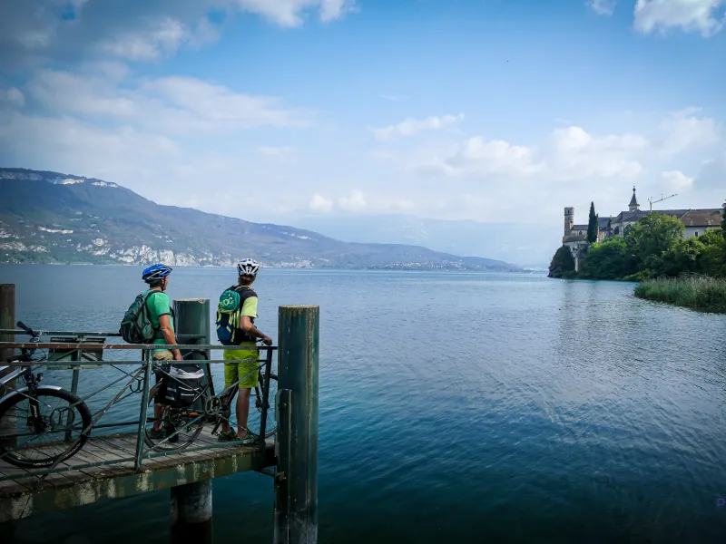
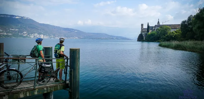
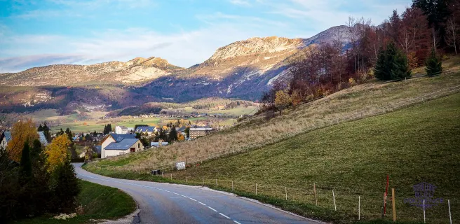
Between Seyssel and Chanaz, first take the ViaRhôna, then leave it to reach Lac du Bourget, crossing the Chautagne plain, a protected wetland and natural area. From Chanaz, the road gradually diverges from the Rhône and ViaRhôna to reach Jongieux. This is the route of the Chemins du Soleil, the great mountain bike crossing of the Pre-Alps. The route leaves Jongieux, amidst vineyards and on the slopes of Mont du Chat, and descends to St Jean-de-Chevelu. Here we enter the Savoyard Avant-Pays, once known as the Savoyard Petit-Bugey.
It's a great day for sightseeing, because after Lac du Bourget and Chanaz, Jongieux, on the Compostelle trail and self-defined as an oenocyclo-tourist village, is well worth an extended stop.
4 Saint-Jean-de-Chevelu / Aiguebelette-le-Lac
After heading south on the outskirts of Yenne, you begin the ascent of the northern slope of Mont Tournier (851 m). Its modest altitude conceals a not-so-easy ascent: almost 600 m of positive ascent spread over 10.5 km at an average gradient of 6%.
The climb is divided into two sections. The first (7.8 km) is on the slopes of Mont Tournier, at an average gradient of 6%. The open landscape offers breathtaking views of Mont du Chat and Montagne de l'Épine. The second part, 2.7 km long, starts at L'Abully, when you leave the D40 to take the D42, which climbs to the summit of Mont Tournier. You're now in the forest, on slopes of between 7.5% and 8.5%. The last kilometer, at 3.5%, brings this ascent to a gentle close.
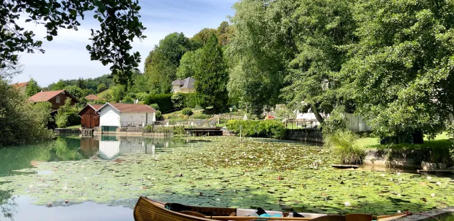
The descent and the rest of the way to Saint-Maurice-de-Rotherens are on pleasant, rolling forest paths. The route then passes through Novalaise, before joining the shores of Lac d'Aiguebelette, near the A43 exit. Finally, it runs along the eastern shore of the lake, on a gravel surface dedicated to bicycles. End of section at Aiguebelette-le-Lac station.
5 Aiguebelette-le-Lac / Grenoble
After passing through Attignat-Oncin, a rural, forested commune, you join the D921, which is a little busier as far as Les Échelles and Entre-Deux-Guiers. Here, you leave the P'tites Routes du Soleil® by road, which leads to Saint-Pierre-d'Entremont via the Col de Couz (626 m) and the Col des Égaux (958 m). This is an option that the more athletic and/or motivated can take to reach the heart of the Chartreuse massif. Instead, you can take the Via Chartreuse, linking Saint-Christophe-la-Grotte to Saint-Joseph-de-Rivière: a 17 km greenway, mainly made up of white paths, with numerous stops (natural areas, heritage, tastes) to discover the area.
From Saint-Joseph-de-Rivière to Voreppe and Grenoble, a dozen kilometers remain via the Col de la Placette (587 m). Not a very nasty climb, but on a fairly busy road. In Voreppe, join the pleasant cycle path along the banks of the Isère, where it's easy going. You can then return to Grenoble and your accommodation, unless you've decided to tackle the Vercors climb from Seyssinet-Pariset.
6 Grenoble / Herbouilly
Alternatively, you can make the ascent by road from Seyssinet-Pariset. This tough climb is renowned for its superb panoramic views over the Grenoble area and the Belledonne mountain range. And if you want to skip the long climb up to the Vercors plateau, you can take the T64 and T65 buses, equipped with bike racks, from Grenoble bus station.
After Saint-Nizier-du-Moucherotte (1168 m), site of the former springboard for the Grenoble Olympics and the highest point of the climb from Grenoble, take the ViaVercors for around 25 kilometers to Corrençon-en-Vercors, via Lans-en-Vercors and Villard-de-Lans. What a surprise! The route is fun, especially in the first part, with curves, slope breaks and mostly gravel surfaces.
After Corrençon-en-Vercors, descend along forest roads to the D221, which comes from the Col d'Herbouilly. Then reach the Auberge-Refuge de Roybon, 500 m from the Herbouilly Nordic area, where you can spend the night in the forest.
7 Herbouilly / Die
From the Auberge-Refuge de Roybon, in Herbouilly, descend to the hamlet of Tourtre on a fairly technical forest track, then join La-Chapelle-en-Vercors on pleasant forest paths (2 or 3 pushes in the sand pits in case of rain), some of which are used by sled dogs in winter. From La-Chapelle-en-Vercors, continue to Vassieux-en-Vercors via the hamlet of Fouletier. From the village center, head towards the Col de Rousset, passing the Château-Loup gîte and the Raphaël Poirée biathlon stadium.
Cross the Col de St-Alexis (1222 m) to reach the Col de Rousset (1245 m). The 769 m-long Rousset tunnel requires a little lighting.
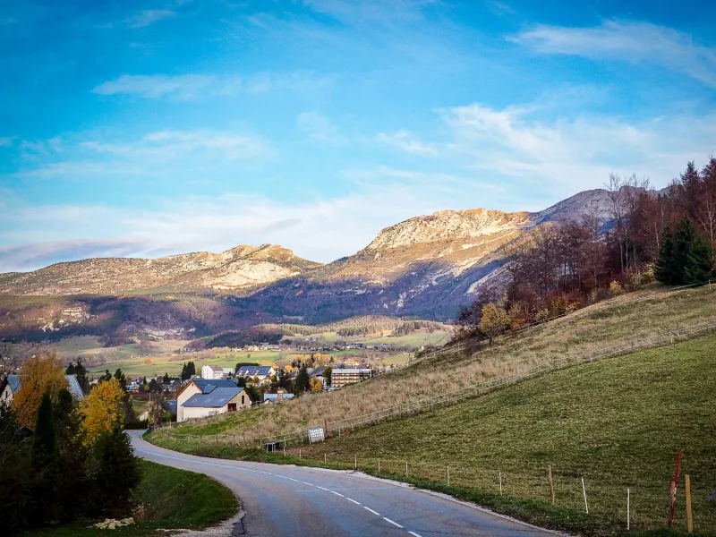
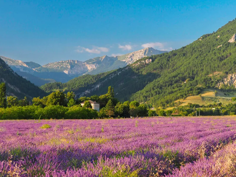
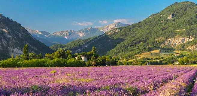
The Col de Rousset (1245 m) is a beautiful descent into the Diois region. When you switch to the Die side, the contrast is striking. You come across your first lavender fields, a foretaste of Provence. A final steep climb past Chamaloc to the Col de Romeyer before dropping down to the Diois capital.
8 Die / Valdrôme
We leave Die and cross the Diois, heading for the Buëch, on wide, rolling forest tracks. Lavender fields, vineyards, Scots pines... the landscape changes. You're in the southern Pre-Alps, and the atmosphere becomes Provençal.
From Die, reach Aix-en-Diois on the left bank of the Drôme. Cross over to the right bank and follow the Drôme meander as far as Saint-Roman. Near Menglon, you turn away from the river to begin the ascent of the Col du Pinet (1199 m) on a nice, rolling forest track.
At Miscon, head for the Drôme, which you reach at Pic de Luc (1085 m), south of Luc-en-Diois. You then cross the Claps de la Drôme, a spectacular rocky chaos, to progress along the left bank through a series of perched valleys via Beaumont-en-Diois and Charens to Valdrôme, at the end of this stage.
9 Valdrôme / Lagrand
From the gîte, you're in the northern part of the Baronnies Provençales regional nature park, and you'll reach the Oule valley at Montmorin via an old road, now accessible to hikers. Beware of a ten-metre-high climb! Large needle-shaped cliffs with views over the entire Oule valley.
From Montmorin, you then begin the fairly serious ascent to the Col des Tourettes (1126 m) between the Montagnes de Maraysse and Chauvet. From the pass, descend towards Ribeyret, on the road between Gap and Nyons. From Ribeyret, take the Chemins du Soleil mountain bike route to Montjay via the Col de Roure (1198 m) and the Col de Serre Larobe (1014 m). Quiet climbs in a charming setting, between photovoltaic installations and lavender fields.
From the Col de Serre Larobe, follow the balcony trail through forests and lavender fields. It leads to the two main difficulties of the day: the descent of the gorges d'Aumage and their ascent, where pushing is necessary. From Montjay, follow the valley of the Blaisance, a tributary of the Buëch. You pass Chanousse, perched on a spur overlooking the valley, and then reach Trescléoux, a village of old walls and pink tiles, steeped in sunshine and history. On the way to Lagrand, "Petite cité de caractère", with its superb panoramic views over the Buëch valley, we stop off at the Gite du Mont-Garde, which has been awarded the "Accueil Vélo" label.
10 Lagrand / Sisteron
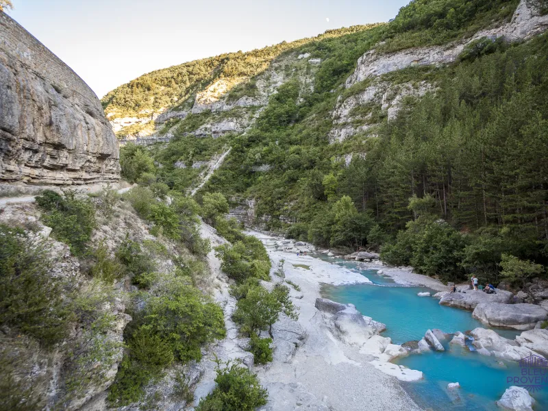
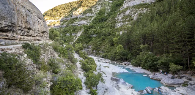
After the pass, descend to Ballons, then cross the Col de la Croisette (927 m), and follow the Gorges de la Méouge.
The Méouge winds its way through deep, winding gorges. The river winds through magnificent landscapes created by erosion. Huge boulders with ivory-colored strata, chaotic cliffs and scree, limestone tuffs make for an unforgettable visual experience.
After the Méouge joins the Buëch, head south-east towards Ribiers. From Ribiers, head for Sisteron on the Chemin de la Marquise path, which leads to the Sisteron citadel.
11 Sisteron / Digne-les-Bains
From Sisteron, the route reaches Entrepierres, along the Riou de Jabron. At Les Andrieux, it turns east to Saint-Geniez, located in the northern part of the Digne Pre-Alps and in the Haute-Provence geological nature reserve.
Then take the spectacular Route du Temps to Authon, nestled in a high-altitude valley in the heart of the Monges massif, equidistant between Lac de Serre-Ponçon and Digne-les-Bains. From Authon, take the road over the Col de Fontbelle (1304 m) and join the lovely forest tracks on the adret slope.
From Fontbelle, the trails are very rolling, with a succession of ascents and descents, including a few balcony sections, before descending more steeply towards the Duyes valley, for the most part on a small, traffic-free road. The landscape opens up in this perched valley. Shortly after Hautes-Duyes, past the friendly village of Thoard, the route continues uphill to a new pass. A small road and a track lead down to the Bléone valley. Be careful, it's a short, highly technical section over a good 50 m or so!
The junction with Digne-les-Bains, where you will follow and cross the Bléone, is via the cycle paths.
12 Digne-les-Bains / Barrême
After Majastres, a dry-stone path leads downhill to the Clue de la Melle, on the Riou d'Ourgeas. The route takes you through a fairly flat landscape: an area of pastureland, with lots of stones. You follow old paths and ford streams amid huge boulders. Before continuing downhill on an old stony road on the mountainside. Wilderness, incredible scenery, you're all alone in the world.
It's much greener before you reach a narrowing and an old path overlooking the gorge of the Riou d'Ourgeas ravine. The path, bordered by a wrought-iron railing, must have seen a lot of people.
Once you've crossed the gorge, you'll reach Barrême, a stopover on the Route Napoléon, so famous for its ammonite fossils that it gave its name to a period of the secondary era: the Barremian.
13 Barrême / Saint-Auban
From Saint-André-les-Alpes, the route follows the eastern shore of Lac de Castillon, from its source to the dam (watch out for cars on the N202!). It crosses Saint-Julien-du-Verdon, perched on an almost-island of the lake, and then climbs towards Soleilhas, via Demandolx and the Col de Saint Barnabé.
Demandolx is a tiny village with exceptional views over the Castillon and Chaudanne lakes. As for the road to the Col de Saint-Barnabé (1365 m), it features a series of 8 hairpin bends at an average gradient of 6%, allowing you to gain height quickly, while enjoying superb panoramic views. The descent to Soleilhas is fairly short: just under four kilometers, with a few more beautiful switchbacks.
From Soleilhas, a bright village nestled in a valley surrounded on all sides by mountains and forest, follow the course of the Estéron, a tributary of the Var. It leads to Saint-Auban, an ancient village set in terraces at the foot of the immense Tracastel rock, famous for its Clue, a magnificent gorge much appreciated by canyoning enthusiasts.
14 Saint-Auban / Bézaudun-les-Alpes
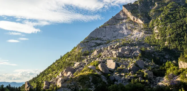
From Thorenc, the route follows the course of the Lane, before continuing northeast towards the resort of Gréolières-les-Neiges. The route passes at the foot of the Montagne du Cheiron, culminating at the cime du Cheiron (1778 m), on whose slopes ski runs have been laid out.
You're very close to Nice, but it's so wild! Unforgettable sea and mountain views... One of our favorites, but beware, it's a bit mountain-bikey, even if it's on Gravel. For those who hesitate, there's an alternative via the very pretty route de la clue de Gréolières: passage along a ledge, through rocks, through the pretty village of Gréolières, with a view of the sea.
At the end of this splendid stage, you reach the foot of the village of Bézaudun-les-Alpes.
15 Bézaudun-les-Alpes / Nice
After Carros, another beautiful medieval village dominated by its 12th-century castle, the route crosses the Var and heads north along the busy Grenoble road.
After three unpleasant kilometers of traffic, you take a sharp right to juggle the tracks, paths and roads of the Nice hinterland.
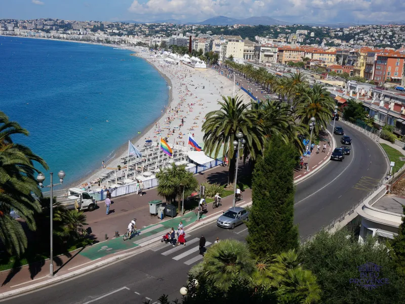
After following the Banquière to its junction with the Paillon, follow the latter to the sea and the Promenade des Anglais. Well done, you've done it!