
Altitude 1136 m
Massif des Préalpes de Castellane
Département Alpes-Maritimes
Topo West side
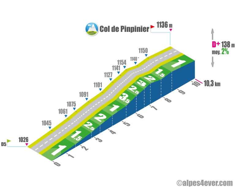
The Col de Pinpinier will be one of the easiest "1000 m" of your trip. It's a long, rising false flat - max 3.5% - offering almost no difficulty.
East side topo
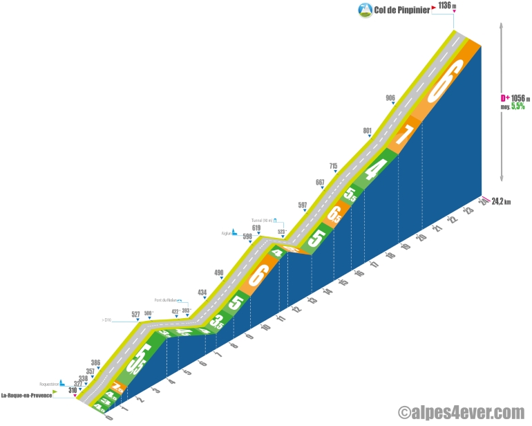
As much as the Col de Pinpinier was one of the easiest "1000 m" of the Petites Routes du Soleil itinerary in the Thonon > Nice direction, its opposite side will give you more trouble!
Starting from La Roque-en-Provence, the ascent is very long at almost 24 kilometers. Even though there are 2 descents, the total vertical drop exceeds 1,000 m, which means you'll have to manage it well.
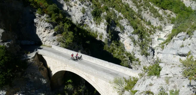
You'll often have to deal with the slope. You'll often have to contend with a gradient that alternates between 5% and 7%, but you'll be able to enjoy a narrow road lost in the middle of nowhere - a spectacular crossing at the Clue d'Aiglun with 2 tunnels carved out of the rock - that ends on a cornice in the final stretch.
The road is on the south side, not very steep. The road is south-facing, with little shade, and can be very hot in summer.
.
The map
The map
20 Saint-Auban / Les Ferres
Author
Joris Lesueur
webmaster of alpes4ever.com
contact@alpes4ever.com