arrow_back
Tartonne / Saint-André-les-Alpes P'tites Routes du Soleil
44,54 Km
3 h 05 min
Medium
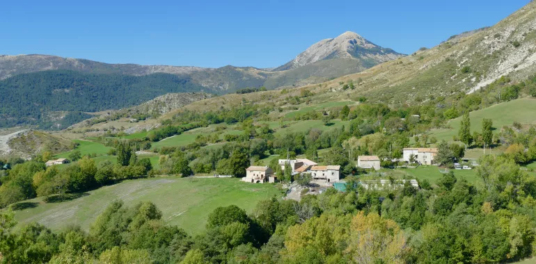
44,54 km cycling route from Tartonne to Saint-André-les-Alpes
The P’tites Routes du Soleil® cycle route takes you quietly into the Parc Naturel Régional du Verdon with its heady mix of gorges, lakes and deep valleys. So well located where French Alps, Provence and Mediterranean lands meet, the Middle Verdon will delight you with its grand, unspoilt landscapes. Here, you follow the river and its turquoise waters as far as Saint-André-les-Alpes. This exceptionally beautiful stage doesn’t present too many cycling difficulties except for the climb to the Col du Défens (a pass at 1,267m).
Elevation of the stage
956 m m
Waytypes of the stage
By road: 44,59 km
Surface of the stage
Smooth: 44,59 km
↗ 561 m ↘ 621 m
Don't miss:
- The Montagne de Chalvet: internationally known for hang-gliding, this mountain dominates Saint-André-les-Alpes and its valleys.
- Thorame-Haute: a charming little village of the Alpes-de-Haute-Provence, clinging to the side of the Chamatte Range, in the Upper Verdon Valley. The old village encircled by hills and mountains proves a delight with its green, bucolic setting far from any main roads.
- Parc Naturel Régional du Verdon: stretching across the départements, or French counties, of Alpes-de-Haute-Provence and the Var, this regional natural park encompasses areas as varied as the Plateau de Valensole, the upper and lower Verdon Gorges, the Haut-Var, the Préalpes de Digne and Préalpes de Castellane, Sainte-Croix Lake and more…
Accommodation on the stage
Did you like this?
You may also be interested in this...


Travellers’ reviews