How to organize your trip along the Route des Grandes Alpes® cycle route?
A cycling trip always requires planning, especially along the Route des Grandes Alpes®.
To make the most of your cycling trip and enjoy it to the full, it’s sensible to make sure you’ve asked yourself some basic questions at the outset. We’ve chosen 12 questions, with 12 answers, to make you think of precisely what will be involved taking on this cycling adventure.
Question n°1: Do I have the right level of fitness?
The Route des Grandes Alpes® is not recommended for novices to cycling trips. All of its sections and stages are classed as either ‘‘difficult’’ (coloured red) or ‘‘very difficult’’ (coloured black), according to the national criteria produced by the French supervisory ministries, calculated using four benchmarks (length, shifts in altitude, gradients and types of surface), to which we’ve added one extra criterion, concerning altitude above sea level. Of course, e-bikes allow a greater number (if not the greatest number) of cyclists to tackle this cycle route!
Question n°2: How many km should I cycle per day?
We’ve divided up the main cycle route and the additional alternatives into 26 stages. In reality, they’re sections calculated according to the range of an e-bike’s battery as well as to what constitutes a moderate stretch of 50km for cyclists on conventional bikes. Having combined the distance with the realities of the various sections (taking into account shifts in altitude, accommodation possibilities, services and more), we present you with:
- 2 sections between 30km and 39km in length;
- 19 sections between 40km and 69km in length;
- 5 sections between 70km and 76km in length.
So, on average, the sections are 56.5km in length – 51.5km for sections along the main cycle route and 63km along the alternative sections. It’s up to you to put together the sections that suit you, according to your level of expertise, physical fitness, motivation and equipment!
Question n°3: With whom can I organize my cycling trip?
Do you want to cycle off with as little hassle as possible? Then opt for a travel agency specializing in cycling trips that can organize everything for you: luggage transfer from place to place, reserving your accommodation, possibly organizing bike hire for you and even, potentially, accompanying you along the route.
We can recommend two travel agents that have established an excellent reputation for reliability: France Bike Trips (by Vélorizons) and www.larebenne.com
Question n°4: When should I go on my cycling trip?
The two best periods to head out on your cycling trip along the Route des Grandes Alpes® are at either end of the main summer season: from mid-June (when the very high passes generally open) to mid-July, or from late-August to mid-October. September often proves a very good month, even if daylight hours are of course fewer.
To check on the state of the roads and whether the various passes are open: www.infotrafic.com
For weather forecasts, go to: www.meteofrance.com/meteo.montagne or tel 33 (0)8 99 71 02 + county (département) number (€2.99 per call + price of the call).
Question n°5: How long should I go for?
It’s up to you! Ignore those who claim that cycling the Route des Grandes Alpes® is an all or nothing affair! The many intersections between the main cycle route and the six alternative sections proposed allow you to put together circuits for long weekends or short breaks. At the other end of the scale, you could head off for several weeks, making the most of the extra time to ride the alternative sections and their extensions, discovering further areas.
Question n°6: Which itinerary should I choose?
The Route des Grandes Alpes® links Lake Geneva to the Mediterranean, crossing the French Alps north-south, or south-north. There’s the backbone formed by the main route, then the six alternative sections branching off it. These alternative sections enable you, for example, to bypass obstacles or roads and passes that may be closed, or then to discover new areas, landscapes and passes. Under the section ‘‘Cycle route’’ (‘‘Itinéraire’’ in French) we’ve divided the route up into 26 sections, including the main route and the additional alternatives, allowing you to select sections of interest and tailor your trip to your requirements.
We’ve also included a route itinerary as well as a travel planner which acts like a basket in which you can place your selection of stages, accommodation and more as you go along.
Question n°7: What equipment should I take?
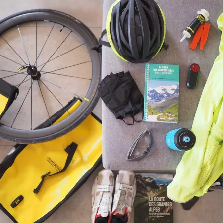
For how to choose a suitable bike (be it a conventional bike or an e-bike, geared to touring or the more sporty), the necessary cycling equipment and what items to travel with… see our advice under the section ‘‘What equipment to choose?’’ (‘‘Comment s’équiper’’ in French).
We’ve drawn up a list for you of bike hire companies dotted along the route or near to it. However, unless you’re planning your cycling trip with the assistance of a travel agency or you’re just coming for a short break, we advise you to bring your own bike, that you’ve already tested out and adjusted, even if that’s a bike you’ve rented from a company near where you live.
Question n°8: How do I reach the cycle route?
Access by road to any part of the Route des Grandes Alpes® is easy.
Between Thonon-les-Bains and Nice, there are also 15 SNCF railway stations on or near the route.
The three major airports near the route are those of Geneva, Lyon and Nice. Take note, transporting batteries for e-bikes is forbidden on planes, meaning that you may have to rely on freight transport services to fly over an e-bike.
Question n°9: Can I organize for luggage transfers?
There’s no general service available along the Route des Grandes Alpes® at time of writing. In order to travel light, you have three options: either organize your trip with a specialist travel agency; or organize for an accompanying motorized vehicle along the route; or then use local taxi services. Certain accommodation providers may sometimes be able to offer a luggage transfer service, but don’t count on such a solution being automatically available.
Question n°10: Is it possible to do the route on an e-bike?
An electric bike or e-bike (in French, vélo à assistance électrique, or VAE) allows a greater number of cyclists (perhaps even the greatest number possible) to tackle the route. Today, there are enough recharging points in place along the route to avoid running out of battery power. You can see the location of recharging points on the stage maps, under the section ‘‘Cycle route’’ (‘‘Itinéraire’’ in French).
Question n°11: How do I find my bearings along the Route des Grandes Alpes®?
- By following the tourist road signposting in place in both directions (north – south and south – north), all along the 720km of the main route.
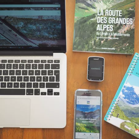
- By downloading the GPS tracks, under the section ‘‘Cycle route’’ (‘‘Itinéraire’’ in French) or on the page ‘‘How to download the GPX tracks?’’ (“Comment télécharger les GPX ?” in French).
- By making use of the detailed topoguide, La Route des Grandes Alpes. À vélo et vélo électrique (Éditions Glénat), and/or the IGN map, Route des Grandes Alpes® on a scale 1: 220,000.
Question n°12: Where can I find accommodation?
Find hotels and other accommodation all along the route via the stage maps, under the section ‘‘Cycle route’’ (‘‘Itinéraire’’ in French).


