


Not to be confused with Col de la Cayolle
Altitude 1678 m
Massif du Mercantour-Argentera
Département Alpes-Maritimes
West slope topo
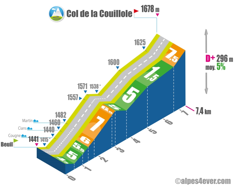
From Beuil, it's a not too long climb of 7.4 km, but quite irregular. You'll start with a short descent. This is followed by a 2.5 km climb with a fairly steady gradient - between 5 and 7%. A further descent takes you to the bottom of the Vallée de la Conche. Then the slope resumes with 1.3 km at 5%, followed by a 1.6 km flat at 1.5%. Make the most of it, as a 725 m long, 7.5% gradient is the final climb up to the Col de la Couillole at 1678 m altitude. At the summit, a restaurant and an unfortunately blocked view.
Topo east side
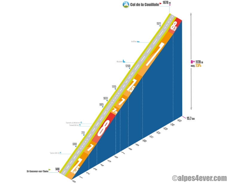
From St-Sauveur-sur-Tinée, the menu is salty! It's a long climb of 15.7 km for 1170 m of D+ at... 7.5%! A figure that suggests that you're in for a big effort. In fact, the gradient doesn't drop below 7%, rising to 8.5% for the final 1.3 km! There are a few distractions on the program: tunnels, rocks (beware, it's a real oven on a sunny day) and the picturesque village of Roubion (you'll have to make a little detour to the center of town to find a fountain).
.
The map
The map
25 Valberg / Saint-Martin Vésubie
Author
Joris Lesueur
webmaster of alpes4ever.com
contact@alpes4ever.com