Col Saint-Martin
Or Col de la Colmiane pass
Altitude 1503 m
Massif du Mercantour-Argentera
DepartementAlpes-Maritimes
West side topo

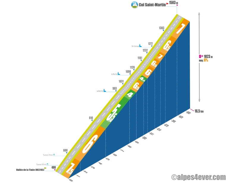
Starting from the Vallée de la Tinée, at the intersection of the M2205 and the M2565, a long and difficult 16.5 km climb with 1023 m of D+ at 6% average gradient awaits you. An initial ramp of 1.6 km (including 2 tunnels, the first of which is unlit) offers a superb view over the Vallée de la Tinée, but also a good effort at an average of 7.5%.
Then it's time to take it easy, with a steep climb to the top. Things settle down after that, with a fairly regular gradient that often varies around 6-7%. You can find watering holes as you pass through the villages of La Bolline, La Roche and St-Dalmas. The Station de la Colmiane occupies the summit at 1503 m.
Topo southeast slope

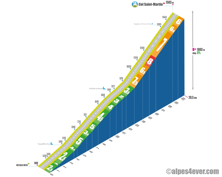
Although the ascent of the Col Saint-Martin really begins in St-Martin-Vésubie, it's important to take into account the 11.7 km ascent of the Vallée de la Vésubie, which offers over 400 m of positive ascent. In St-Martin-Vésubie, a sustained 8.8 km, 6.5% final stretch awaits you, including a belvedere located in a bend that offers a beautiful view of the Vallée de Vésubie, 2 short tunnels (not lit) and a 1 km passage at an average gradient of 8%.
.


