
Altitude 1121 m
Massif du Diois
Département Drôme
Topo eastern slope
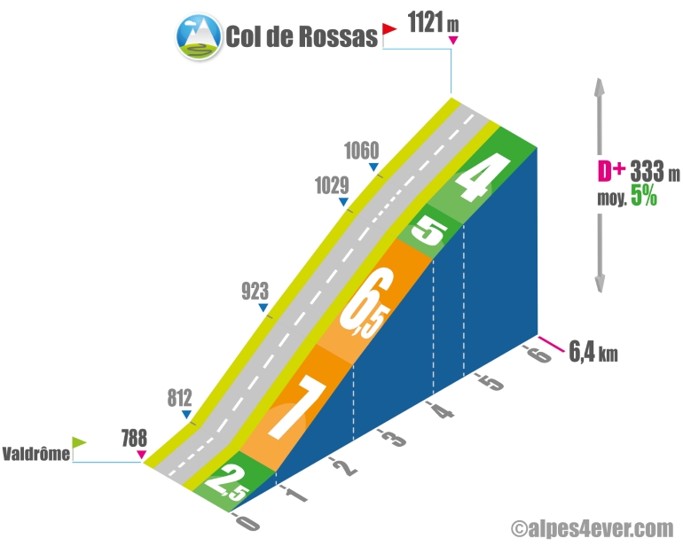
The Col de Rossas is located in the Massif du Diois at 1121 m altitude. The eastern side starts at Valdrôme, at the source of the Drôme. Not very long at 6.4 km, the ascent consists of climbing the slopes of the Vallon du Ruisseau de Rossas, with steep gradients of between 6.5 and 7%. The gradient becomes gentler on the approach to the pass, which lies on a vast high plateau where sheep and goats can often be seen. All of which suggests that this corner in the middle of nowhere exudes assured tranquillity!
Topo south-west facing
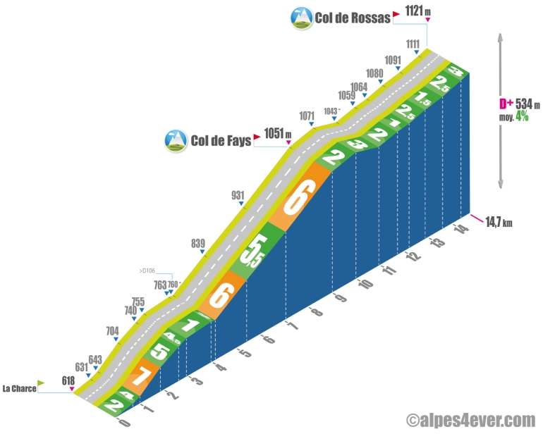
The 14.7 km ascent of the south-west face of the Col de Rossas is divided into 2 parts. The first, starting from La Charce, consists of a 9 km climb on a sustained gradient - often around 6%, which will still be fairly regular - to the intermediate Col du Fays (1051 m). The second 5.7 km section will be very easy, with a gentle descent followed by an uphill false flat that will guide you to the summit at 1121 m.
.
Author
Joris Lesueur
webmaster of alpes4ever.com
contact@alpes4ever.com