
And its panoramic view of Mont du Chat and Montagne de l'Épine
Altitude 821 m
Avant-Pays savoyard
Département Savoie
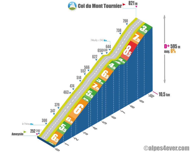
North side topo
The Col du Mont Tournier is located in the Savoyard Foreland but belongs, geologically speaking, to the Jura Massif.
Its modest altitude - 821 m - conceals a not-so-easy ascent on its northern side from Ameysin, considering that you'll have to climb almost 600 m of positive vertical drop spread over 10.5 km at 6% average.
The climb is divided into 2 parts.
The first, 7.8 km long, takes you up and down the slopes of Mont Tournier, often at an average gradient of 6%. The open side of the trail offers breathtaking views of Mont du Chat and Montagne de l'Épine.
The second part, 2.8 km in length, is an easy trail to follow. The second part, 2.7 km long, starts when you leave the D40 and take the D42 to the summit of Mont Tournier. It takes place in the forest. Expect to suffer a little on slopes of between 7.5% and 8.5%. Fortunately, a soothing final 900 m at 3.5% will allow you to finish this climb more peacefully.
South side topo
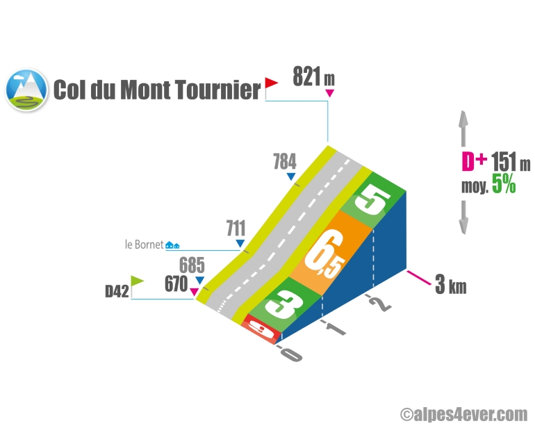
Very short on the south side from the Col de la Lattaz, you should negotiate this climb without too much trouble.
The map
The map
6 Saint-Jean-de-Chevelu / Lépin-le-Lac
Author
Joris Lesueur
webmaster of alpes4ever.com
contact@alpes4ever.com