
Altitude 759 m
Avant-Pays savoyard
Département Savoie
West slope topo
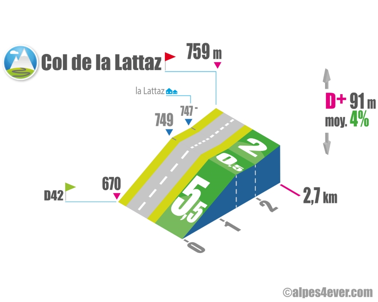
On the descent from the Col du Mont Tournier, remember to leave the D42 fairly quickly (just before St-Maurice-de-Rotherens) to take a small unnamed road that will guide you to the Col de la Lattaz, which this time takes you over another mountain, that of Chaffaron. Not too difficult, apart from a 1.5 km "thigh-burning" ramp at 5.5%. From the hamlet of La Lattaz, an upward false flat will guide you to the summit of the pass at 759 m.
Topo south side
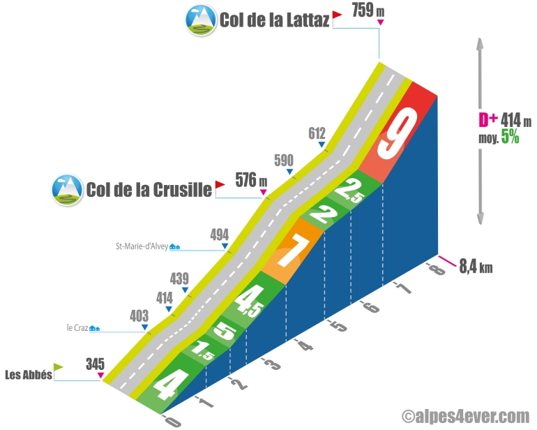
The South-facing slope presents a double-edged climb... indeed, while enjoying a pretty country atmosphere, a gentle ascent then an arduous finale to the intermediate Col de la Crusille and Col de la Lattaz.
The map
The map
6 Saint-Jean-de-Chevelu / Lépin-le-Lac
Author
Joris Lesueur
webmaster of alpes4ever.com
contact@alpes4ever.com