


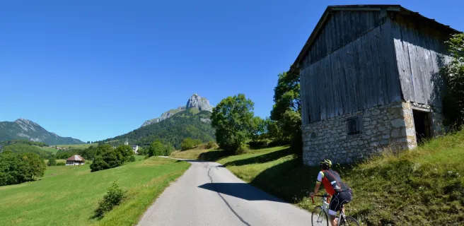
In the heart of the Bauges
Altitude 950 m
Massif des Bauges
Département Savoie
North side topo
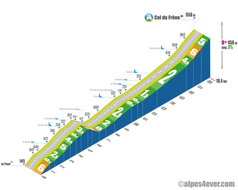
The start is located within the Massif des Bauges on the D911 (le Pont, near Lescheraines). The ascent is quite long at 18.4 km, but not very difficult: after crossing the small Châtelard rise, it's a long 10.2 km uphill false flat to Routhennes. This is followed by a final 1.8 km on a slightly steeper slope averaging no more than 6% to the Col du Frêne.
.
South side top
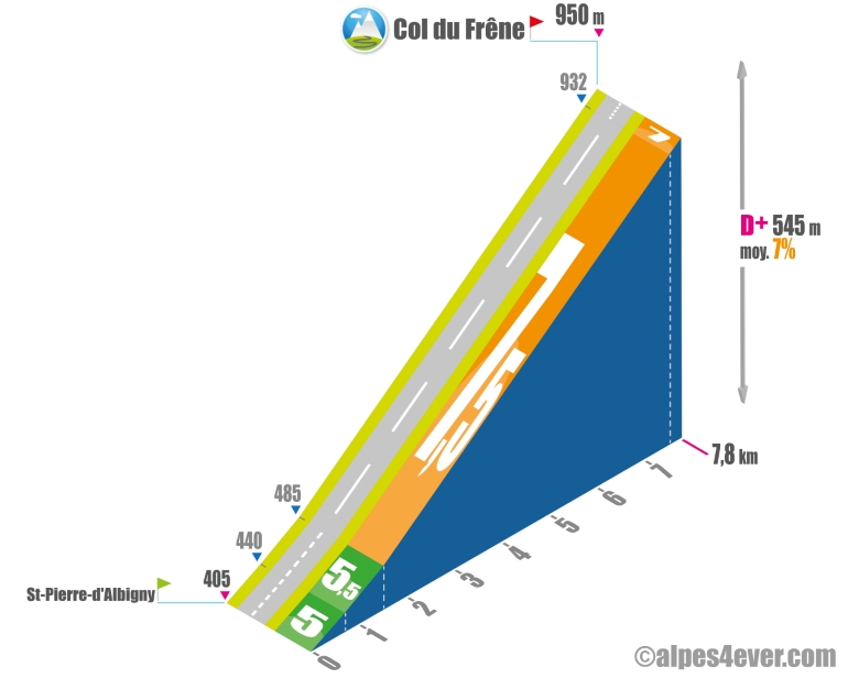
From St-Pierre-d'Albigny, expect a short ascent of 7.8 km with an average gradient of 7%, which suggests that you're going to have to work at it... After a hairpin bend that will help you rise quietly above the village, it's a succession of 14 hairpin bends where the average gradient, fairly regular, won't drop below 7.5% until the Col du Frêne. On the other hand, you'll gain fine views of both the Combe de Savoie and the impressive Dent d'Arclusaz, one of the Massif des Bauges' landmark peaks
.
The map
The map
6 Variante Lescheraines / Beaufort-sur-Doron
Author
Joris Lesueur
webmaster of alpes4ever.com
contact@alpes4ever.com