
And its pretty chapel at the top
Altitude 590 m
Avant-Pays savoyard
Département Savoie
West slope topo
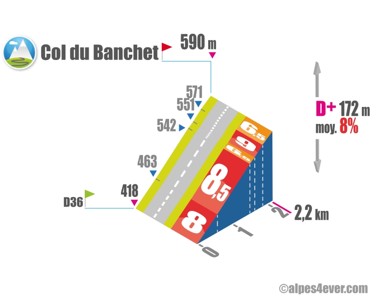
The Col du Banchet is discreetly located in the southernmost part of the Mont Tournier range, which presents the appearance of an impassable wall (the A43, which passes just a few hectometres away, has found no other way of crossing it than through the long Dullin Tunnel). The Petites Routes du Soleil route will take you to the foot of its final section, which will push you to make a big effort over 5 hairpin bends at a steady 8% average gradient. A pretty chapel is located at the summit at an altitude of 590 m.
.Topo south-east side
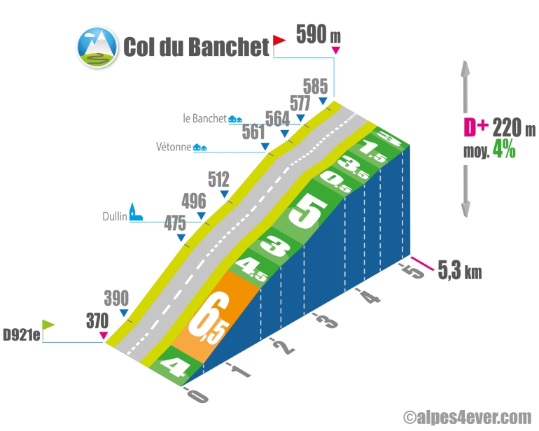
The south-eastern slope, in a pleasant country setting, is much more accessible than its opposite side. You'll just have to negotiate a 1.3 km, 6.5% passage located at the start of the climb just before Dullin.
The map
The map
6 Saint-Jean-de-Chevelu / Lépin-le-Lac
Author
Joris Lesueur
webmaster of alpes4ever.com
contact@alpes4ever.com