
In the heart of the Massif du Diois
Altitude 1126 m
Massif du Diois
Département Alpes-de-Haute-Provence
West side topo
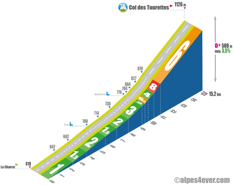
The Col des Tourettes is located in the Massif du Diois. Starting from La Charce (enjoy the view of its castle), the ascent is long at 15.2 km, but the first 10 km consist of a leisurely climb up the Vallée de l'Oule, where you will pass from the Drôme to the Hautes-Alpes departments.
The Col des Tourettes is located in the Massif du Diois.
It's shortly after Montmorin that the difficulties begin: the road twists and turns on several switchbacks to make its way between the Montagnes de Maraysse and Chauvet on a gradient often averaging 6%.
South side top
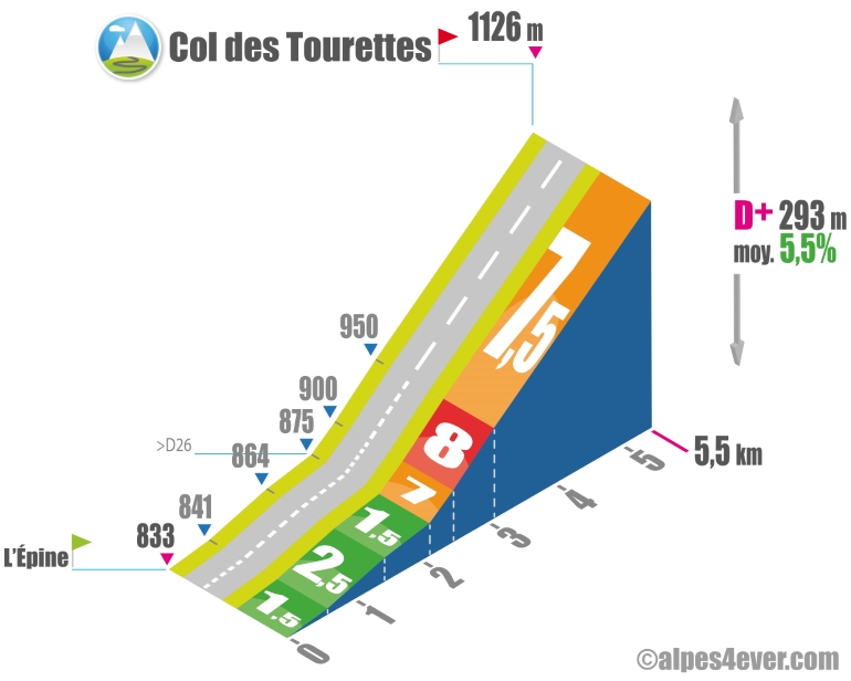
From L'Épine, the southern slope of the Col des Tourettes is short and climbs in 2 stages. The first is an easy 2.2 km as far as the intersection with the D26. For pass hunters, the Col de la Saulce (877 m) is just a stone's throw away - follow the D994 for 250 m. The second time, an infernal 3.3 km ramp at an average gradient of almost 8% awaits you...
The map
The map
13 Valdoule / Garde-Colombe
Author
Joris Lesueur
webmaster of alpes4ever.com
contact@alpes4ever.com