
In the Massif des Baronnies
Altitude 1014 m
Massif des Baronnies
Département Hautes-Alpes
Topo North side
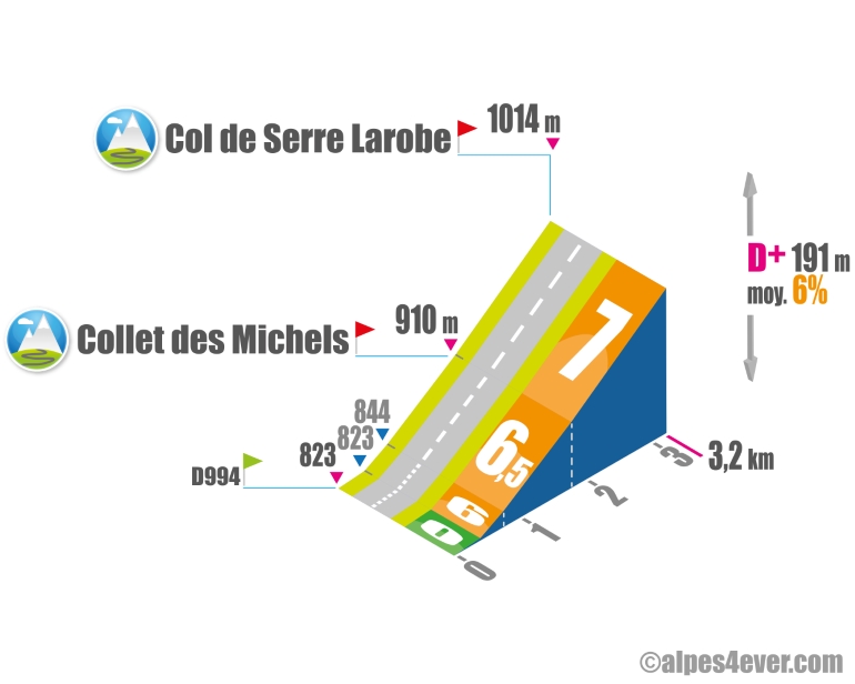
The Col de Serre Larobe is located in the Massif des Baronnies. The ascent of the northern slope is short at 3.2 km, but intense with a fine gradient often close to 7%. On this occasion, you'll also cross the Collet des Michels (alt. 910 m).
Topo South side
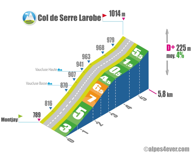
From Montjay, the ascent of the Versant Sud du Col de Serre Larobe is not very long at 5.8 km. The most difficult part is the switchback between Vaucluse basse and Vaucluse haute: 1.1 km at an average gradient of almost 7%. It's worth noting that the summit - despite a fairly rolling passage preceding it - won't be easy to reach, with a final ramp of 650 m at 5.5%.
.Author
Joris Lesueur
webmaster of alpes4ever.com
contact@alpes4ever.com
The map
The map
13 Valdoule / Garde-Colombe
The P’tites Routes du Soleil® leaves behind the Oule Valley to enter the Pays Rosannais area. Although this stage mainly consists of descents, there are still a few little passes to cross. The first in the series, the Col des Tourettes (1,126m), is well worth the effort. The picturesque surroundings and exceptional views are rewarding. You then descend into the Buëch Valley. A bit further on, take on the Col de Serre-Larobe (1,014m), which may be small, but it’s tough! Descending again, you pass via the Col de la Saulce (877m). All told, this stage makes you jump from one valley to the next as you enter the Parc Naturel Régional des Baronnies Provençales.