
Altitude 1365 m
Massif des Préalpes de Castellane
Département Alpes-de-Haute-Provence
Topo west side
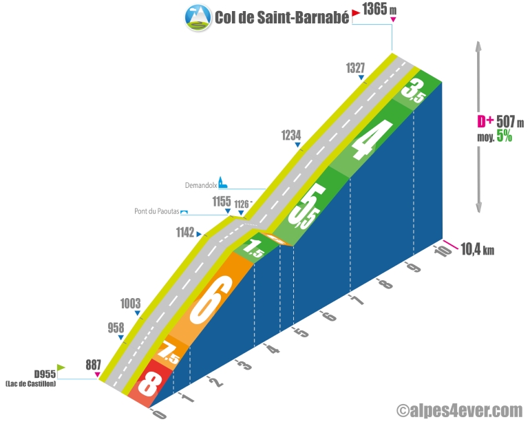
The Col de Saint-Barnabé rises to 1365 m, which suggests that it will take some effort to reach it, but it will soon be rewarded as you set off from the edge of Lac de Castillon.
Although this is the most difficult section, with a gradient approaching 8%, you'll soon be able to gain height and enjoy a beautiful view of the lake. Then, a series of 8 switchbacks allows you to climb more calmly on a 6% gradient.
Before tackling a short descent, a superb panorama opens up of both Lac de Castillon and the Retenue de Chaudanne.
The final section is fairly rolling, but beware of the easterly wind, which is often on your side and can make this final stretch more laborious.
Topo south side
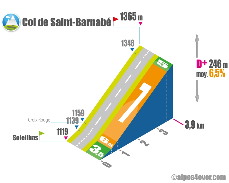
The ascent of the Col de Saint-Barnabé is fairly short from Soleilhas at just 3.9 km, but the 4 beautiful hairpin bends at an average 7% will perhaps go by like a shot...
At the summit at 1365 m, you'll be alone in the world. Note that a road leads up to the Stade de Neige de Vauplane (alt. 1607 m), a resort that has become ghostly due to a lack of snow in winter.
The map
The map
18 Tartonne / Saint-André-les-Alpes
Author
Joris Lesueur
webmaster of alpes4ever.com
contact@alpes4ever.com