
France's highest climber
Altitude 897 m
Massif des Bauges
Département Haute-Savoie
Topo versant Nord
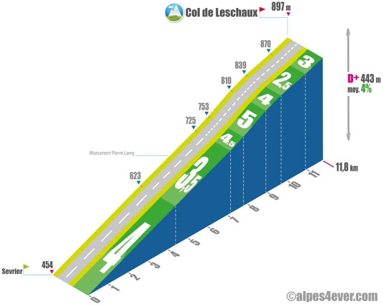
The Col de Leschaux - 897 m - located on the eastern flank of the Semnoz, seems, according to various sources read on the web, to be the most climbed pass in France! From Sevrier on the shores of Lac d'Annecy, the climb is very rolling, offering a profile within the reach of any cyclotourist, with an average gradient of no more than 5%. In the first third of the climb, don't hesitate to take a few breaks to look back and enjoy the beautiful views over Lake Annecy.
Topo versant Sud
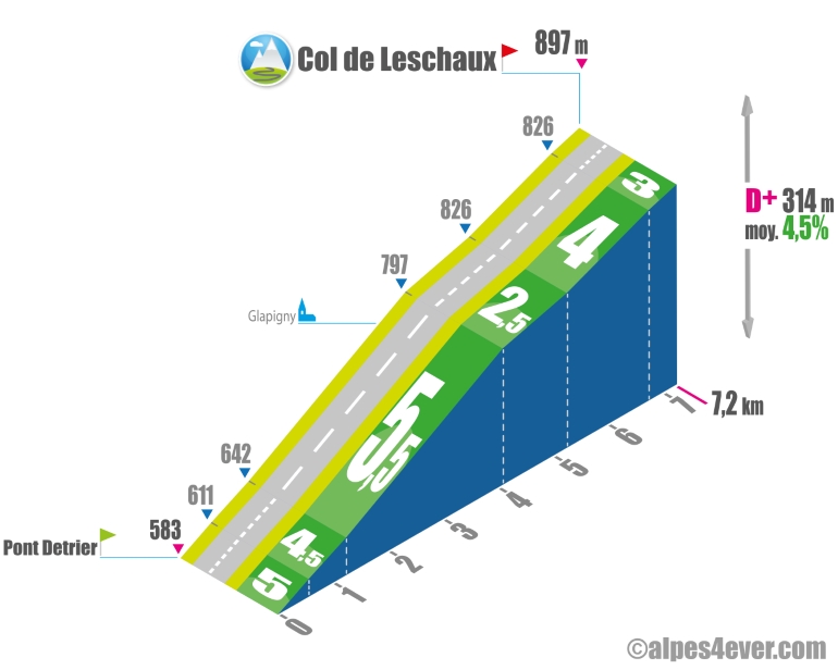
The Col de Leschaux - 897 m - located on the eastern flank of the Semnoz, seems, according to various sources read on the web, to be the most climbed pass in France! The ascent starts from Pont Detrier, which spans the Rau de Bellecombe marking the border between Savoie and Haute-Savoie. Set in a pretty country setting, the ascent won't be too long at 7.2 km and an average gradient of 4.5% suggests that the part won't be too difficult.
The map
The map
5 Alternative section Le Grand-Bornand / Lescheraines
Author
Joris Lesueur
webmaster of alpes4ever.com
contact@alpes4ever.com