

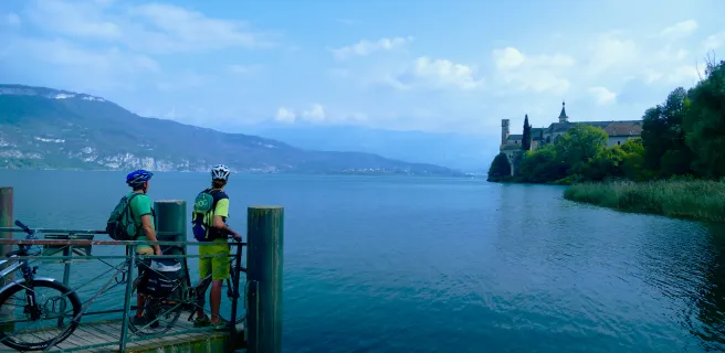
Above Lac du Bourget
Altitude 650 m
Massifs des Bauges
Département Savoie
East side topo
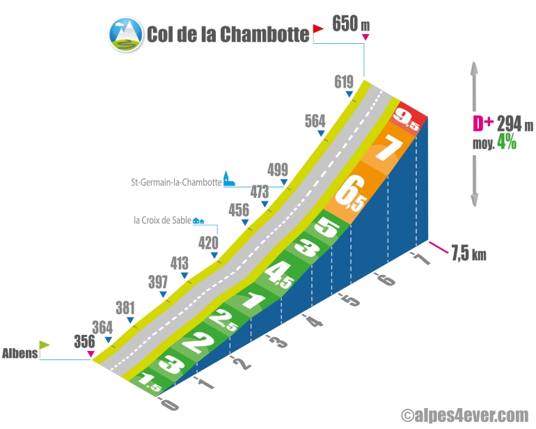
The Col de la Chambotte - 650 m - is located on the heights of Lac du Bourget.
The eastern slope starts at Albens. No difficulty as you climb up the Vallée de l'Albenche to the Croix de Sable. There's still 4 km to climb. Set in pretty countryside, the gradient climbs gradually from 3 to 5% up to St-Germain-la-Chambotte, then steepens up to the pass, with sections at 6.5, 7 and then 9.5%, making the final stretch a little more difficult.
If you've still got some energy left, there's an easy route to follow.
If you've still got some juice left, it would be worth putting in a little effort of 830 m at 9% to climb up to the Belvédère de la Chambotte at 725 m altitude to enjoy an exceptional 360° panorama of Lac du Bourget and the surrounding peaks.
Topo North side
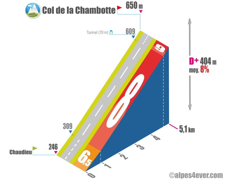
The climb up the north side is fairly short - 5.1 km - but formidable, with an average gradient of 8%. Avoid it in the afternoon if it's hot, as the slope is often overheated with its road running alongside a rock face. It's only one twist, but it offers a fine view of Lac du Bourget. A 70 m-long tunnel cut into the rock (no need for lighting) will punctuate this difficult climb.
.The map
The map
5 Entrelacs / Saint-Jean-de-Chevelu
Author
Joris Lesueur
webmaster of alpes4ever.com
contact@alpes4ever.com