
Cormet d'Arêches
The other Cormet, Gravel version
Summary
- Plan your bike ascent of the Cormet d'Arêches
- Ascent from Beaufort-sur-Doron
- Description north side
- Ascent from Aime
- Description versant sud
- Tips to prepare for the ascent
- Weather conditions
- Recommended equipment
- Services
- Access to Cormet d'Arêches
- Témoignages
- FAQ
- The other nearby passes
- The most beautiful passes
- Places to visit nearby
Plan your bike ascent of the Cormet d'Arêches
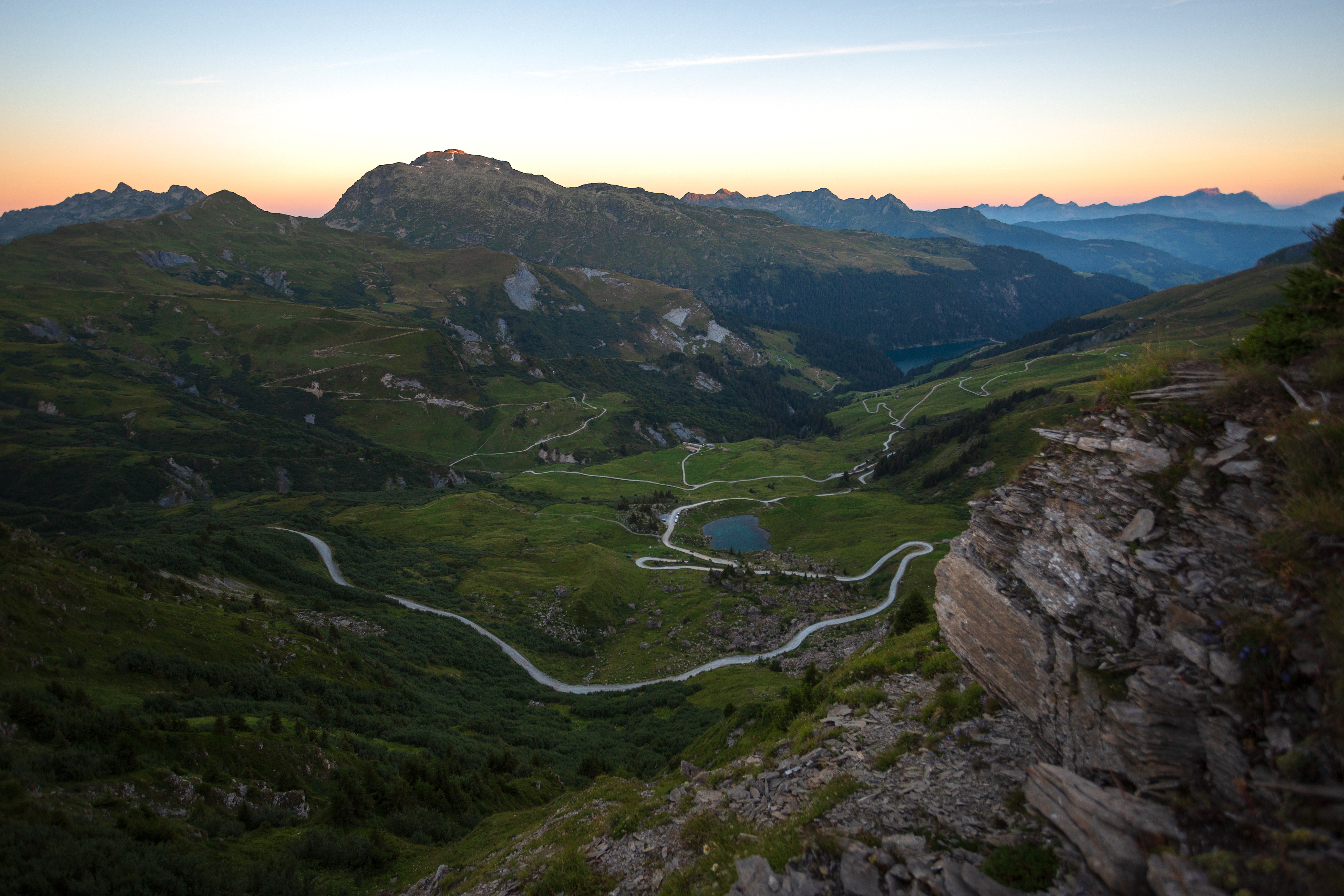
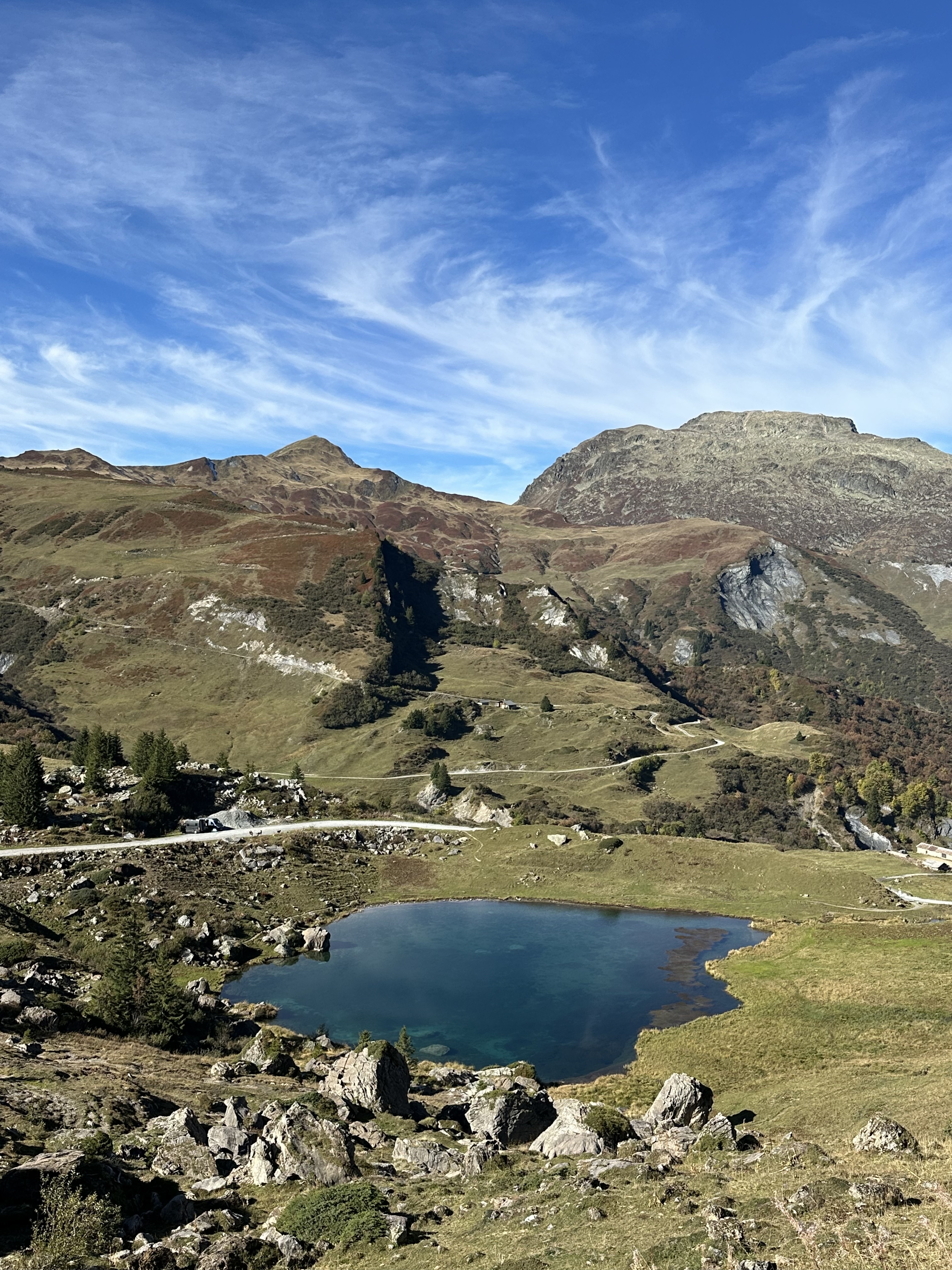
The Cormet d'Arêches is part of the Route des Grandes Alpes® Gravel, between the Beaufortain and Tarentaise valleys. Less well-known than the Cormet de Roselend, it offers a wilder alternative. The last few kilometers on either side of the pass are unpaved or have a degraded surface, which reinforces its Gravel character. A single route via the north side, on the Beaufortain side, while several variants make it possible to reach the pass from the Tarentaise on the south side.
Cycling up the Cormet d'Arêches from Beaufort-sur-Doron (north side)
Beaufort-sur-Doron (740 m)
19.3 km
1396 m
8%
10%
Cormet d'Arêches ascent time (rounded) from Beaufort-sur-Doron (north side)
| At 7 km/h | 2h 45' |
| At 11 km/h | 1h 45' |
| At 15 km/h | 1h 20' |
| At 19 km/h | 1h |
Course map of the Cormet d'Arêches from Beaufort-sur-Doron (north side)

Description of the ascent of Cormet d'Arêches from Beaufort-sur-Doron (north side)
The north side of Cormet d'Arêches offers a unique, long and demanding climb, distinguished by a gradual transition between road and track, reinforcing its Gravel character.
The ascent takes place in two distinct parts.
From Beaufort to Lac de Saint-Guérin
From Beaufort, the climb follows a road in good condition, with a steady, sustained gradient. It first progresses through forest, then opens up as you approach Lac de Saint-Guérin. The gradients remain constant, with no particular technical difficulty, but the effort gradually builds over time.
From Lac de Saint-Guérin to the pass
After the dam, a short descent of around 850 meters allows you to relax before tackling the second part. The road then becomes narrower and the surface more uneven.
About 3 kilometers from the summit, it turns into an unpaved track. The gradient then stabilizes at between 8 and 9%, with no real recovery phase until the pass. The environment is open, alpine pastures, with greater exposure to wind and weather.
To sum up: a long, continuous climb, with a regular first part preceding a more technical second part, with a demanding 100% Gravel finish.
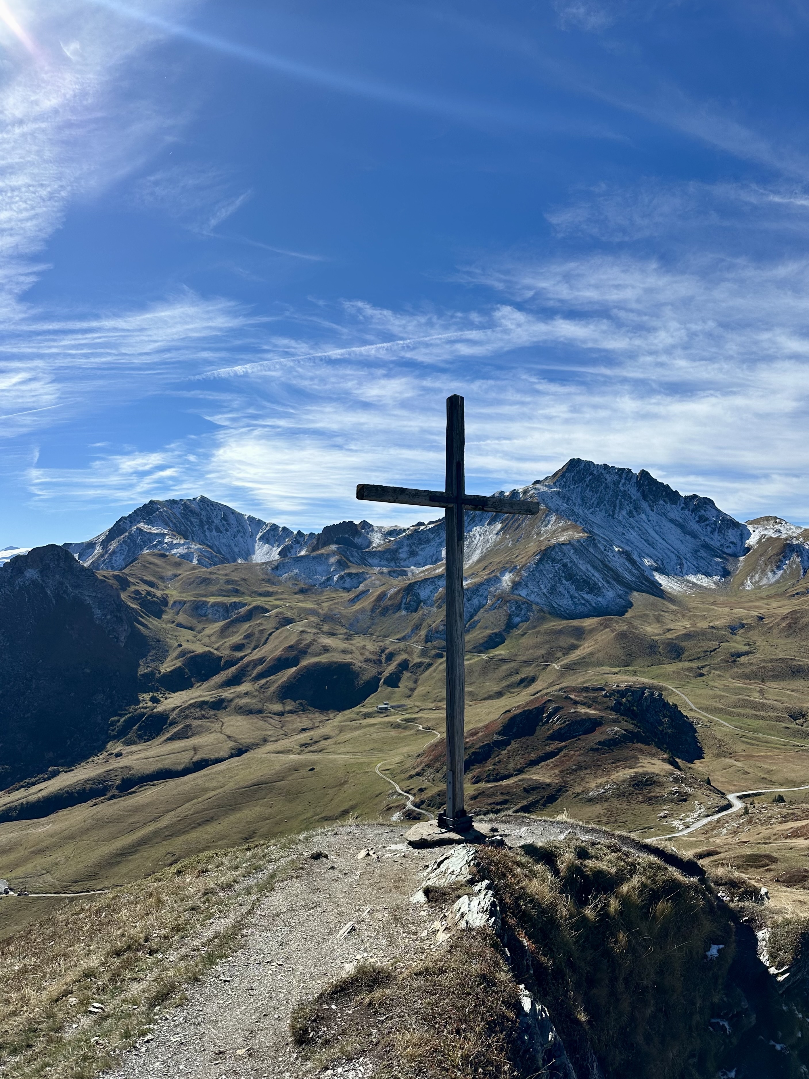
Cormet d'Arêches bike climb from Aime (south side)
Aime (661 m)
27.2 km
1474 m
7.5%
11,5%
Rounded ascent time for Cormet d'Arêches from Aime (south side)
| At 7 km/h | 3h 55' |
| At 11 km/h | 2h 30' |
| At 15 km/h | 1h 55' |
| At 19 km/h | 1h 25' |
Map of the Cormet d'Arêches route from Aime (south side)
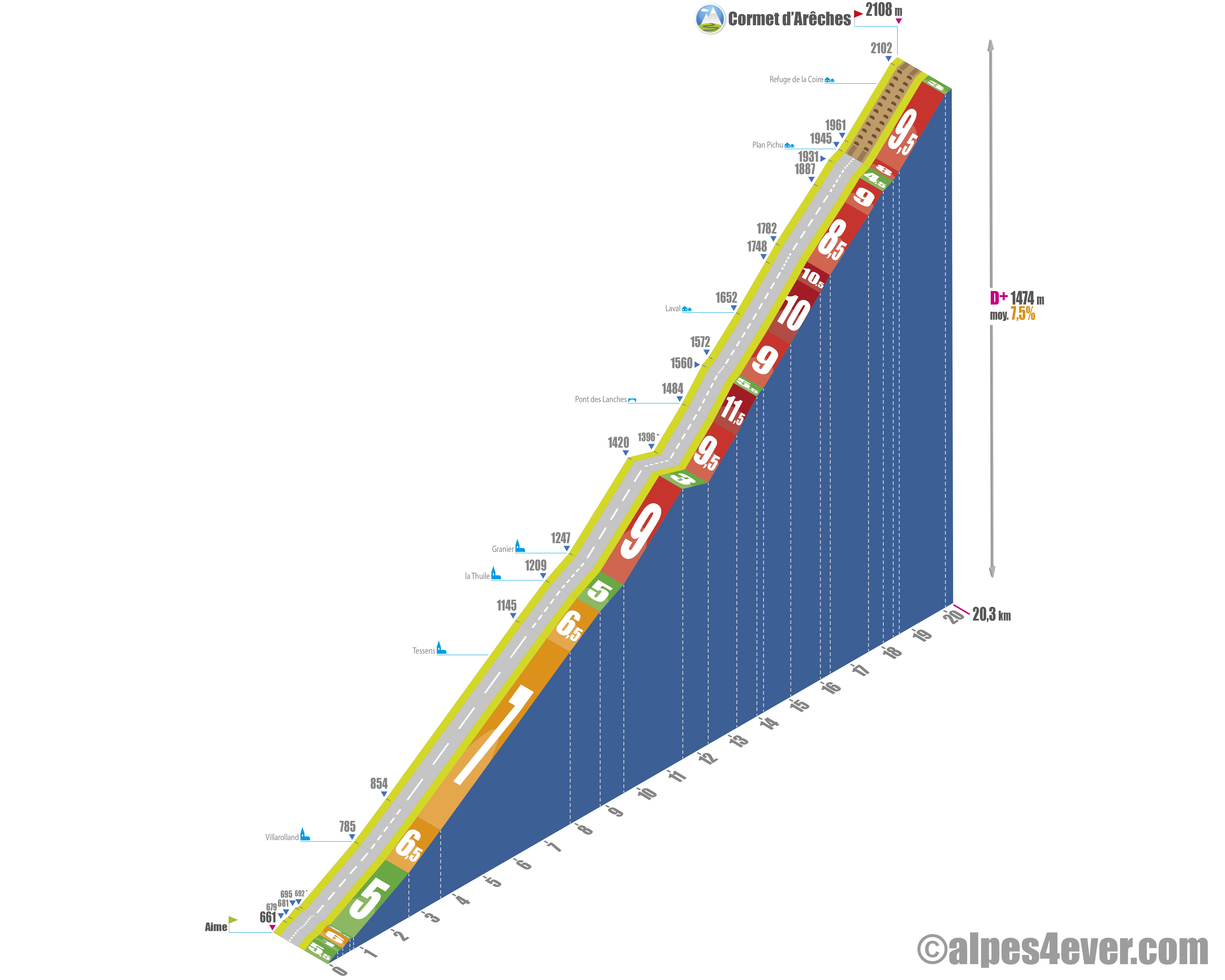
Description of the ascent of Cormet d'Arêches from Aime (south side)
The south side of Cormet d'Arêches can be approached by several routes. The Tarentaise valley offers at least four starting points, from Aime-la-Plagne to Bourg-Saint-Maurice, plus various intermediate variants.
Whichever option you choose, the climb takes place in two stages.
An initial section with variable profiles, alternating moderate sections and much harder passages.
A second, common section from Granier onwards, clearly more demanding. The slope becomes steeper, never dropping below 8%, apart from a short descent of around 850 meters and two small flat spots. Some sections reach around 11.5% for several hundred meters.
The road then becomes narrower, before giving way to a track at Plan Pichu. It's then about 1.9 km to the pass, on unpaved terrain.
From Aime, the ascent begins in the valley with a gradual climb towards Granier. This first section alternates between moderate slopes and steeper sections, with no particular technical difficulty. From Granier onwards, the nature of the climb changes. The slope becomes steadier and more sustained, with percentages generally between 8 and 10%. The effort becomes continuous, with little opportunity for recovery.
The final section, from Plan Pichu, is on an unpaved track. This 100% Gravel section requires special attention. The slope remains steady all the way to the summit.
Tips for preparing to climb the Cormet d'Arêches
The Cormet d'Arêches is part of the Route des Grandes Alpes® Gravel itinerary. To find out more about this practice, you can consult this dedicated article: What is Gravel?
Note that, unlike some sections of the itinerary, this passage is accessible from both the north and south sides.
Weather conditions
The Cormet d'Arêches is generally open from mid-June to mid-October. Due to its high altitude (over 2,100 m) and isolated environment, it is important to take certain precautions, in particular to check the weather conditions before setting off.
To find out about weather conditions on the Cormet d'Arêches or the Cormet de Roselend, check this site.
To find out what time of year to set off on Route des Grandes Alpes ®
Recommended equipment
There are many types of Gravel bikes on the market, but in general Gravel bikes are designed to offer a stable and comfortable ride over rough terrain.
The frame is usually made of aluminum, steel or carbon. It is designed to be sturdier than a traditional road bike frame. It also has a geometry that allows for a more upright riding position, for greater stability on rough terrain.
Gravel tires are wider than those on traditional road bikes, ranging from 35 to 45 mm wide. They often have studs for better grip on gravel and dirt surfaces.
Disc brakes are common on Gravel bikes, as they offer better braking power and greater reliability on rough terrain.
Gravel bikes often have wide-range gearing to adapt to the different slopes and terrain encountered.
Gravel bikes can be fitted with luggage racks and mudguards, to enable riders to carry equipment and ride in adverse weather conditions.
Routes via the Cormet d'Arêches
Arêches - Bourg-Saint-Maurice stage
Services next to the Cormet d'Arêches
At Beaufort-sur-Doron or Arêches-Beaufort and in Aime or Bourg-Saint-Maurice, you'll find all the useful and necessary services for your trip: accommodation, catering, supplies, bike repair and rental...
On the way, nothing after Arêches (north side). A few hamlets or refuges on the southern slope.
Access to Le Cormet d'Arêches
SNCF and bus stations
- Albertville
- Bourg-Saint-Maurice
- Beaufort-sur-Doron
Road access
- D925 from Albertville (A43).
- D212 from Ugine and the Arve valley (A40).
- D902 from Bourg-Saint-Maurice (N90).
Those who have done it speak best of it!
"It was one of the most memorable stages for me. We set off early, and quickly entered a much more mineral, wilder world. We went over the Cormet d'Arêches, which is a really beautiful pass, quite isolated."
Tom and Valentin
Read testimonial
"Incredible scenery, magnificent Gravel roads. The stage to the Saint-Guérin dam, with a magical lunch at the refuge at the top of the Cormet d'Arêches."
Thomas Guillaud
Read testimonial
FAQ
On which route is the Cormet d'Arêches located?
On Route des Grandes Alpes® Gravel which links Thonon-les-Bains (Haute-Savoie) to Nice (Alpes Maritimes). A very challenging route, with 28,000 m of positive vertical drop over 857 km of diversely surfaced routes!
What does "Cormet" mean?
In Beaufortain patois, the term "cormet" simply means "pass". The word is said to have its origins in the Latin culmen, evoking a ridge line or summit. A definition that fits perfectly with this pass south of the Cormet de Roselend, naturally linking the Beaufortain to the Tarentaise.
What makes the Cormet d'Arêches unique?
Lightly traveled, technical in its surface, and located in an active pastoral environment, the Cormet d'Arêches offers an authentic experience, in a committed and wild environment.
Can you see the Pierra Menta from the Cormet d'Arêches?
Located between the Cormet d'Arêches and the Cormet de Roselend, the monolithic spur of the Pierra Menta is visible from certain points on the ascent and from the approaches to the pass. This emblematic summit of the Beaufortain is a strong visual landmark in the landscape and reinforces the interest of the route.
The other cols close to Cormet d'Arêches
Les plus beaux cols de Route des Grandes Alpes ®
- Col de Joux-Plane
- Cormet de Roselend
- Col de la Loze
- Col de la Croix de Fer
- Col de la Madeleine
- Col de l'Iseran
- Alpe d'Huez climb
- Col du Granon
- Col du Galibier
- Col de la Cayolle
- Col et Cime de la Bonette