
On either side of the Galibier: the Telegraphe Pass and the Lautaret Pass
When we think of the great mythical passes on the Route des Grandes Alpes®, we often think of the Galibier, closed for a double tour in winter. But we think less often of the two passes that are always open around it: the Télégraphe and the Lautaret. Two strategic elevators which, from March onwards, can also become a playground for well-prepared cyclists
Why are these passes interesting in winter?
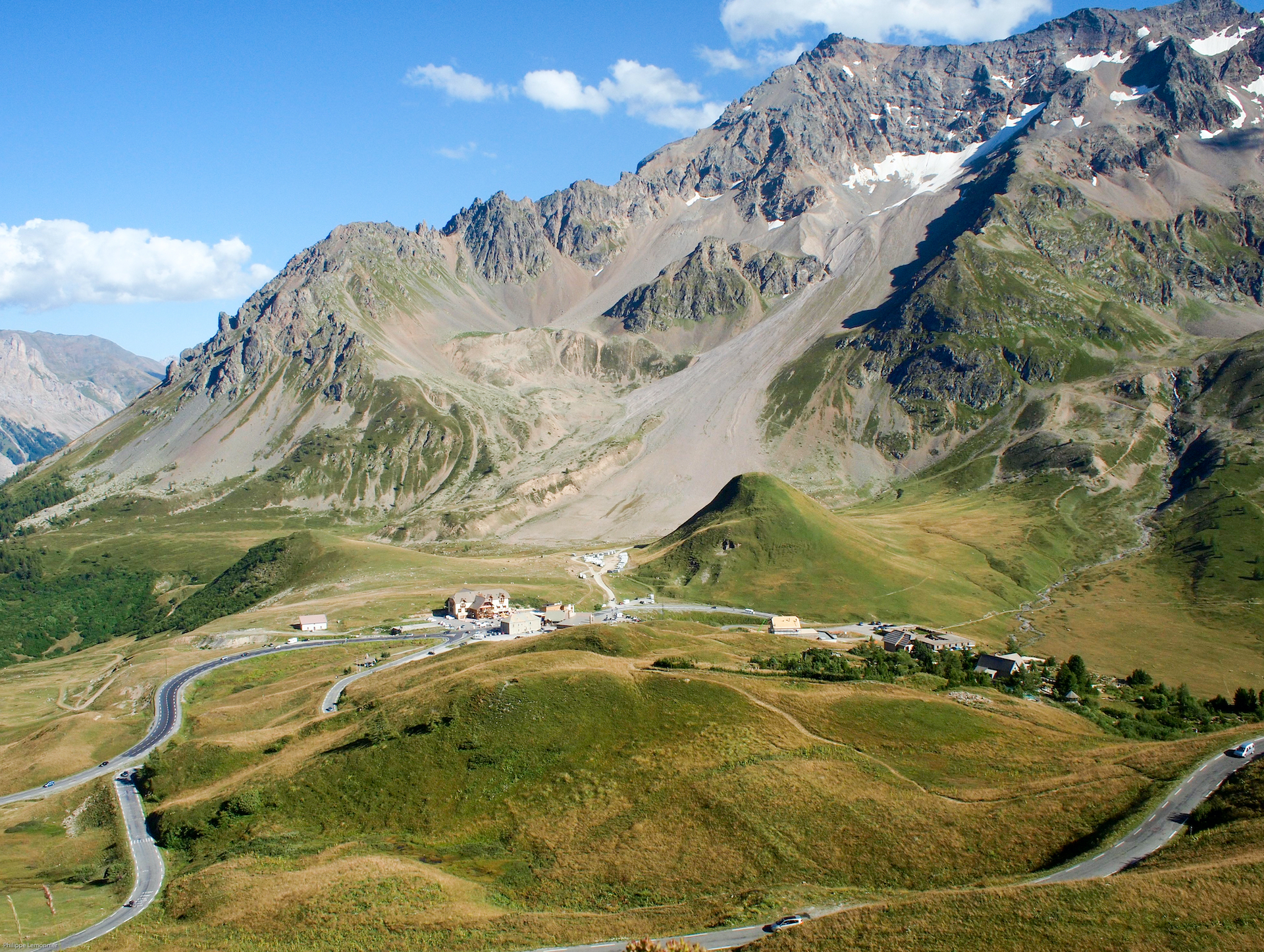
Col du Lautaret: the highest pass open to traffic in winter
The Col du Lautaret, culminating at 2,057 m, is renowned for being open all year round despite its high altitude. This makes it an exceptional winter choice among the major Alpine passes. Of course, wind, snow and ice can occasionally cause problems, but maintenance is reliable and the road is clear most of the time. On the other hand, beware of the temperature!
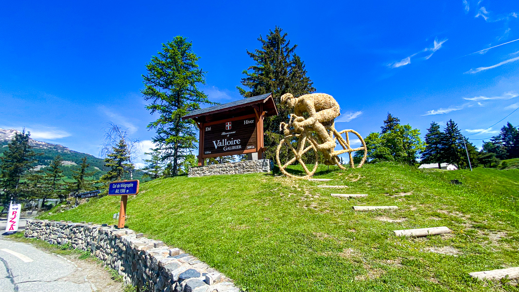
The Col du Télégraphe: for a coffee in Valloire!
At an altitude of 1,566 m, the Col du Télégraphe stands up well to winter weather conditions. It makes a great "preparatory" climb or winter alternative in the Maurienne valley.
Focus
Col du Télégraphe (1,566 m)
Starting from Saint Michel de Maurienne, the climb is around 11.8 km long, with an ascent of 846 m and an average gradient of 7%. The profile is fairly steady: passages at 8-9% in the first kilometers, then steady progress to the summit. In winter, beware of traffic and road maintenance (snow removal). The road passes through woods and tight bends, which can make the outing even more intense. Access from Valloire is much more moderate (4.7 km at 3%).
Col du Lautaret (2,057 m)
On the road linking Briançon to Grenoble (via the D1091), the Col du Lautaret is a major passage. It is listed as "the highest French pass open to motorized traffic in winter". Please note: in winter, conditions can vary greatly (frost, wind, snow), but the route is maintained, making it an ambitious but achievable goal. Profile: depending on the route chosen, the ascent totals almost 1000 m D+ and climbs to 2,057 m. Beautiful, gradual climbs on both sides: La Grave and Briançon. Panorama guaranteed: glaciers, cliffs, wide valleys... a pure mountain setting.
Tips for making the most of it
A goal for early March
Except for an exceptionally mild winter month, of course!
Check road opening and condition
Despite their "open in winter" status, temporary closures are possible (high wind, avalanche, frost).
Choose a late morning start
In winter, the road freezes early and shade sets in.
Equip yourself seriously
Tyres in good condition, brakes checked, windproof jacket, warm gloves, rear light.
Be vigilant on the way down
Wind, frost, sharp turns; even a controlled climb can turn tricky.
Plan your route according to your level
The Telegraphe is fairly short but demanding. Le Lautaret is longer and at high altitude.
Pack a supply of water and bars
In winter you sweat less, but the effort is no less intense.
If you're looking for a meaningful winter cycling outing, head for the Col du Télégraphe or the Col du Lautaret. Two link roads on the Route des Grandes Alpes® that take you to higher altitudes, off the beaten track, but still passable in good conditions. Enjoy the cold air, immaculate scenery, and a climb that's unlike any other in summer.