


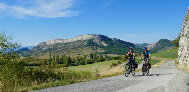
At the summit, a deserted but splendid atmosphere
Altitude 1304 m
Massif des Préalpes de Digne
Département Alpes-de-Haute-Provence
Topo west side
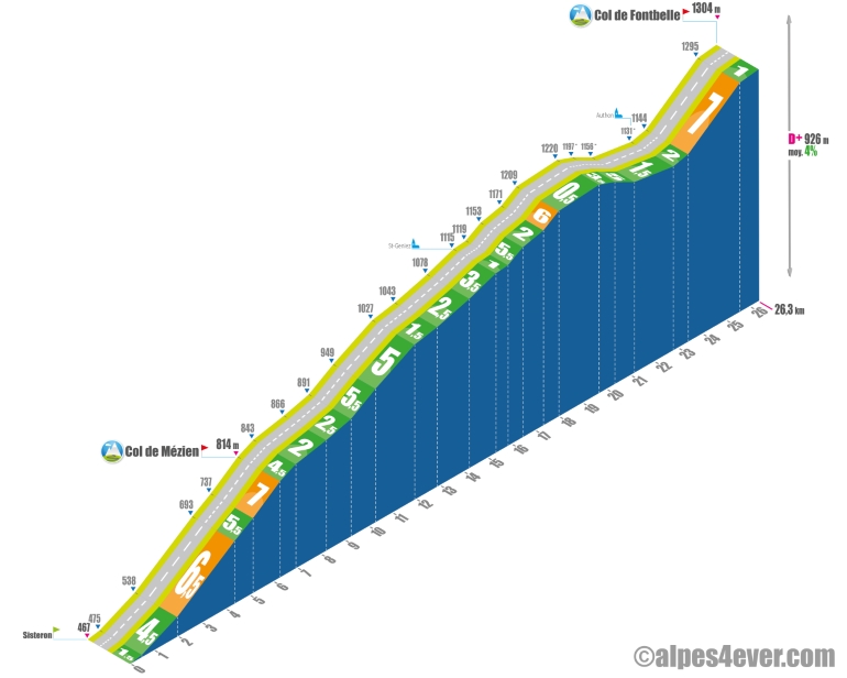
After a succession of fairly short cols, here's the Fontbelle pass where, from Sisteron, you'll have to work hard for... 26.3 km!
Don't be fooled by its average percentage!
Don't be fooled by its average gradient of 4%, which might lead you to think that the climb won't be very difficult, but rather by its 926 m positive difference in altitude, which means that the Col de Fontbelle, with its charming name, won't be handed to you on a plate...
.
The ascent takes place in 3 parts: the first is fairly sustained to reach the intermediate Col de Lézien (814 m), the second is not very difficult on paper - between 0.5 and 6% max - but long and tiring, punctuated by the magnificent passage through the Défilé de Pierre Écrite, the third begins with a descent that takes you to Authon, the starting point for the final climb up a beautiful 2.2 km ramp at an average gradient of 7%.
At the summit, the atmosphere is deserted but the climb is very hard.
At the summit, you'll find yourself alone in the world, in a desolate but splendidly calm and voluptuous atmosphere.
South side top
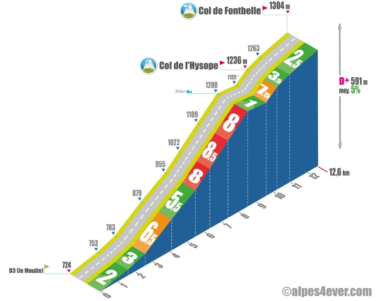
The 12.6 km ascent of the Col de Fontbelle will take place in 2 stages: the first up to a first intermediate pass, the one with the funny name of Hysope. The gradient will be very steep - 2.3 km at 8% - as you wind your way up to Mélan. You'll be able to take a breather as you leave the village, but you'll have to climb a little more - 625 m at 7.5% - before reaching the Col de l'Hysope (1236 m). Take in the magnificent scenery of the Vallée des Duyes and the imposing Crête de Géruen. All that remains is for you to tackle the second part, which will be easy and fairly short (around 2.4 km), in a forest setting, to reach the Col de Fontbelle.
The map
The map
16 Sisteron / Digne-les-Bains
Author
Joris Lesueur
webmaster of alpes4ever.com
contact@alpes4ever.com