


Col des Saisies
From Val d'Arly to Beaufortain
Altitude 1658 m
Massif du Beaufortin
Département Savoie
North side topo
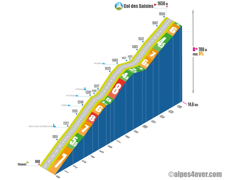
On paper, this climb looks easy, but it's long all the same at 14.6 km. A fairly regular gradient, a few flat spots and an easy finish will enable you to negotiate this climb without too many problems. Please note that the real geographical pass (1633 m) is located below the resort, but you'll be able to pass the sign at 1658 m altitude! On the first part of the descent, take time to admire the beautiful views of Mont Blanc
.Topo south side
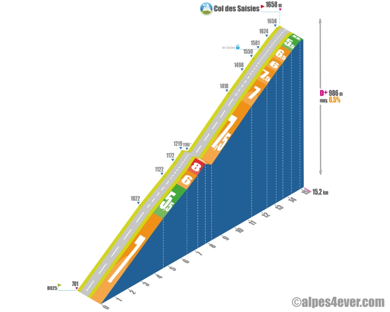
The second part of this ascent is quite rural, allowing you to discover Mont Blanc.
The starting point is on the D925 between Villard-sur-Doron and Beaufort. At 15.2 km long, it's a fairly regular climb punctuated by 9 hairpin bends, you'll be flirting with 7% quite often. The first part is rather monotonous, as you'll be in the middle of fir trees that offer no view, and you'll have to share the road with a fair amount of traffic. At the halfway point, you'll be able to take a breather on a 450 m descent to the junction with the road leading to Hauteluce.
.The final 6.9 km section at 7% average can be managed quietly as the gradient is very steady all the way to the Col des Saisies, which you'll reach after crossing the Station des Saisies. It's on this part that you'll be able to enjoy some very fine views of Mont Blanc.
Note that the real geographical pass (1633 m) is located below the resort, but you will be granted passage at the signpost at 1658 m altitude!

Author
Joris Lesueur
webmaster of alpes4ever.com
contact@alpes4ever.com