
Vence Pass
Altitude 963 m
Massif des Préalpes de Castellane
Département Alpes-Maritimes
Western slope topo
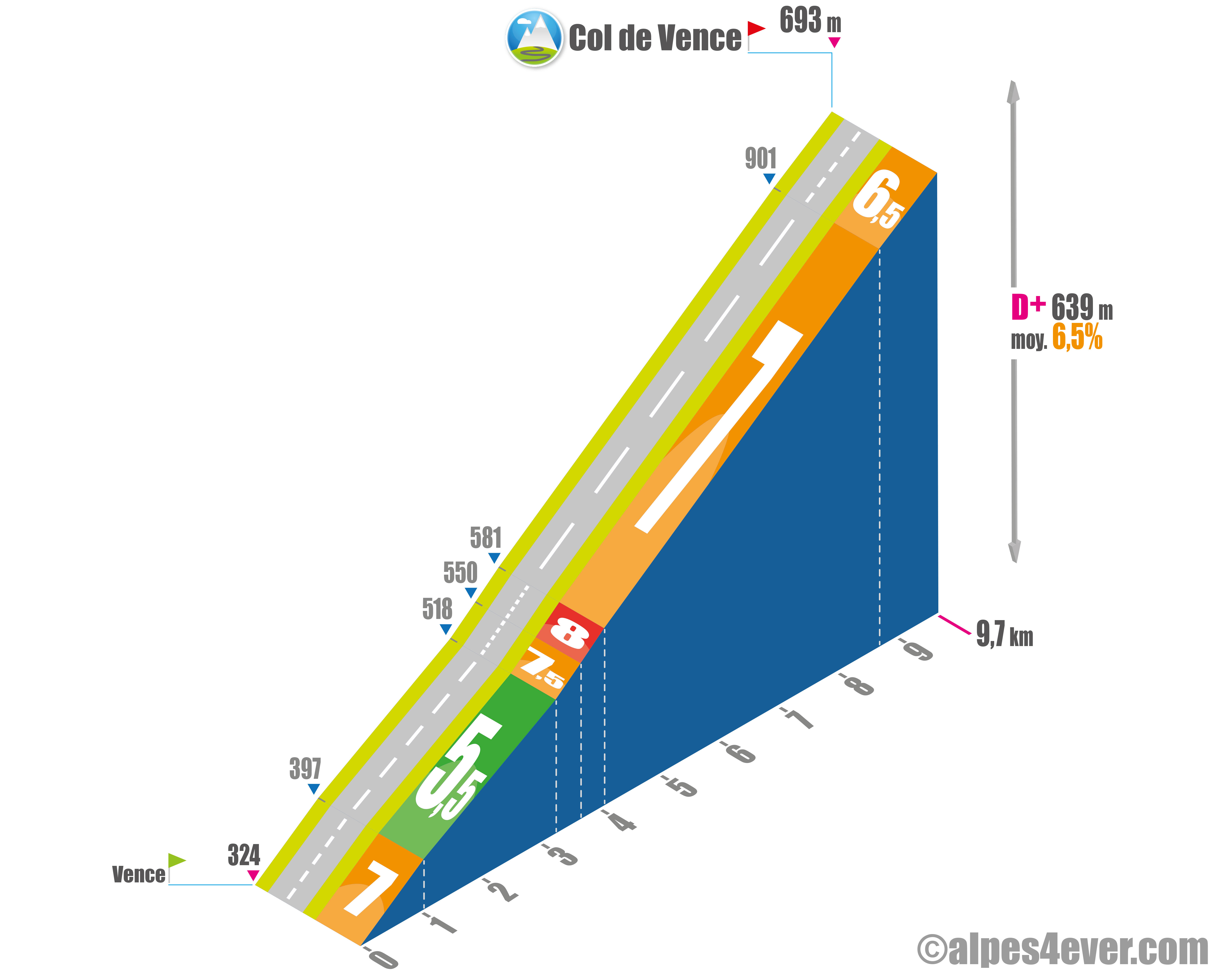
After a leisurely climb of around 330 m D+ over 19 km from Cagnes-sur-Mer, you'll start with a serious ascent to the Col de Vence at 963 m altitude. Nearly 10 km at an average gradient of 6.5% will give you a good idea of the climbs that await you along the Petites Routes du Soleil route.
In Vence, don't forget to fill up your water bottles at the fountain just down the road, as it can get very hot there in summer.
The first kilometer is urban and straight as an i, and you're immediately confronted with a steep incline averaging 7%.
Crossing the Lubianne, things calm down for 2.3 km at 5.5%, with the Baou des Blancs (alt. 673 m) in sight.
As you climb up the Vallon de la Lubianne, the landscape becomes more deserted, offering no shade whatsoever on this south-facing slope. It's also at this point that the gradient steepens, offering you the most difficult part of the climb, with 800 m at an average gradient of 8%
.
Then a series of 6 hairpin bends will lead you up a long 5.6 km stretch, where the gradient will be steady but steady, with a nice average gradient of 7%.
In the last 2 km, enjoy the lovely panorama of the Mediterranean coastline.
The Col de Vence lies within the impressive Parc des Noves, where rocky terrain and sparse vegetation give it a desert-like character. It is also reputed to be a hot spot for UFO sightings in France, but each person will have to make up his or her own mind!

Author
Joris Lesueur
webmaster of alpes4ever.com
contact@alpes4ever.com